Australia Daily Snow

By Mike O'Connor, Meteorologist Posted 1 year ago July 7, 2024
A Couple of Dustings Later this Week amongst Grey & Damp Conditions
Summary
We've got a rather grey week ahead of us in the Australian Alps as weak storm systems bring cloud and mostly light precipitation. Some of this will at first fall as snow up high on Tuesday before a cold change early Friday brings snow levels down lower for a wee dusting that day and again over the weekend.
Short Term Forecast
Current Conditions
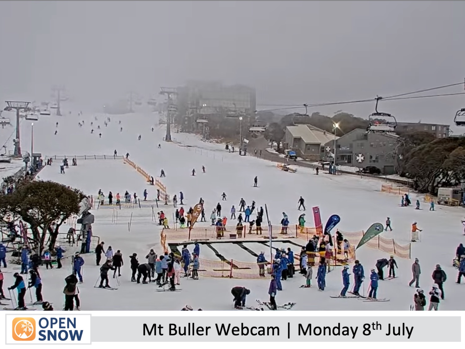
Since that last decent snowfall two weekends ago, we've had a good stint of fine, settled weather in the Australian Alps with cool nights giving the snow machines a good run. It's been great conditions for all the kids on their mid-year school holidays. However, the snowpack is still a little thin with most resorts reporting depths ranging between 20cm to 40cm while a lot of terrain remains closed.
Forecast for Monday & Tuesday (8th & 9th July)
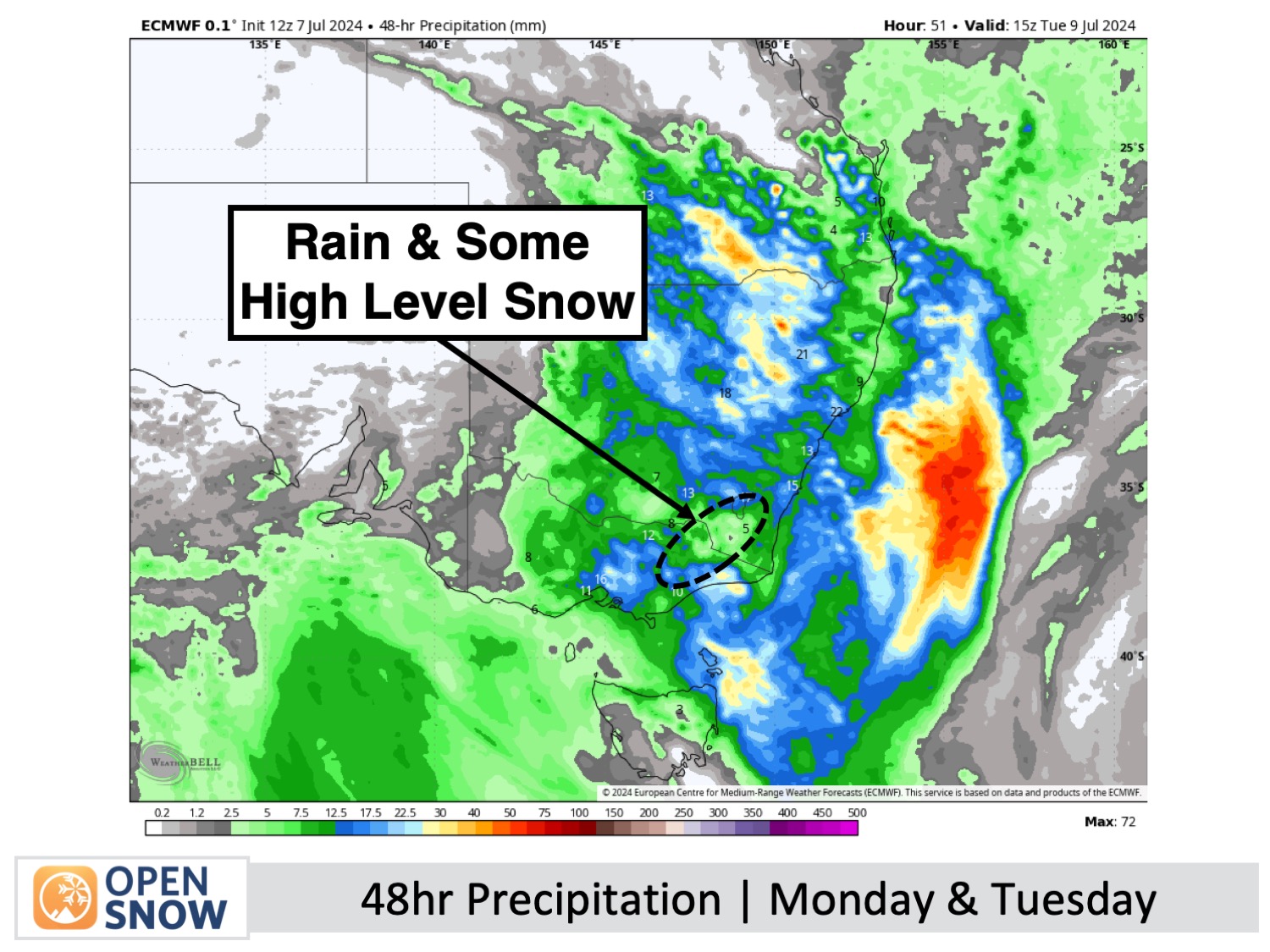
During this period a weak storm from the north and west will pass over the Australian Alps. On Monday, northerly winds will be fairly strong as cloudy skies eventually start to drop light showers of rain.
The showers will become more frequent on Monday night, looking more like periods of rain. The rain will persist through Tuesday while turning to snow above about 1800m as winds drop off and turn to a light southerly.
Victorian resorts will see the majority of this precipitation and could accumulate up to 5-7cm up top, while New South Wales may receive bout 1-3cm up high. However, the mid-lower slopes will get a little wet and slushy during this time.
Forecast for Wednesday to Friday (10th to 12th July)
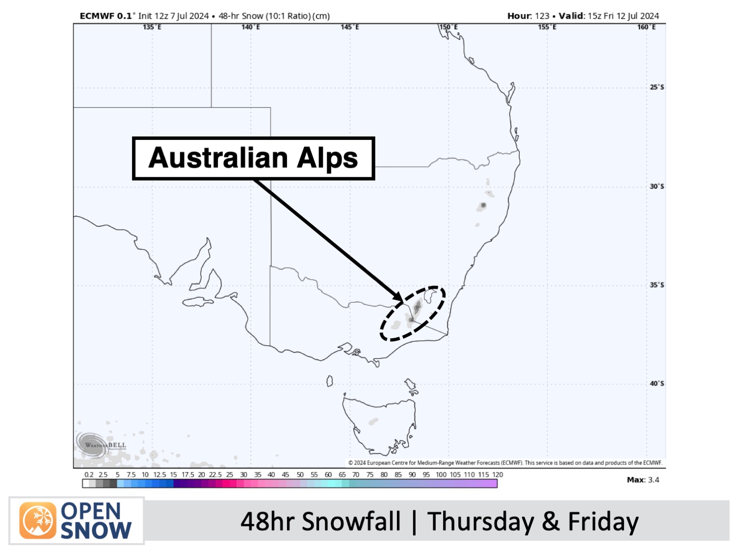
Wednesday and Thursday won't be too bad with mostly grey skies, especially on the Victorian side where it'll be a bit murkier with the odd spot of drizzle. New South Wales will be a bit brighter less extensive cloud cover, although a stiff northwesterly will develop on Thursday.
Then, from Thursday night, another weak storm system passes over the Australian Alps, bringing a colder airmass. Light snowfall should lower to around 1500m early Friday before clearing out later in the day, leaving behind a dusting of a couple to several centimetres. Base levels will again just get a little wet.
Extended Forecast
More light snowfalls this weekend should add a few more centimetres to the snowpack, thanks to another weak cold front which will most likely pass over the Australian Alps on Sunday.
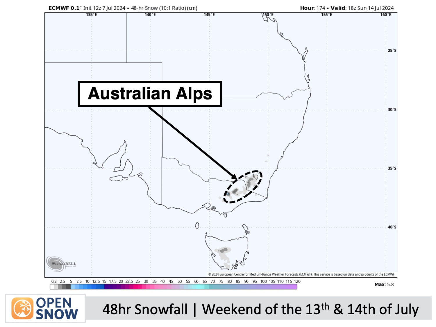
Starting Monday, July 15th, a cold southerly flow could linger over the Aussie Alps for a few to several days, possibly bringing additional snowfall and ideal conditions for snowmaking. We'll have to wait closer to the time before gauging how much snow may or may not accumulate as it's all too uncertain at this stage.
Thanks for reading. I'll keep these forecasts coming every Monday, Wednesday & Friday throughout the southern hemisphere season.
Mike O'Connor
About Our Forecaster


