Australia Daily Snow

By Mike O'Connor, Meteorologist Posted 1 year ago July 9, 2024
Slow going this week, but things look to perk up next week
Summary
The Australian Season will continue to tick along at a snail's pace this week as several weak weather systems bring a mix of rain, drizzle, and light snowfalls, with a little sunshine mushed in between. Snow levels start high but will gradually lower as successive cooler airmasses arrive, and come the weekend, the snow guns will be firing at base levels before fresh snow arrives next week.
Short Term Forecast
Current Conditions
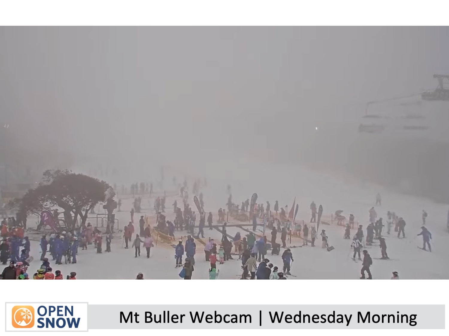
It's been a long time since we had a decent snowfall in the Aussie Alps, and resorts are still operating on a limited cover within firing distance of the snow guns. After a long, fine, dry spell, the last couple of days have been mild and wet, which hasn't helped.
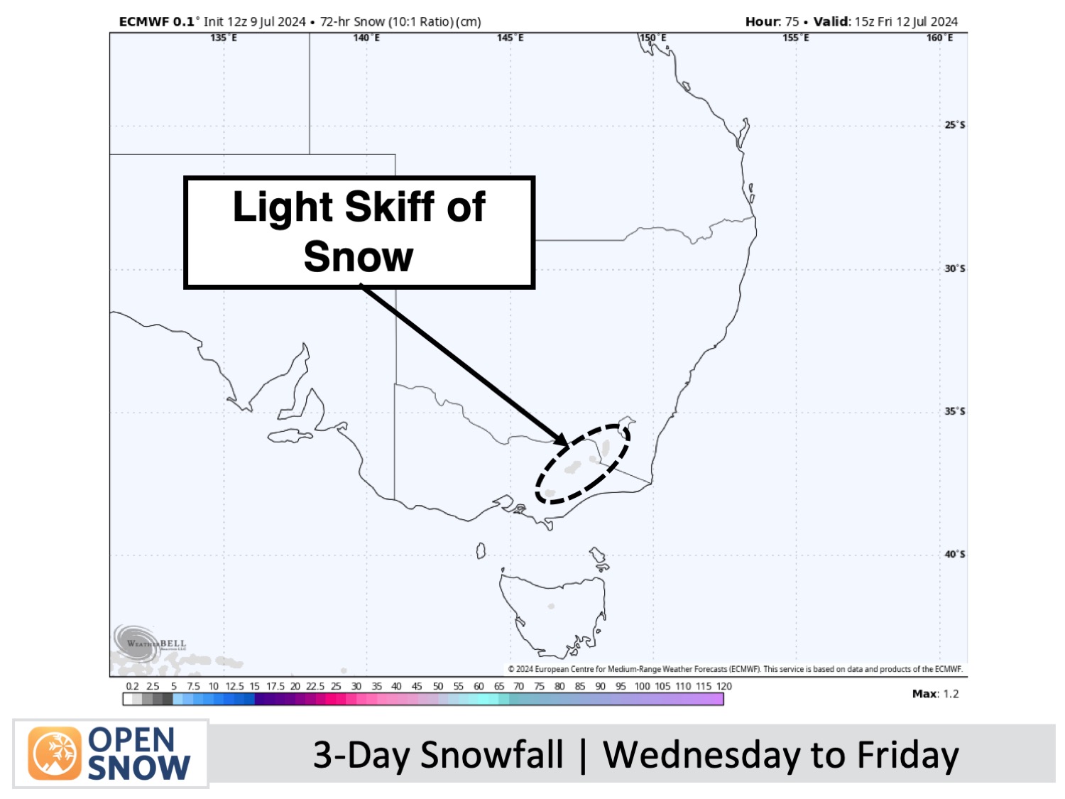
Forecast for Wednesday to Friday (10th to 12th July)
A couple of weak storm systems will bring light precipitation to the Australian Alps during this time. The first one has light rain and drizzle falling through most of Wednesday, with snow levels sitting above about 1800m.
Thursday will start off mostly fine, but there will be an increase in cloud and northwest winds as the day progresses. A weak front will then spread light showers over Victoria late in the day. As a cooler airmass arrives, snow levels will gradually lower to about 1500-1600m Thursday night.
The light showers will continue over Victoria until late Friday, leaving a light dusting of fresh snow about mid-upper slopes. One or two of the light showers will also likely turn up on New South Wales resorts late in the day, but they will mostly sit under high cloud for the day.
Forecast for the weekend (13th & 14th July)
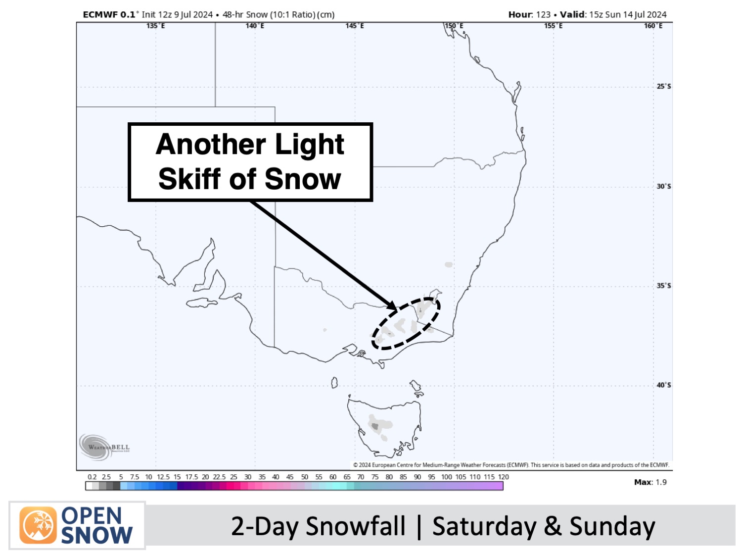
Both Saturday and Sunday are expected to start off mostly fine with light southwest winds. However, a couple of very weak cold fronts will spread clouds and a few light snow flurries eastwards over the Aussie Alps each day. While accumulations will be minimal to none, Mt Baw Baw may see several centimetres accumulate on Saturday. As temperatures continue to cool, freezing levels will drop below the base level of all resorts late Saturday, so the snow machines will get some good run time.
Extended Forecast
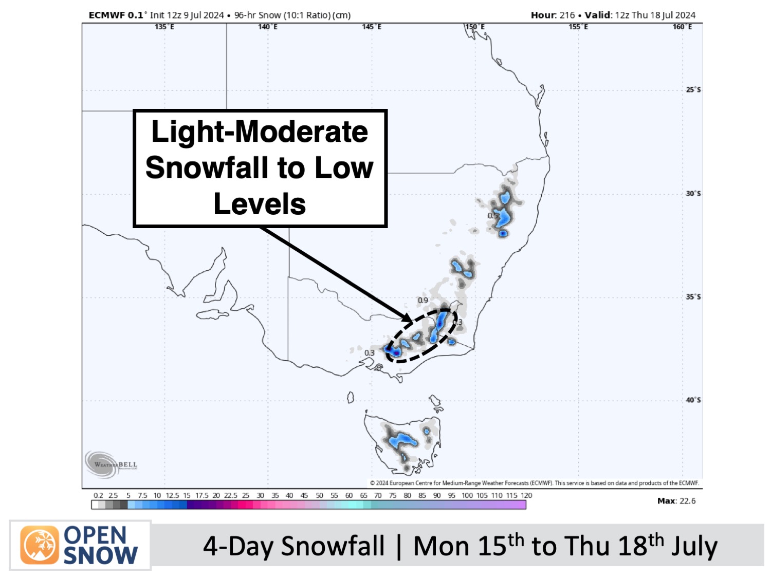
We should see a big improvement in conditions next week as a slow-moving Tasman Storm brings an unsettled and icy southwest flow to the Aussie Alps. Snow showers are likely from Monday, July 15th through to Thursday, July 18th, possibly bringing moderate accumulations, while snow guns will get plenty of run-time.
Thanks for reading. I'll keep these forecasts coming every Monday, Wednesday & Friday throughout the southern hemisphere season.
Mike O'Connor
About Our Forecaster


