Australia Daily Snow

By Mike O'Connor, Meteorologist Posted 1 year ago July 12, 2024
Snow Aid On The Way as Storm Ramps Up
Summary
Australian cries for more snow will be answered over the next several days as conditions gradually become colder, snowier and rougher, thanks to a storm in the Tasman Sea sending some much-needed snow aid our way. It won't all go our way, however, as snow levels will jump around at the beginning and end of this storm cycle, mixing in some wet stuff at low and mid altitudes.
Short Term Forecast
Current Conditions
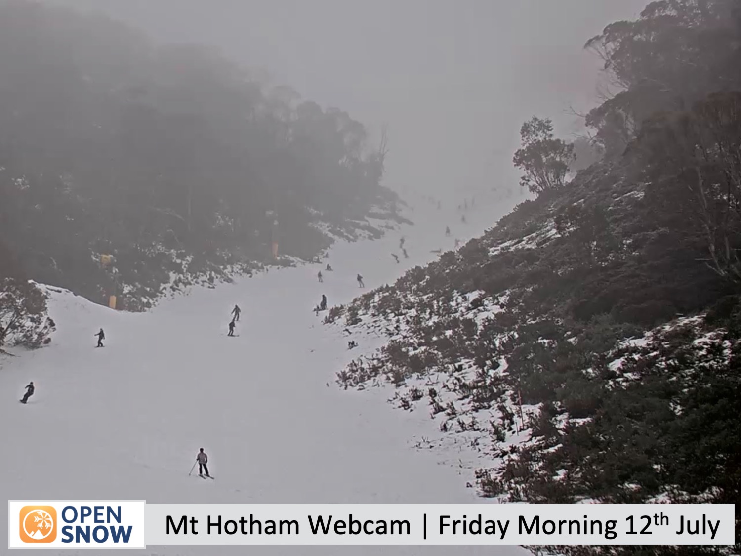
It's been a long time since we had a decent snowfall in the Australian Alps and ski resorts here are screaming out for more. A string of fine, sunny weather followed by wet, humid conditions has seen the small, precious snowpack built up earlier in the season slowly whittle away these last couple of weeks. The limited terrain once on offer has become even more limited as resorts have had to close a number of lifts.
However, relief isn't far off, as you'll read. The next several days will bring desperate snow aid, which has already started in Victoria, with some light snow falling overnight Thursday alongside some snowmaking.
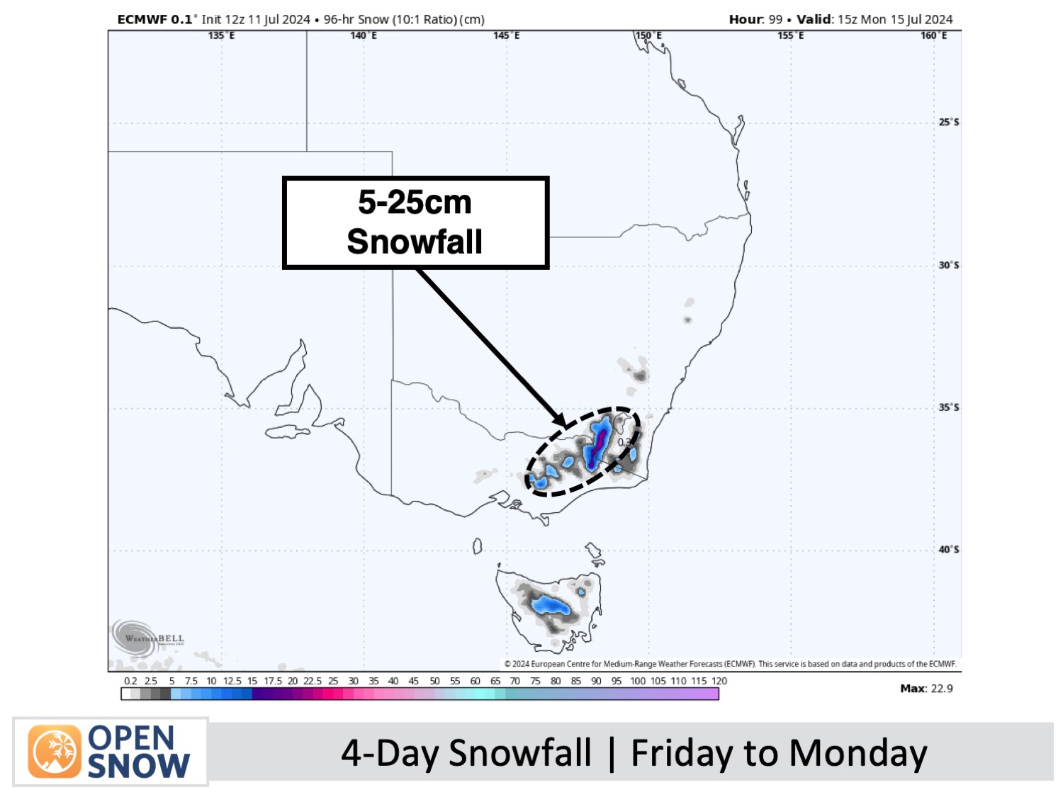
Forecast for Friday, this Weekend and Monday (12th to 15th July)
Conditions in the Australian Alps will gradually become rougher, colder, and snowier over this period as a storm develops in the southwest Tasman Sea. Overall, Australian ski resorts should score a decent top-up of snow, as the image below shows.
On Friday, light snowfall over Victoria will turn wet at mid and lower altitudes as temperatures warm. New South Wales will only see a spot or two of this precipitation at most, but it will otherwise sit under an extensive layer of high clouds.
Colder southwest winds will arrive and strengthen this weekend, bringing a few light snow showers on Saturday and then more widespread snow showers to low levels on Sunday. The colder temperatures on Sunday should also have the snowguns firing on all four cylinders as resorts desperately make snow while they can. Mt Baw Baw will likely score the most snow during this time, with up to about 10-15cm possible, while the others will likely receive 5cm or less.
Monday will bring more snow, with periods of moderate to heavy falls possible as southwest winds become strong. They will likely reach 60-80km/h or more in places and create blizzard conditions. Warm air will also get caught up in the storm, causing snow levels to rise over Victoria, where it'll turn wet and nasty at mid and low altitudes.
Extended Forecast
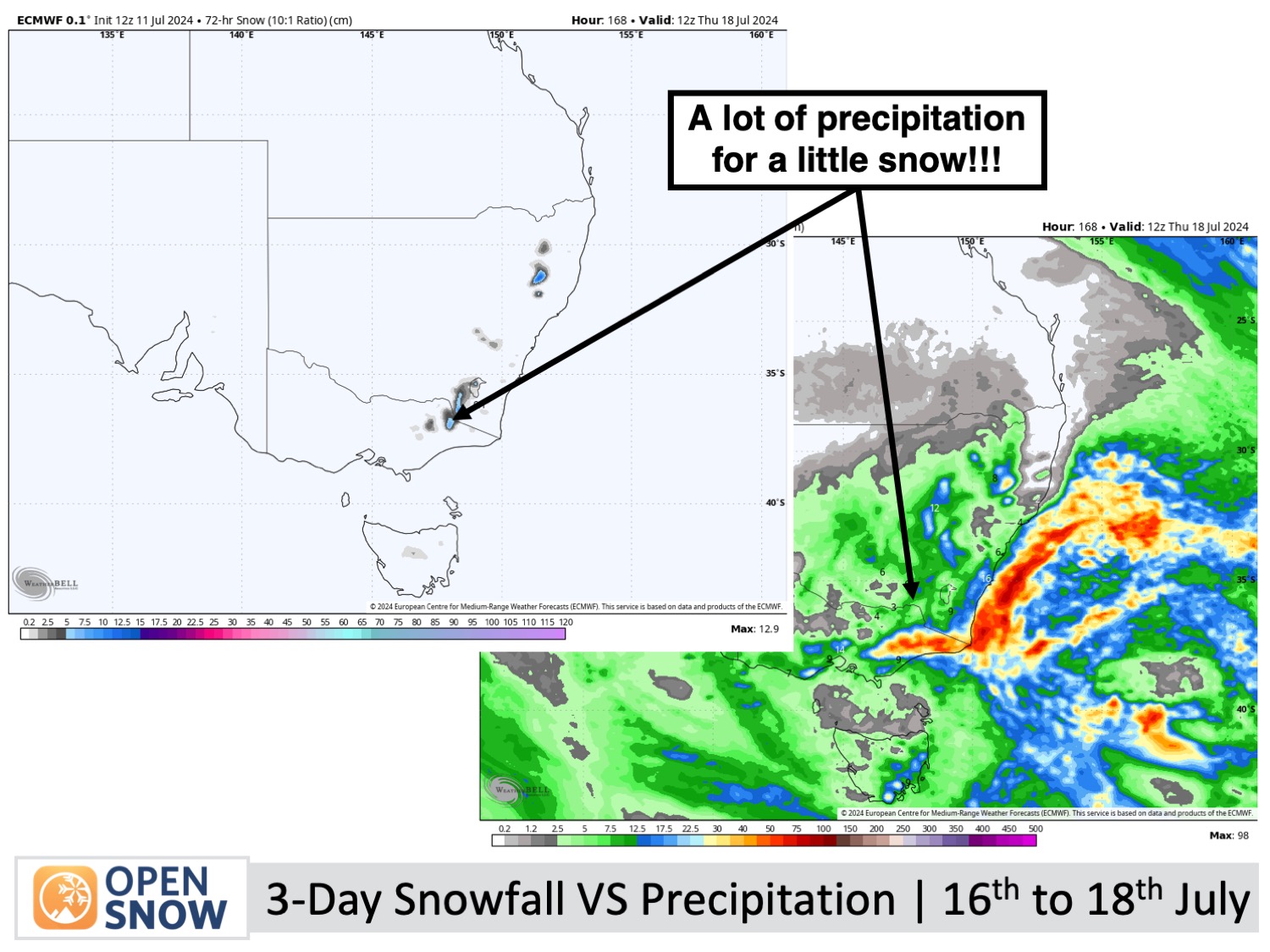
Snowfall will continue in the Australian Alps on Tuesday, July 16th, before gradually winding down on Wednesday, 17th, and Thursday, 18th, as the storm centred to the east eventually moves away towards New Zealand. During this time, winds may turn to the southeast, with warm air momentarily getting caught up in the mix. So, although high altitudes will pick up another top-up of powder, the mid and low altitudes will likely just get a dusting amongst some wet stuff.
Thanks for reading. I'll keep these forecasts coming every Monday, Wednesday and Friday throughout the southern hemisphere season.
Mike O'Connor
About Our Forecaster


