Australia Daily Snow

By Mike O'Connor, Meteorologist Posted 1 year ago July 14, 2024
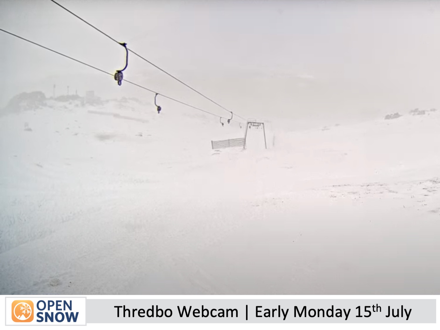
First Decent Snowstorm in over a Month
Summary
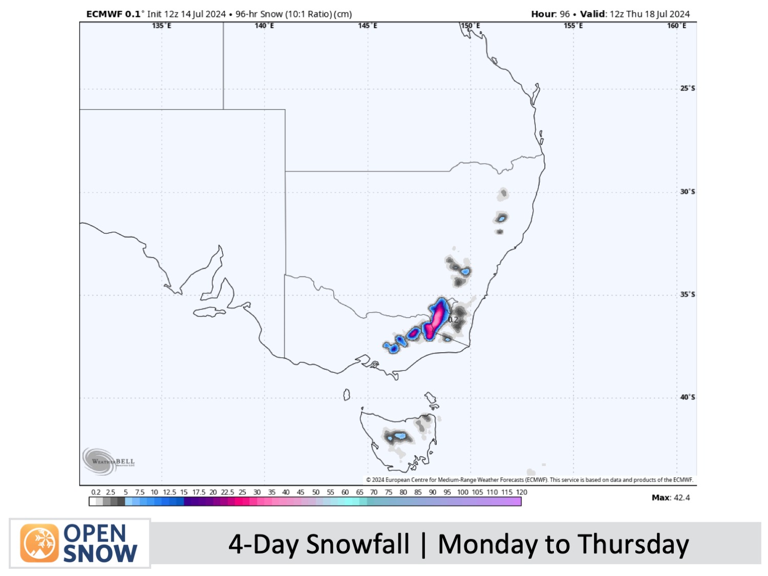
Australian resorts are about to see a huge improvement in conditions as a snowstorm arriving Monday is set to dump up to 40+ cm of powder at high altitudes and as little as 15cm at low altitudes. The heaviest snowfall is earmarked for late Monday, after which time temperatures will jump around, turning snow to rain at times at mid-low altitudes, hence the large range in accumulations.
Short Term Forecast
Forecast for Monday to Thursday (15th to 18th July)
At last, the Australian Alps will see the first decent snowstorm in over a month. A storm centred to the southeast will drop between 15 cm and 40+ cm of snow during this period. However, it won't all go our way as temperatures and snow levels will jump around, turning snow to rain at times at mid and low altitudes, leading to a large range in accumulations between the top and bottom of ski resorts. Nevertheless, this storm will see conditions take a massive leap in the right direction after being stuck in struggle street for so long.
First, on Monday, light snowfall, which has already been falling over the past 24 hours, will gradually intensify to heavy falls late in the day while westerly winds go from strong to even stronger, creating harsh blizzard conditions and limiting ski operations.
Then, Monday night into early Tuesday, warmer winds from the south arrive, turning snow to rain at mid and low altitudes. Luckily, as this happens, the precipitation will pin back to showers for the rest of Tuesday, so damage to the snowpack shouldn't be too bad. However, the showers are expected to get heavier and more persistent for a time in Victoria during the second half of the day as strong southerlies turn southeast, likely limiting lift operations again.
On Wednesday, resorts will pick up some more light snowfall about the top half of their slopes before clearing to a mostly fine day on Thursday as the storm slowly moves away, allowing strong southerly winds to ease and turn southwest gradually. Mt Baw Baw will make the most of these dwindling snow showers, likely hanging on to them until late Thursday.
Extended Forecast
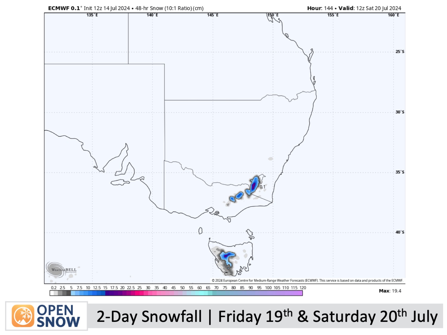
An eastward-moving cold front is set to drop another light to moderate dusting of snow late Friday into Saturday. Early model figures suggest we can expect anywhere up to 20 cm, giving Australian resorts another significant boost.
Thanks for reading. I'll continue to provide these forecasts every Monday, Wednesday, and Friday throughout the southern hemisphere season.
Mike O'Connor
About Our Forecaster


