Midwest Daily Snow

Heads up, there may be fresher snow! Read the latest Midwest Daily Snow

By Croix Christenson, Meteorologist Posted 1 year ago February 5, 2023

Mild With Multiple Rounds of Rain and Snow on Tap

Summary

The week ahead promises to bring milder temperatures and a few rounds of rain and snow. The first arrives Monday into Tuesday with the second arriving Thursday into Friday. Some hints of a little bit colder air possible this upcoming weekend but nothing arctic, perhaps cold enough for some light lake effect snow.

Short Term Forecast

Sunday:

Snowfall reports so far Sunday morning are in the dusting to 1" range for the Lake Superior region over towards lower Michigan. The area of light snow is slowly moving east Sunday morning across the UP with light snow showers or flurries found elsewhere. Additional snow on Sunday will be minimal, mainly a dusting to 1" or so. Some light snow is being reported near the Twin Cities as well, but accumulations will mainly be a dusting. 

Temperatures will be pleasant on Sunday with mainly low 20s to low 30s, however, the Detroit, Michigan resorts may sneak into the low 40s as some southwesterly winds bring in warmer air coupled with a decreasing snowpack.  

Monday - Tuesday:

  • Snow quality will be wet/dense to medium-density powder
  • Generally, 1-3" of snow is expected
    • Best odds favor the north shore of Lake Superior, UP, and over towards Searchmont

For a system now only 36 hours out, there's still quite a bit of uncertainty on how far north the rain/snow line makes it. There is about a 75-mile difference between the models, which is quite a lot for a system that's only a day+ out. 

Some of the most recent trends have been to bring the rain/snow line a little further south, and if that is the case we may see a little more snow for the northern Wisconsin and Twin Cities resorts. 

Here is a look at the OpenSnow Multi-Model, which I think is doing a decent job of handling the snowfall amounts and locations of snow. 

What about the snow quality expected? Sadly, with the milder temperatures I still expect the snow quality to be wet/dense to medium-density snow, rather than dry/fluffy. 

By early Monday the mesoscale (small-scale) models will be able to capture the full event and hopefully help nail down the snowfall totals a little bit more. 

Timing:

Precipitation arrives in Minnesota Monday afternoon with most of it ending by midday Tuesday in the Midwest, with lingering snow up near Searchmont. 

Forecast precipitation types from the ECMWF from midday Monday to Tuesday early evening:

Extended Forecast

Wednesday - Sunday (February 8-12):

  • Wednesday will be quite mild all the way from Loch Lomond down to the southern portions of the Midwest
  • Overall above normal temperatures likely lasts into the middle of February
  • A significant number of models (~65%) have another system Thursday into Friday
    • This system would bring rain and snow to the Midwest
    • A swath of moderate snowfall (3-6"?) is possible
    • Models inconsistent on where the heaviest band of snow sets up
  • Some models (~40%) have a weaker system for next weekend that would bring light snow chances
    • Maybe some colder air for some lake effect snow this upcoming weekend too

Fantasy Land Week of February (13-19):

  • Likely continue to see above-normal temperatures overall
  • About half of the models (~40-50%) have a larger system around 14-16 of February
    • This is a surprising signal for something 10 days away
  • Hints of a pattern change around the 17th, to near normal or below normal for a period
    • If this pattern change is being accurately handled by the models, it would mean the return of more lake effect snow

-Croix

Announcements

Road Conditions:

Regions:

North Shore Lake Superior/Northeast Minnesota
Giants Ridge, Spirit Mountain, Mont du Lac, Lutsen, Bearskin, Loch Lomond, Mount Baldy

UP/South Shore Lake Superior/Lake Effect Snow Belt
Birkie, Whitecap, Powderhorn, ABR, Porkies, Snowriver, Ripley, Bohemia, Marquette Mtn, Ski Brule, Pine Mtn, Searchmont

Twin Cities Region
Trollhaugen, Wild Mountain, Powder Ridge, Hyland Hills, Afton Alps, Buck Hill, Welch Village, Mount Kato, Coffee Mill

Central Wisconsin
Granite Peak, Paul Bunyan, Nordic Mtn

Southern Wisconsin Region
Mt La Crosse, Cascade, Devil's Head, Tyrol, Little Switz, Sunburst, Wilmot, Alpine Valley(WI), Sundown(Iowa), Chestnut(Illinois)

Northern Lower Michigan/Traverse City Region/Lake Effect Snow Belt
Boyne Highlands, Nub's Nob, Boyne Mtn, Shanty Crk, Crystal Mtn, Caberfae, Treetops, Otsego

Southwest Lower Michigan/Grand Rapids Region/Kalamazoo Region/Lake Effect Snow Belt
Cannonsburg, Bittersweet, Timber Ridge, Swiss Valley

Southeast Lower Michigan/Eastern Michigan/Detroit Region
Mt Holly, Pine Knob, Mt Brighton, Alpine Valley(MI)

About Our Forecaster

Croix Christenson

Meteorologist

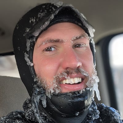
Croix grew up in Saint Paul, Minnesota where he developed his passion for the outdoors and snow. He attended the University of Wisconsin-Madison and received his BS and MS in Atmospheric Science. When not working, you will find Croix exploring his Duluth, Minnesota backyard by skiing, mountain biking, fishing, surfing, hiking with his dog Doppler, or just about any activity that gets him outside.

Free OpenSnow App