New Zealand Daily Snow

By Mike O'Connor, Meteorologist Posted 1 year ago June 6, 2024
Dry spell ends Sunday with wind and rain. Shots of powder Monday & Tuesday
Summary
The recent dry spell continues Friday and Saturday but ends Sunday with strong winds and rain as the next storm cycle begins. A couple of cold southerly changes bring shots of powder to the South Island on Monday and Tuesday.
Short Term Forecast
Current Conditions & Opening Dates
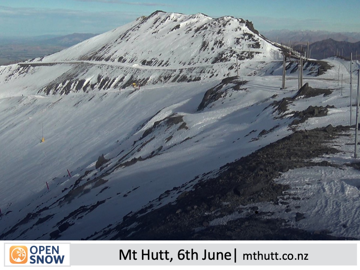
After a couple of weeks of sunny skies and several strong northwest wind events, the early snowpack has taken a beating, leaving Kiwi slopes as a patchwork of snow, rock and tussock.
The next few weeks will be crucial for snowfall and snowmaking as Mt Hutt and the Southern Lakes resorts plan to open on the 14th and 15th of June respectively. Whakapapa and Turoa on Mt Ruapehu and Porters Pass plan to open on 28th June, while club fields elsewhere will open thereafter as conditions allow.
Forecast for Friday & Saturday (7th & 8th June)
Friday and Saturday will bring mostly sunny skies and light winds to all Kiwi resorts as high pressure continues to dominate. However, Friday may see a shower or two passing over Mt Ruapehu and there’ll just be a little bit of cloud about the Southern Lakes. Low cloud will also fill the valleys and basins below resort level for at least part of the morning periods, but don’t let that fool you into thinking it’s not fine up top! Overnight temperatures should be cold enough for snowmaking.
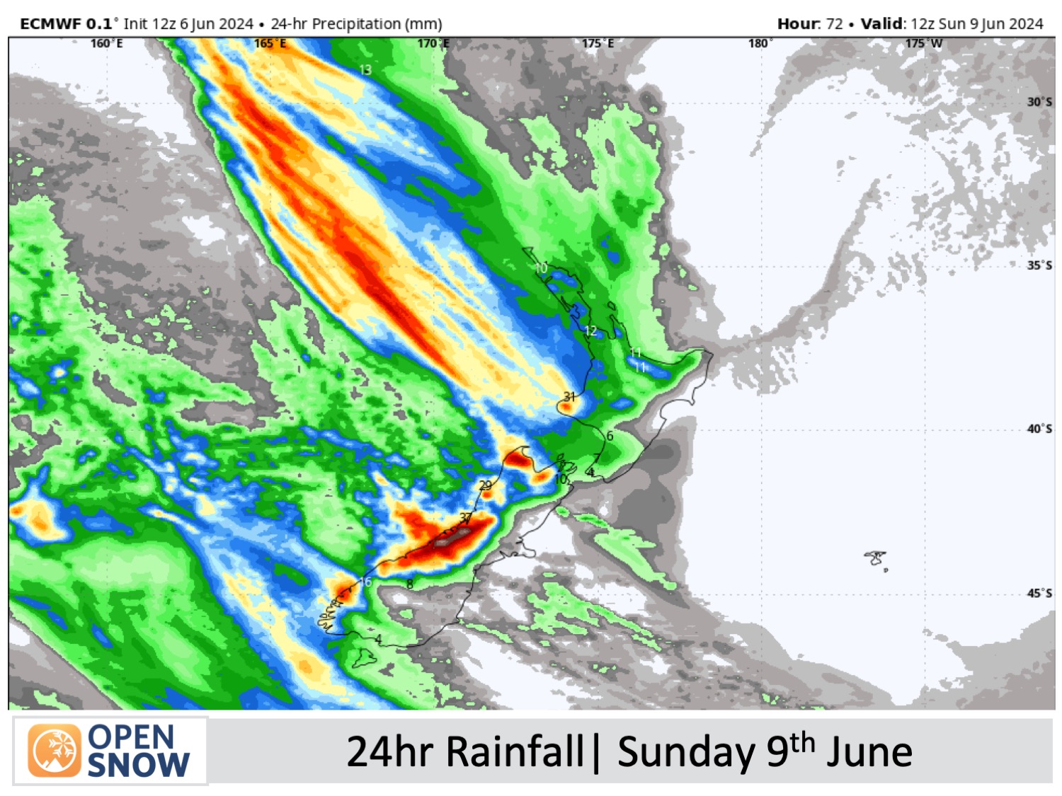
Forecast for Sunday (9th June)
Sunday will be a write-off as a storm from the Tasman Sea moves onto the country. Rain spreads over the South Island during the day, then over Ruapehu in the evening, with heavy falls at some resorts, especially those closest to the Main Divide (eg Treble Cone and Temple Basin). Northwest winds become strong, especially over Canterbury where gusts could reach 100-120km/h.
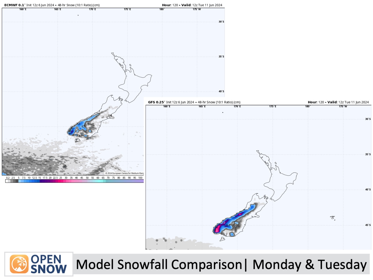
Forecast for Monday & Tuesday (10th & 11th June)
The main storm front moves out east during this time, allowing a couple of cold southerly fronts to quickly pass over the South Island on Monday and Tuesday. Both fronts bring a shot of powder, the second one dropping snow to low altitudes being the coldest of the two. Model forecasts have sneakily backed off on snowfall accumulations, but at present, we're looking at a range of 5 to 15cm across South Island resorts.
On Mt Ruapehu, heavy rain and strong northwest winds ease to showers on Monday and persist through Tuesday. Unfortunately, both fronts wilt before reaching the mountain and snow is unlikely.
Extended Forecast
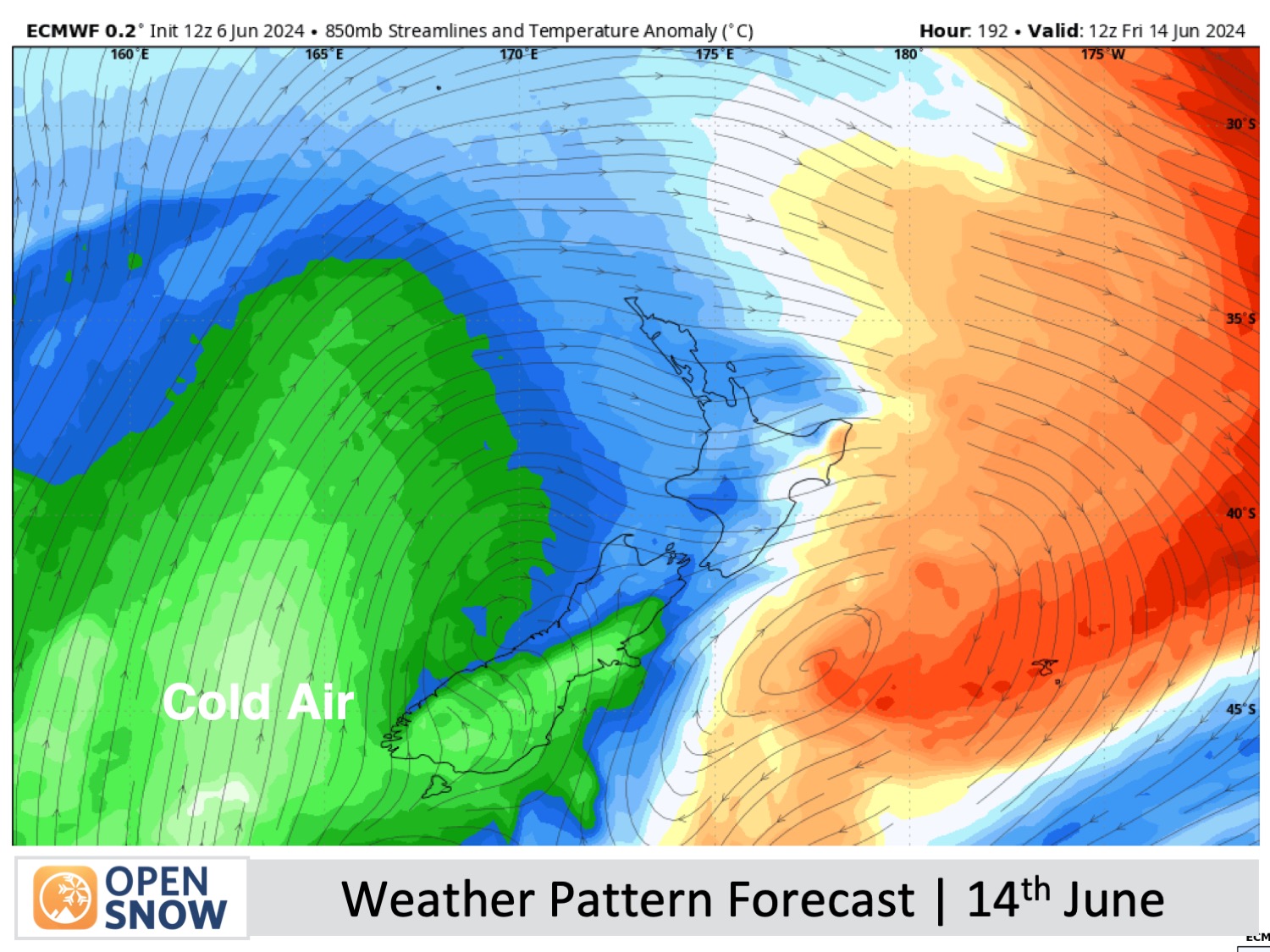
The future is looking very positive with the next storm likely to hit New Zealand on Wednesday 12th of June, starting out with a mix of snow and rain before the cold air arrives on Thursday 13th or Friday 14th June. The storm is then expected to rage on for several days, with bitterly cold temperatures bringing snowfall to the country through Opening Weekend and possibly into Monday 17th or Tuesday 18th of June. At this early stage, Mt Ruapehu looks like it'll cop a heavy load of snow, with light-to-moderate loads for South Island resorts. Resorts will also be able to make a tonne of snow. This should get the season off to a rocketing start.
Thanks for reading. I'll keep these forecasts coming every Monday, Wednesday & Friday throughout the southern hemisphere season.
Mike O'Connor
About Our Forecaster


