New Zealand Daily Snow

By Mike O'Connor, Meteorologist Posted 1 year ago June 9, 2024
Shots of powder Monday into early Tuesday. Rain & dense snow from Thursday
Summary
A couple of shots of powder and some snowmaking on Monday and early Tuesday will provide a much-needed boost to NZ's snowpack. However, a slow-moving Tasman storm will likely bring rain and/or low-quality snow from Thursday into Opening Weekend this weekend.
Short Term Forecast
Current Conditions & Opening Dates
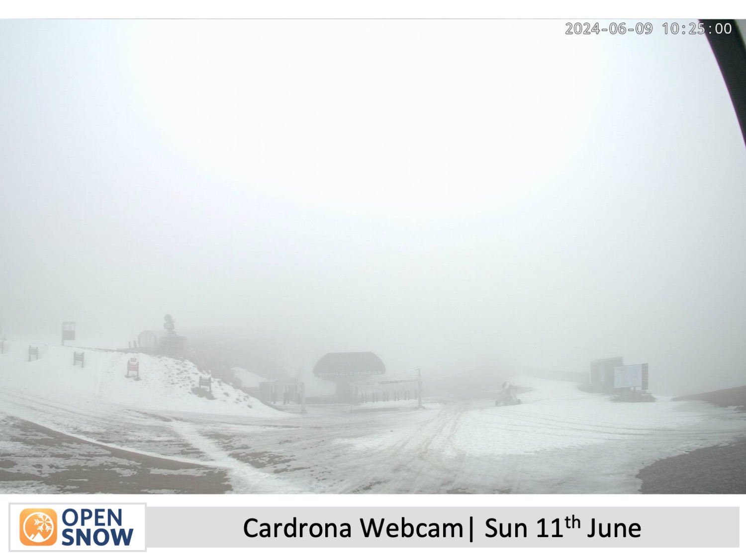
Strong northwest winds and rain during Sunday have further damaged our already thin and patchy snowpack, adding a little more salt in the wound after it had already taken a beating these last couple of weeks.
This week is crucial for snowfall and snowmaking as Mt Hutt and the Southern Lakes resorts plan to open on the 14th and 15th of June respectively. Treble Cone, Porters Pass, and Whakapapa and Turoa on Mt Ruapehu plan to open on the 28th and 29th of June, while club fields elsewhere will open thereafter as conditions allow.
Forecast for Monday & Tuesday (10th & 11th June)
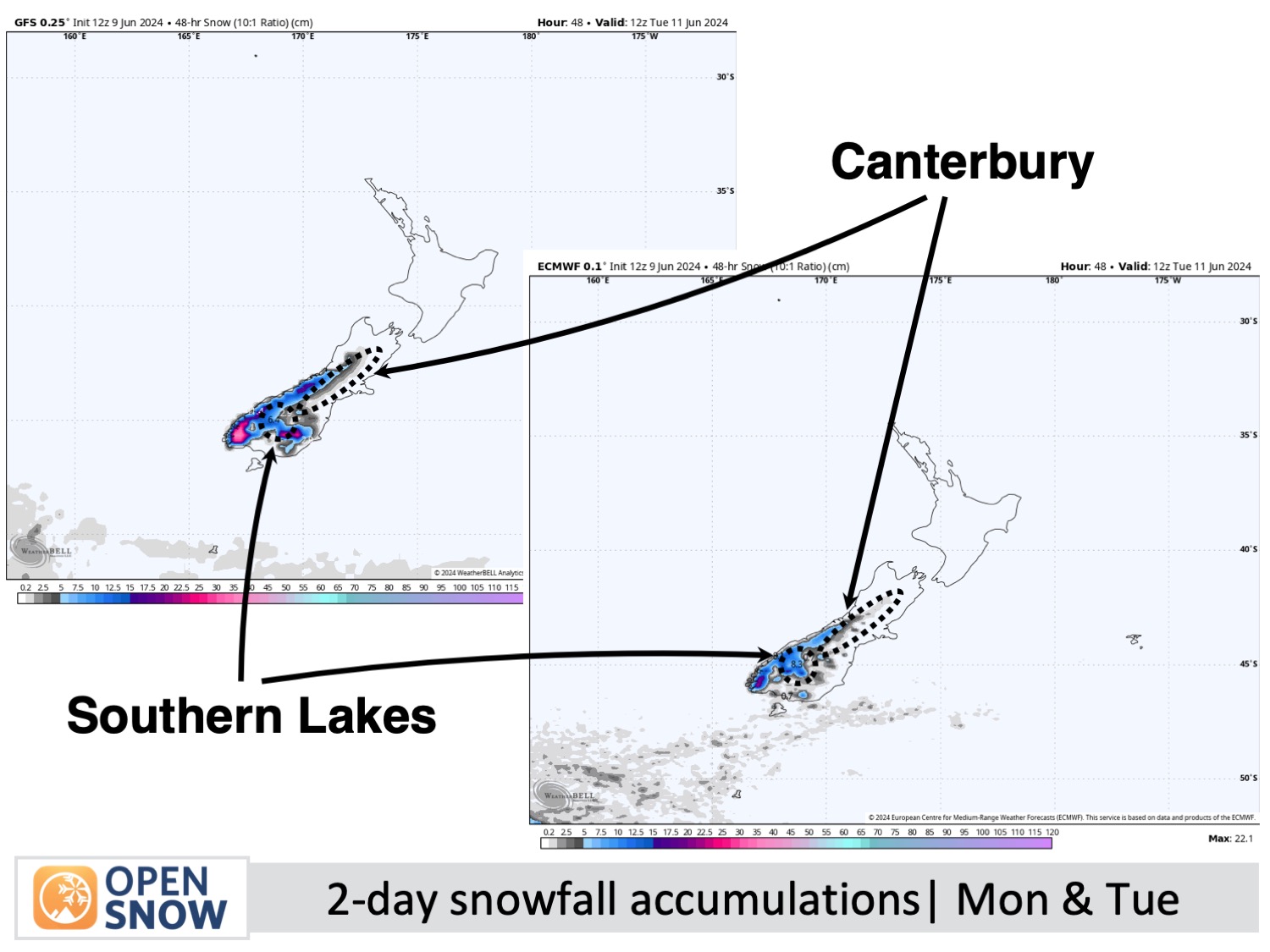
Two fast-moving cold fronts will bring shots of powder to South Island resorts during this time. The first front passes over the Southern Lakes early Monday morning before working its way up Canterbury throughout the rest of the day, turning winds to a cooler southwesterly for a time. Snowfall totals will be in the 3-7cm range down to mid-low altitudes.
The second front will be colder and will hit the Southern Lakes Monday night, with another 3-7cm falling to low altitudes. However, winds will be westerly orientated so Canterbury resorts will only receive a light dusting, if anything at all, during predawn hours of Tuesday. Skies will then clear for a nice day on Tuesday and temperatures will remain cold to give resorts the chance to make snow.
Forecast for Wednesday to Friday (12th to 13th June)
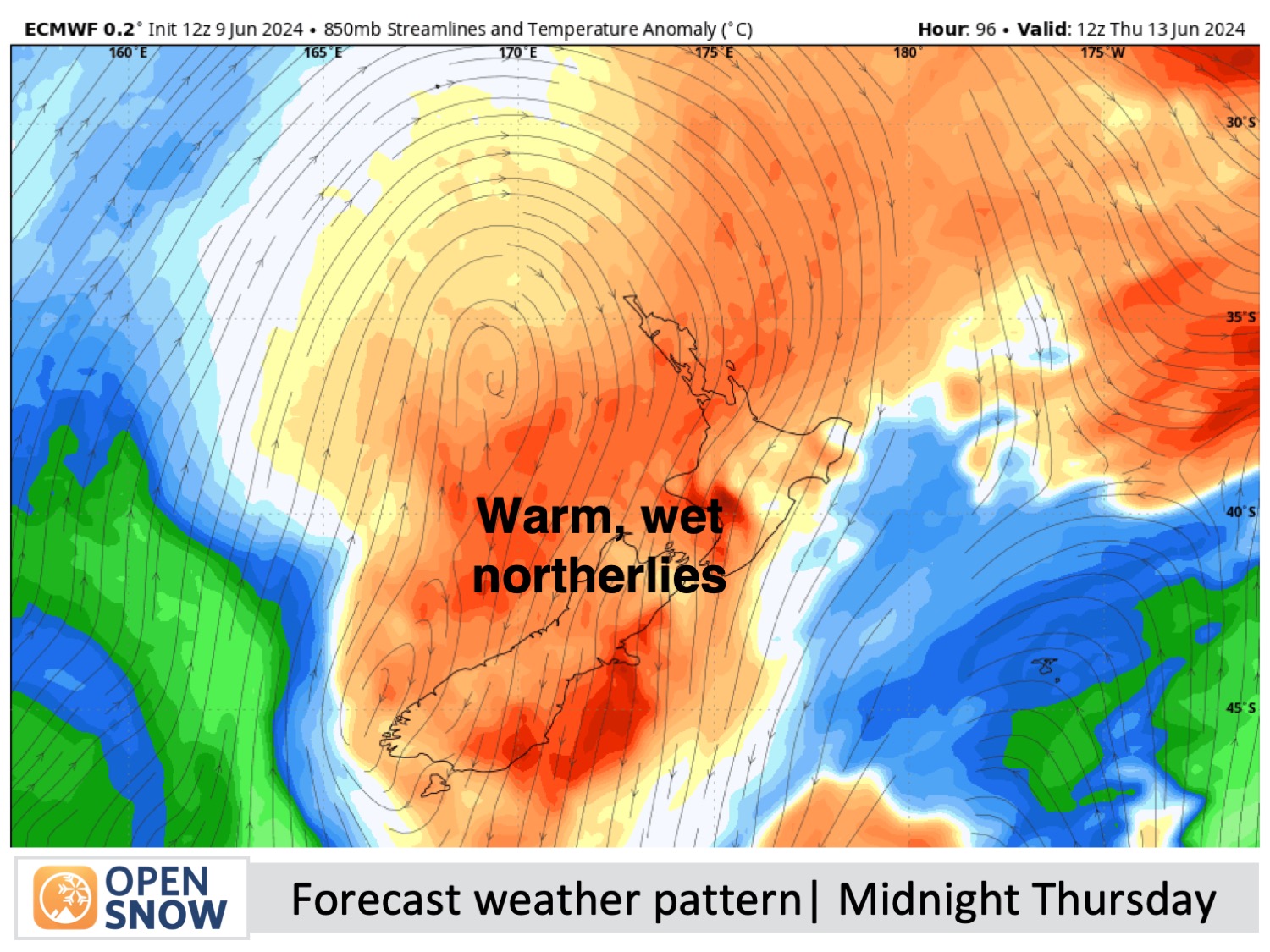
A cold start to Wednesday should see more snow being made on South Island resorts before milder northerly winds develop as a storm enters the Tasman Sea. Cloud will build later on Wednesday before rain starts to spill over the Main Divide onto the Southern Lakes from Thursday morning, then onto Canterbury resorts from Thursday evening.
From here uncertainty ramps up as forecast models struggle to deal with the storm as it bounces around in the Tasman Sea for about another six more days.
Friday will likely bring more widespread rain to the country, which, if we're lucky, will fall as snow to resort-base levels in the Southern Lakes and about the tops in Canterbury. Any snow that does fall will be the dense, low-quality type, and the snowpack on at least the mid-lower slopes of Canterbury will likely suffer more damage - not ideal for opening Day at Mt Hutt!
Extended Forecast
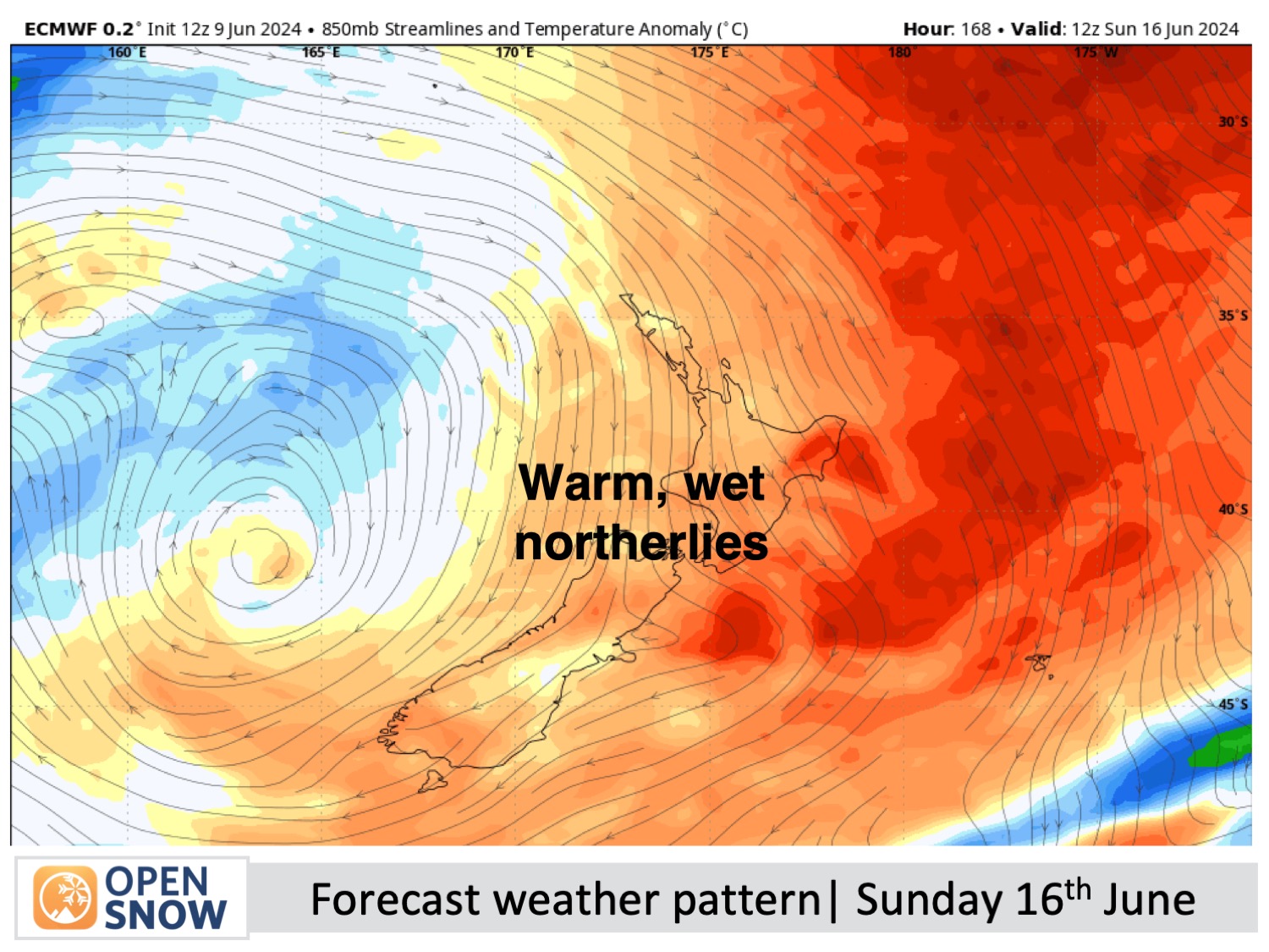
As I mentioned above, a storm will continue to bounce around in the Tasman Sea until around Thursday 20th of June. There's a lot of uncertainty during this time as small changes in its position can lead to big changes in the forecasted weather. Earlier forecasts expected a lot more cold air to get caught up in the system, leading to big snowfalls for the South Island. However, the latest model forecasts show that winds will remain from the warmer northerly quarter, so we're likely to cop periods of rain and/or high-level dense, low-quality snow - long story short, it doesn't look pretty.
Thanks for reading. I'll keep these forecasts coming every Monday, Wednesday & Friday throughout the southern hemisphere season.
Mike O'Connor
About Our Forecaster


