New Zealand Daily Snow

By Mike O'Connor, Meteorologist Posted 1 year ago June 11, 2024
Lingering Tasman Storm to Bring Rain for Friday and Saturday Opening Days
Summary
Wednesday will be nice and white after a couple of shots of powder on Monday and Tuesday. But a lingering Storm in the Tasman Sea will bring rain and mostly high-level snow to the country at times from Thursday into Saturday, clearing to fine Sunday.
Short Term Forecast
Current Conditions & Opening Dates
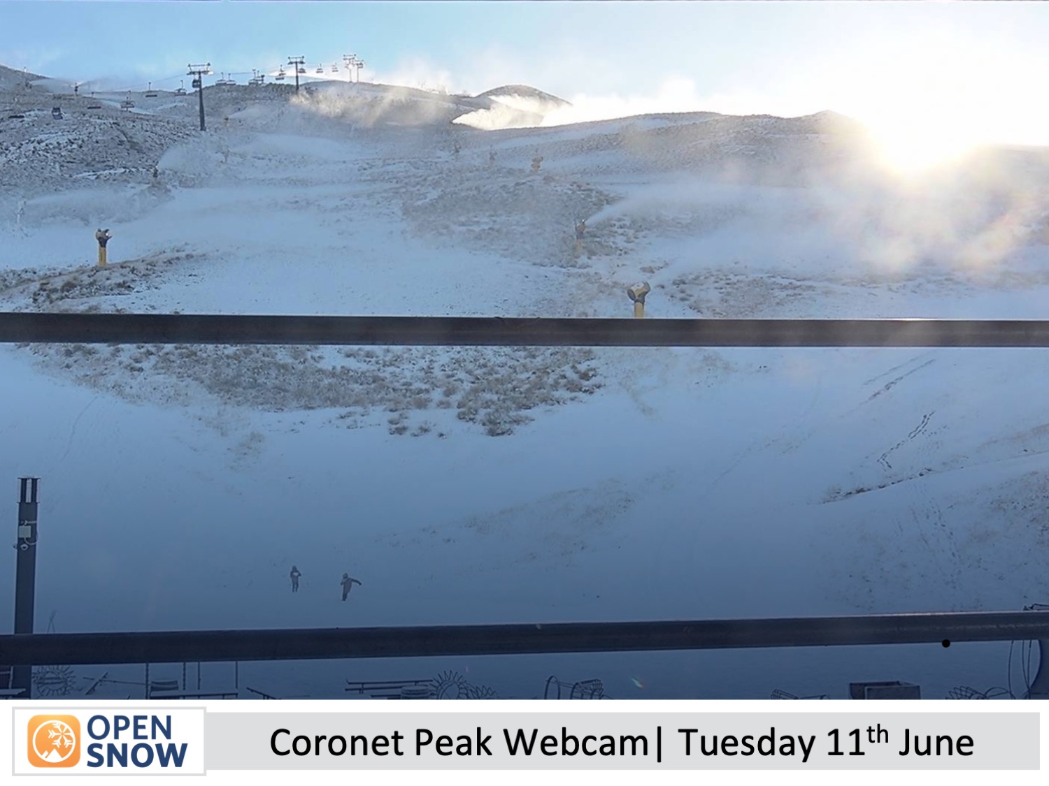
A couple of small shots of powder Monday and early Tuesday have left a dusting of snow covering New Zealand ski fields, and cold temperatures have given resorts a good chance to make a heap of snow. It's a timely improvement with only a few days left until resorts start opening their gates.
Mt Hutt plans to open on Friday, and Coronet Peak, The Remarkables and Cardrona are scheduled for Saturday. Treble Cone, Porters Pass, and Whakapapa and Turoa on Mt Ruapehu plan to open on the 28th and 29th of June, while club fields elsewhere will open thereafter as conditions allow.
Forecast for Wednesday and Thursday (12th & 13th June)
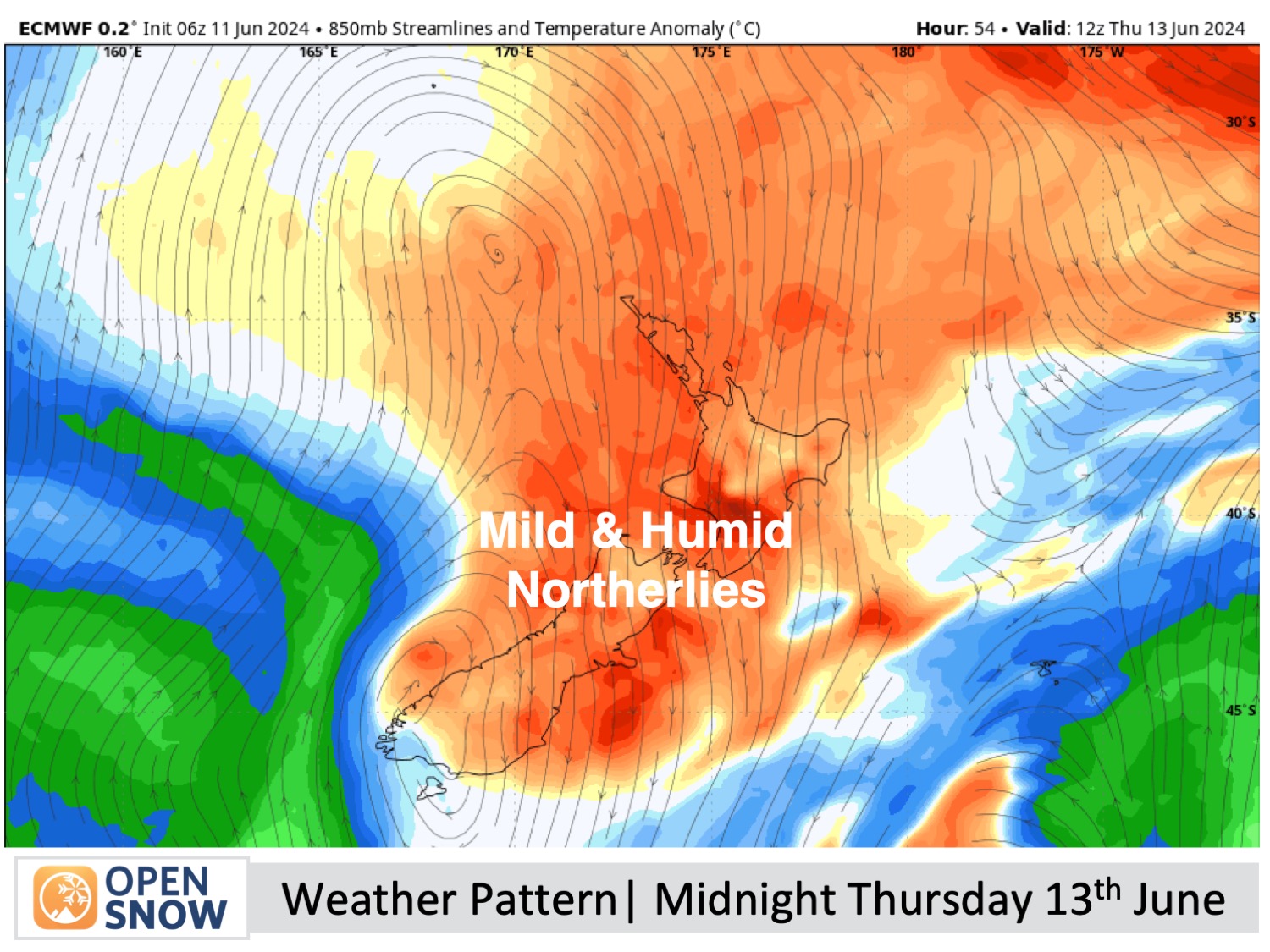
Wednesday will start fine and chilly for South Island, which should have the ski fields still running their snow machines. Clouds will then build from later in the day as a storm system arrives in the Tasman Sea where it becomes stuck and is expected to churn away for over a week, directing humid north-to-easterly winds over the country.
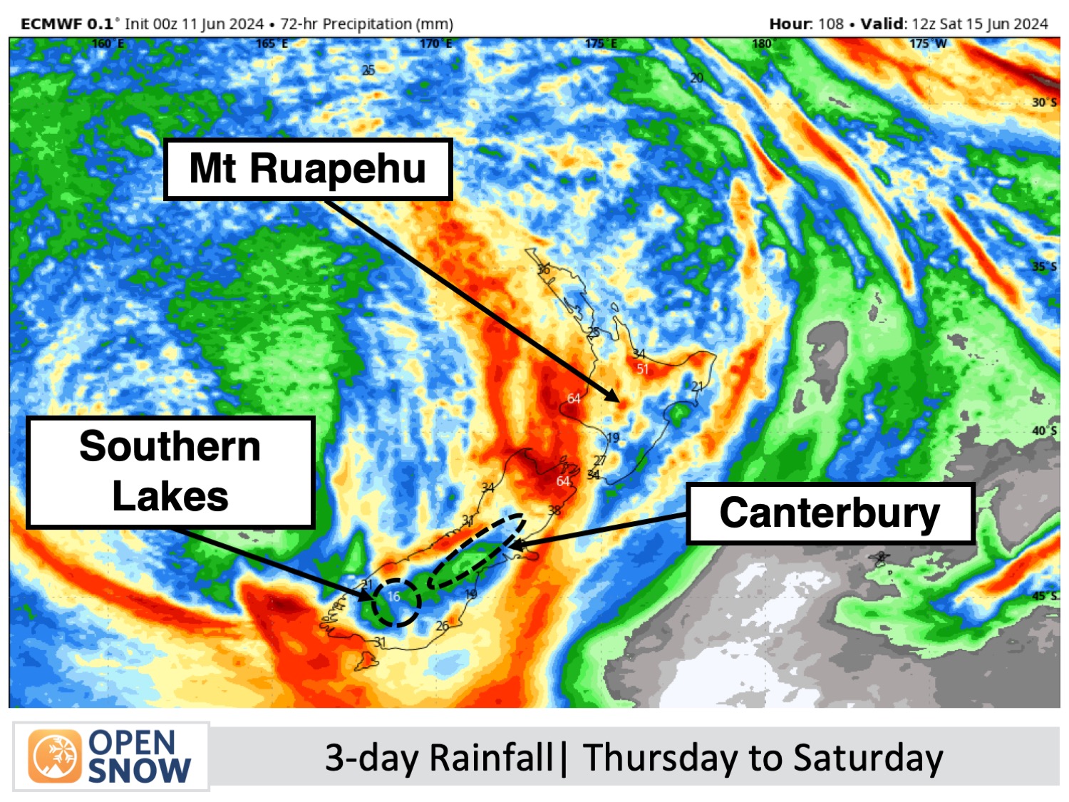
Light showers will get started over the Southern Lakes Wednesday night, falling as snow up high, picking up in tempo and volume on Thursday while spreading over Canterbury later in the day. There'll be heavy falls Thursday night, and we may even see snow levels coming down low in the Southern Lakes if we're lucky, although models are at odds about this and will likely be the dense, low-quality type.
It's not the kind of weather we want leading up to Opening Weekend and the snowpack will likely suffer some damage.
Forecast for Opening Weekend (Friday 14th to Sunday 16th June)
The storm will continue to churn in the Tasman Sea, literally raining on our Opening Weekend parade. There's a lot of uncertainty during this time as small changes in the storm's position can lead to big changes in the forecasted weather. I wouldn't be surprised if the forecast for Opening Weekend changes drastically when I reissue on Friday.
Rain will continue over the South Island on Friday and Saturday, although it may clear for periods. It may also be heavy at times, especially in Canterbury where conditions are likely to be the worst. The rain is likely to be lighter and less persistent over the Southern Lakes until later on Saturday, and we could see snow about the upper mountain.
The weather should clear up on Sunday for a mostly fine day as the storm centre drifts a little farther from the country.
Extended Forecast
The Tasman Storm is likely to continue bringing periods of rain and/or showers to the country until at least Thursday 20th June. The details are still very uncertain, but there is a chance we could see some cold air getting caught up in the mix which would lead to snow rather than rain.
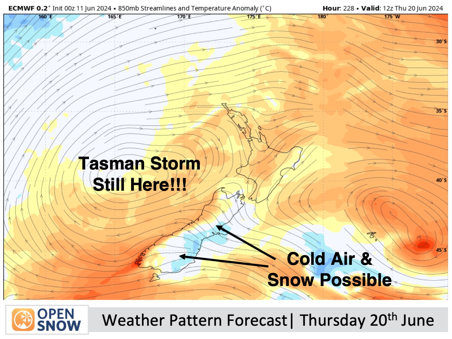
From about Friday 21st of June, the storm should pass over the country, leaving a period of cold southerlies and snow in its wake.
Thanks for reading. I'll keep these forecasts coming every Monday, Wednesday & Friday throughout the southern hemisphere season.
Mike O'Connor
About Our Forecaster


