New Zealand Daily Snow

By Mike O'Connor, Meteorologist Posted 1 year ago June 13, 2024
Better Conditions & Weather for Opening Weekend, Fresh Dump Mon-Tues
Summary
Recent snowfall and a couple of days of snow-making have improved conditions just in time for Opening Weekend this weekend. The weather is also looking much better compared to previous forecasts, with rain and snow clearing for at least large parts of each day. Then, on Monday & Tuesday, cold winds from the southeast will bring a fresh dump of high-quality snowfall.
Short Term Forecast
Current Conditions & Opening Dates
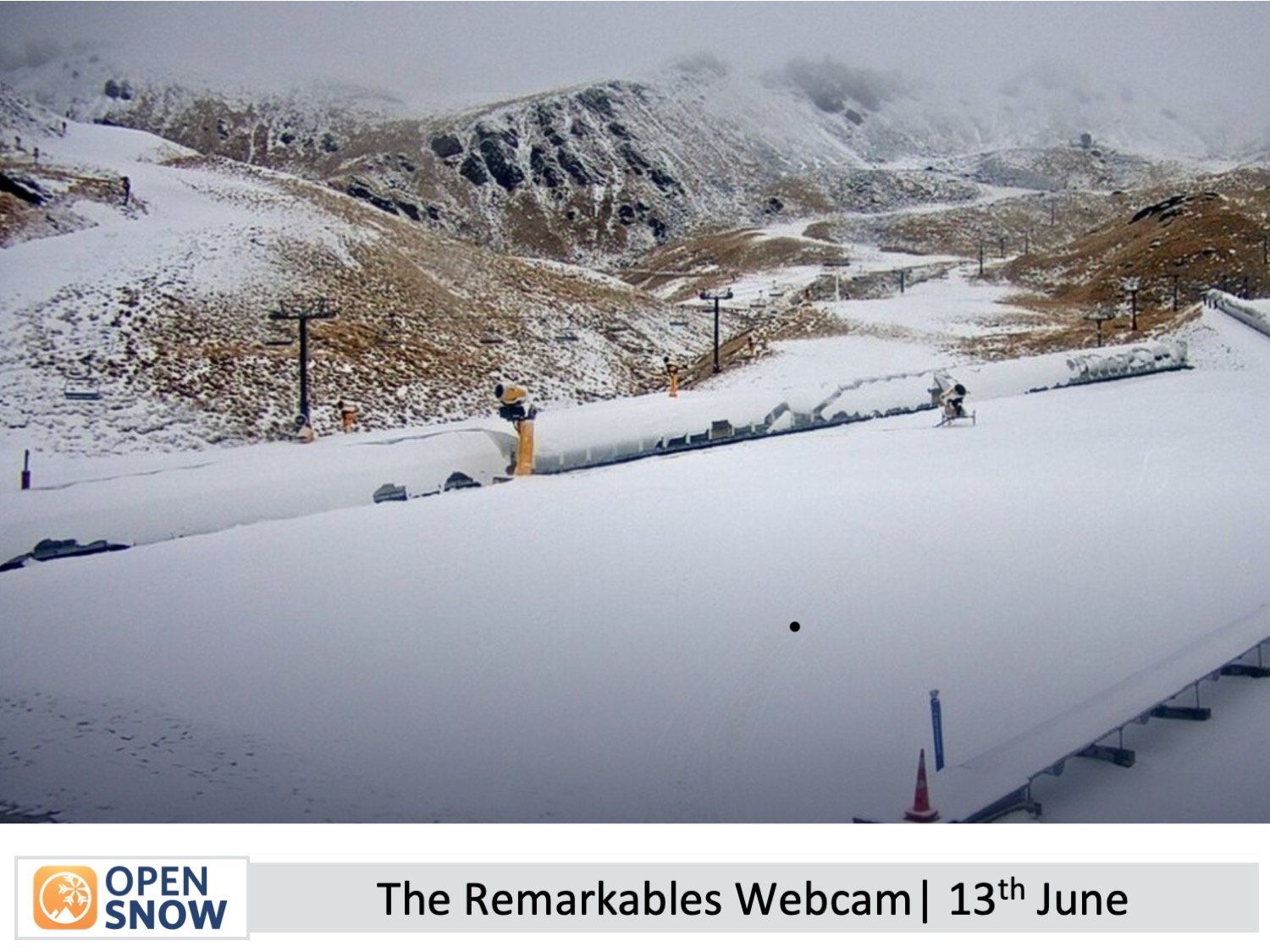
After those shots of powder on Monday and Tuesday, resorts were able to get a couple of days of snow-making done, and the Southern Lakes also received light snowfall on Thursday which has continued overnight up until the time of writing (early Friday morning). So ski fields are looking much better for Opening Weekend this weekend, and as you'll see/read, the weather is looking much better too compared to previous forecasts.
Mt Hutt is aiming to open on Friday. Coronet Peak, The Remarkables and Cardrona are aiming for Saturday. However, the final call to open will be made the morning of, and it'll be restricted to limited terrain. Treble Cone, Porters Pass, and Whakapapa and Turoa on Mt Ruapehu plan to open on the 28th and 29th of June, while club fields elsewhere will open thereafter as conditions allow.
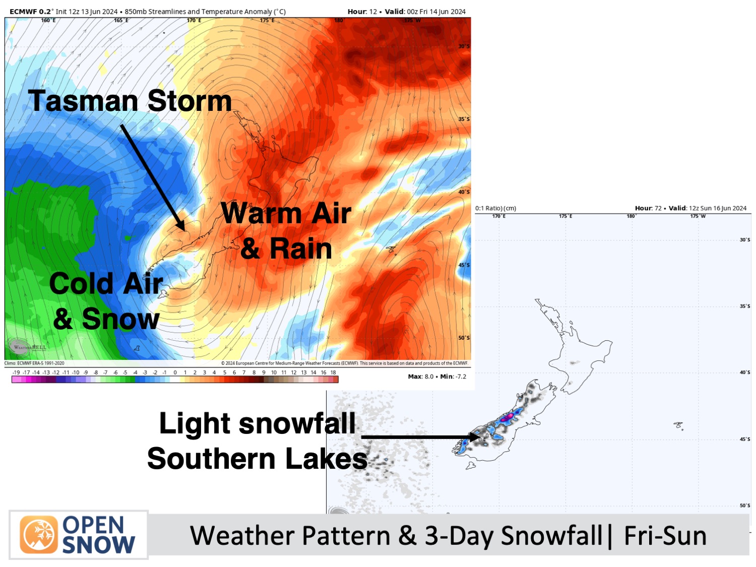
Forecast for Opening Weekend, Friday 14th to Sunday 16th June)
The storm system that's been lingering in the Tasman Sea will continue to hang about there throughout this period, briefly brushing up against the west coast.
The Southern Lakes will pick up another 5cm or so during this time, but it'll be the dense low-quality variety. The bulk of that will fall early Friday, then again Friday night into early Saturday, before skies clear up for a fine day Saturday - perfect timing for Opening Day there. Sunday will also be mostly fine, with the slight chance of light snow showers, although models are at odd about this.
In Canterbury, rain clears early Friday just in time for Mt Hutt to Open, but will return from late Friday afternoon and turn to snow up high for a time Friday night. Skies will clear early Saturday for a nice, sunny day, then snow showers will spill over the Main Divide on Sunday as northwest winds strengthen. The snow showers will reach the Craigieburn club fields, but only one or two, if any, is likely for Mt Hutt.
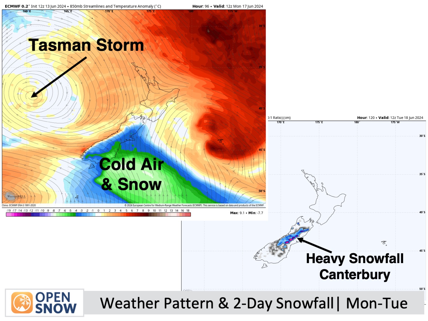
Forecast for Monday & Tuesday (17 & 18th June)
From here uncertainty grows as models diverge - they've been all over the show as they've struggled with the Tasman storm which will keep on keeping on to the west of the country.
The scenario that I think is most likely, and the one I happen to like the most, is that a cold southeast flow will develop over the South Island on Monday, pushing in high-quality snow to low levels, with heavy falls possible in Canterbury. That should continue through early Tuesday before starting to ease during the latter half of the day. If this scenario plays out, we'll see a lot of terrain open up and the New Zealand season will be off to a great start.
Extended Forecast
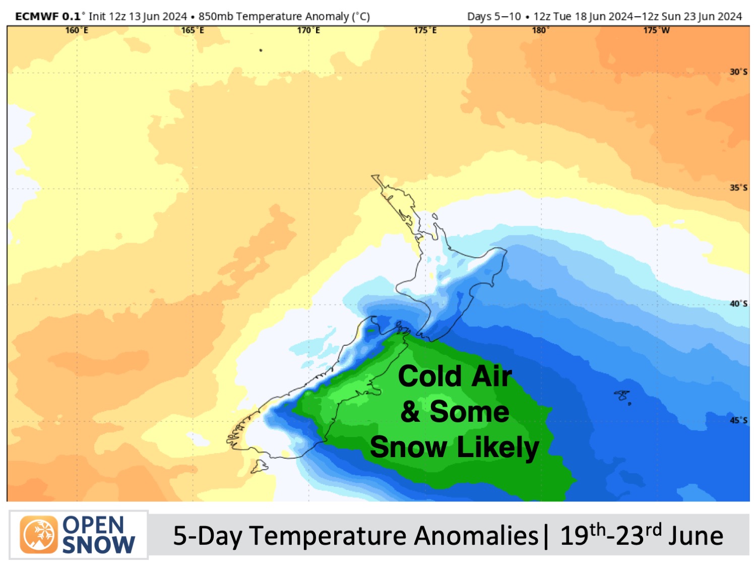
The storm will likely continue churning in the Tasman Sea, before beginning to make a move over the country next weekend, the 22nd-23rd of June, likely bringing another round of rain and/or snowfall.
As the storm centre shifts east of the country, possibly early the week starting the 24th of June, we may have a period of cold south-to-southwest winds and more snowfall before we finally say bon voyage to one of the longest and slowest-moving storm systems I can remember. By then, New Zealand ski fields should be in full swing.
Thanks for reading. I'll keep these forecasts coming every Monday, Wednesday & Friday throughout the southern hemisphere season.
Mike O'Connor
About Our Forecaster


