New Zealand Daily Snow

By Mike O'Connor, Meteorologist Posted 1 year ago June 18, 2024
Little Snowfall & Cloud Chasing Next Several Days as Tasman Storm Persists
Summary
No major snowfall over the next several days will see New Zealand continue slowly building its snowpack with man-made powder, especially on Wednesday and Thursday before these cold and foggy northeast winds ease. Only light snow showers are expected to fall in Canterbury and on Treble Cone.
Short Term Forecast
Current Conditions & Opening Dates
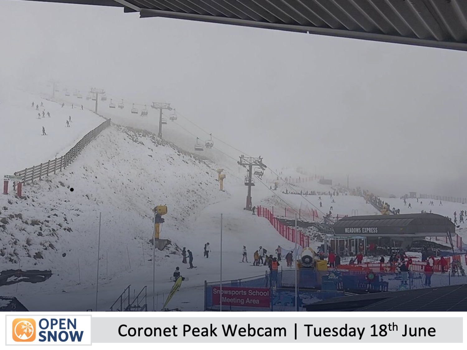
The New Zealand snowpack continues to slowly build with small shots of snowfall and a tonne of snow-making, thanks to cold winds from the southeast-northeast recently, which have been brought about by a sluggish storm system in the Tasman Sea - perhaps the slowest and longest-lasting system I've ever seen there.
Coronet Peak picked up 4cm on Monday, which was enough to get them over the line and open for the season on Tuesday. Treble Cone received 15cm Sunday night, so they're on track to open on Saturday 29th June.
The Remarkables, Cardrona and Mt Hutt all had their opening days on Saturday with limited terrain on offer while off-piste is still a little raw and bony. Whakapapa and Turoa up on the North Island's Mt Ruapehu, as well as Porter's pass in Canterbury, are projected to open over the long holiday weekend of Matariki starting 28th June, marking the Maori new year. The remaining club fields will open thereafter as conditions allow.
Forecast for Wednesday and Thursday (19th & 20th June)
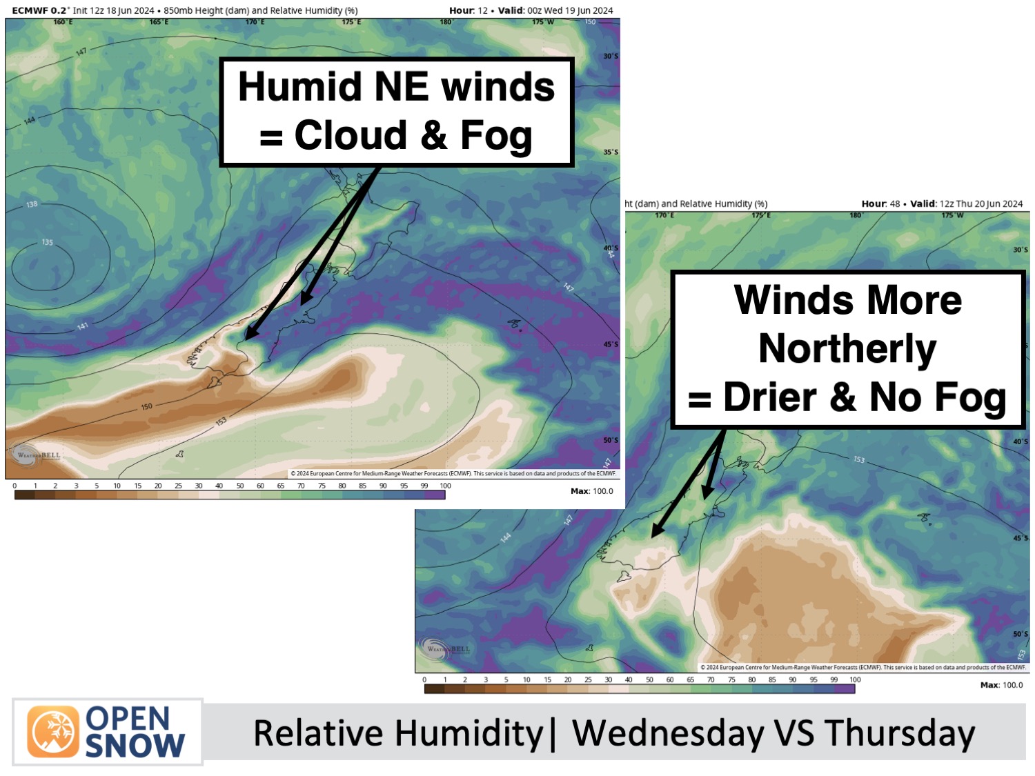
Cold northeast winds will continue to push low-level cloud into many South Island ski fields during Wednesday where it'll appear as fog with low visibility, especially in Canterbury where there'll also be light snow showers. The Southern Lakes will be a little less affected, however.
These conditions will persist into Thursday morning before clouds lift and start to disperse Thursday afternoon as winds ease to a lighter, more northerly direction and warm up a tad.
Forecast for Friday to Sunday (21st to 23rd June)
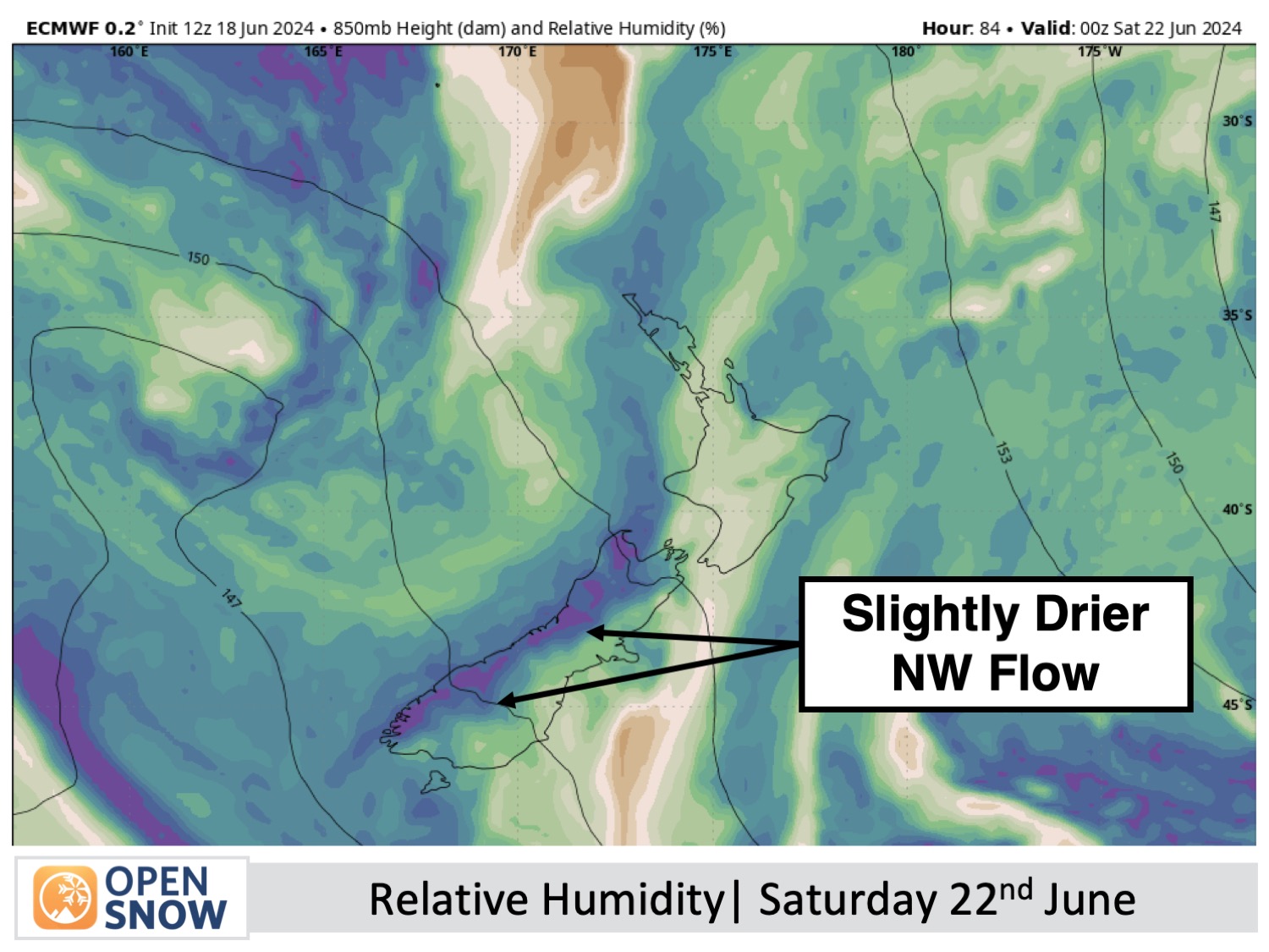
A fair amount of cloud will continue to cover South Island ski fields during this period, which will be blown over from the Tasman as the storm there creeps a little closer, with north-to-northwest winds turning to the northeast on Sunday.
Mt Hutt will see much more sunshine than cloud, whereas Treble Cone will likely see the most of it with snow showers also spilling over the Main Divide to fall on mid-to-upper slopes there from time to time. Temperatures should remain cold enough for snowmaking to continue on mid-to-upper slopes at least in the Southern Lakes.
Extended Forecast
The persistent Tasman Low might strengthen briefly, sending another northeast rain band across the South Island between late Sunday, June 23rd, and Tuesday, June 25th. This will likely bring a mix of rain and/or snow to the resorts, which has the potential to produce some big totals in some places.
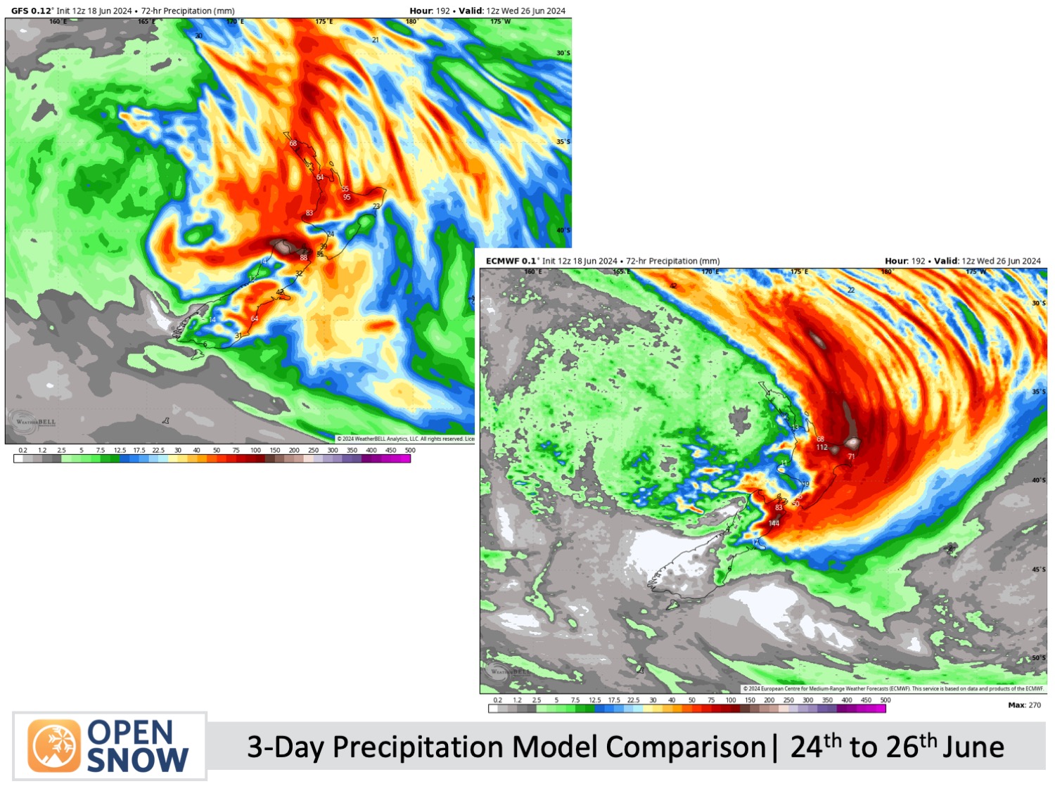
Later in the week, the Tasman Low may finally lose strength and pass over the country with minimal impact, only to be replaced by another weak system. However, it's still too early to be certain about this and forecast models continue to struggle due to all that going on in the Tasman Sea.
Thanks for reading. I'll keep these forecasts coming every Monday, Wednesday & Friday throughout the southern hemisphere season.
Mike O'Connor
About Our Forecaster


