New Zealand Daily Snow

By Mike O'Connor, Meteorologist Posted 1 year ago June 20, 2024
Early-Season Conditions Continue & a Top-Up for Canterbury on Sunday
Summary
Conditions will be great to head up for some early-season runs as Kiwi resorts continue to build the snowpack with man-made powder. However, Canterbury resorts will receive a nice top-up on Sunday as that super slow-moving storm in the Tasman sends in a mix of rain and snow for the day.
Short Term Forecast
Current Conditions & Opening Dates
A long stretch of chilly temperatures has seen the New Zealand snowpack slowly build as resorts have had to rely heavily on man-made snow. However, there have been small shots of powder, thanks to a super slow-moving storm in the Tasman Sea - the slowest and longest-lasting one I can ever recall - sending them our way.
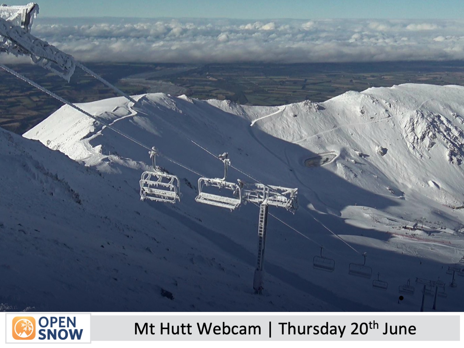
Coronet Peak picked up 4cm on Monday, which was enough to get them over the line and open for the season on Tuesday. Treble Cone are on track to open on Saturday 29th June after receiving 15cm Sunday night. The Remarkables, Cardrona and Mt Hutt all had their opening days on Saturday with limited, but growing, terrain on offer, while off-piste is still a little raw and bony.
Whakapapa and Turoa up on the North Island's Mt Ruapehu, as well as Porter's pass in Canterbury, are projected to open over the long holiday weekend of Matariki starting 28th June, marking the Maori new year. The remaining club fields will open thereafter as conditions allow.
Forecast for Friday & Saturday (21st & 22nd June)
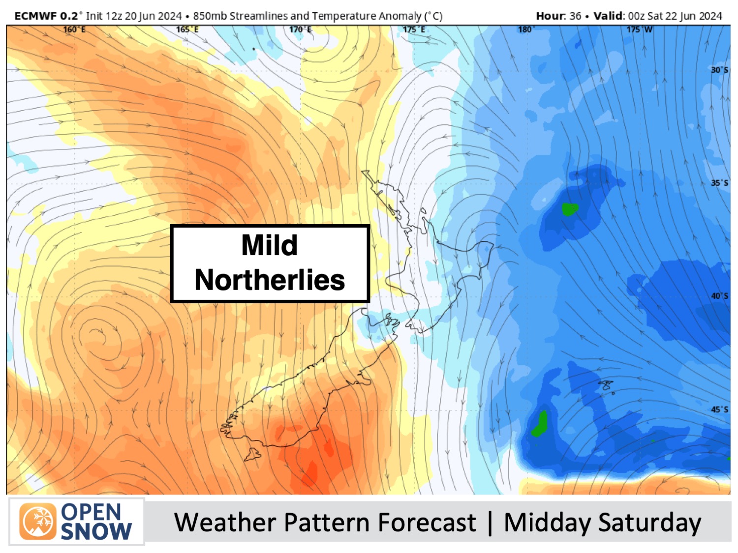
It won't be a bad couple of days to head up for some early-season turns to get legs into shape. North-northwest winds blowing over the South Island will just bring partially cloudy skies to the Southern Lakes, most of it high-level stuff. There is a chance light showers of rain and high-level snow will reach Treble Cone from Friday afternoon onwards.
After a sunfilled Friday, the cloud will spread to Canterbury on Saturday, with the light showers possibly reaching the Craigieburn club fields.
Forecast for Sunday and Monday (23rd and 24th June)
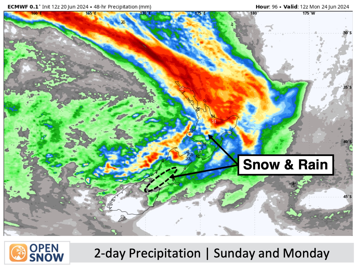
The Tasman Storm will push a belt of rain over the country during this time mostly affecting Mt Ruapehu and Canterbury resorts. The Southern Lakes will be just out of reach of any precipitation, but easterly winds will push in a fair amount of cloud, especially on Monday when low-level clouds may reduce visibility with misty, foggy conditions at some resorts.
Banana pancakes for Sunday breakfast in Canterbury as rain spreads over the region early in the day. It'll start lightly at first, with snow falling up top, but will build throughout the day as snow levels drop to around resort base altitude. Visibility will be limited in soupy conditions, but freshies will be on offer for the brave, especially up high. Between 5-20cm of snow could accumulate before it clears early Monday, and then clouds will start to disperse later in the day, although NE winds will be quite brisk.
Extended Forecast
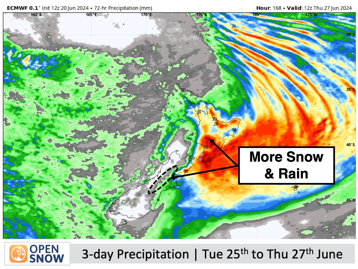
Normally I include a 5th day in the short-term forecast, but since uncertainty is running high, I chucked Tuesday the 25th of July into the Extended Forecast. This is likely to be the day the Tasman Storm finally crosses the country with adverse conditions affecting Mt Ruapehu and Canterbury for a day or two, possibly bringing a heavy mix of snow and rain. The Southern Lakes will likely sit this one out again, but this could all change due to small changes in the forecasted storm track, so we'll keep a close eye on it.
Thanks for reading. I'll keep these forecasts coming every Monday, Wednesday & Friday throughout the southern hemisphere season.
Mike O'Connor
About Our Forecaster


