New Zealand Daily Snow

By Mike O'Connor, Meteorologist Posted 1 year ago June 23, 2024
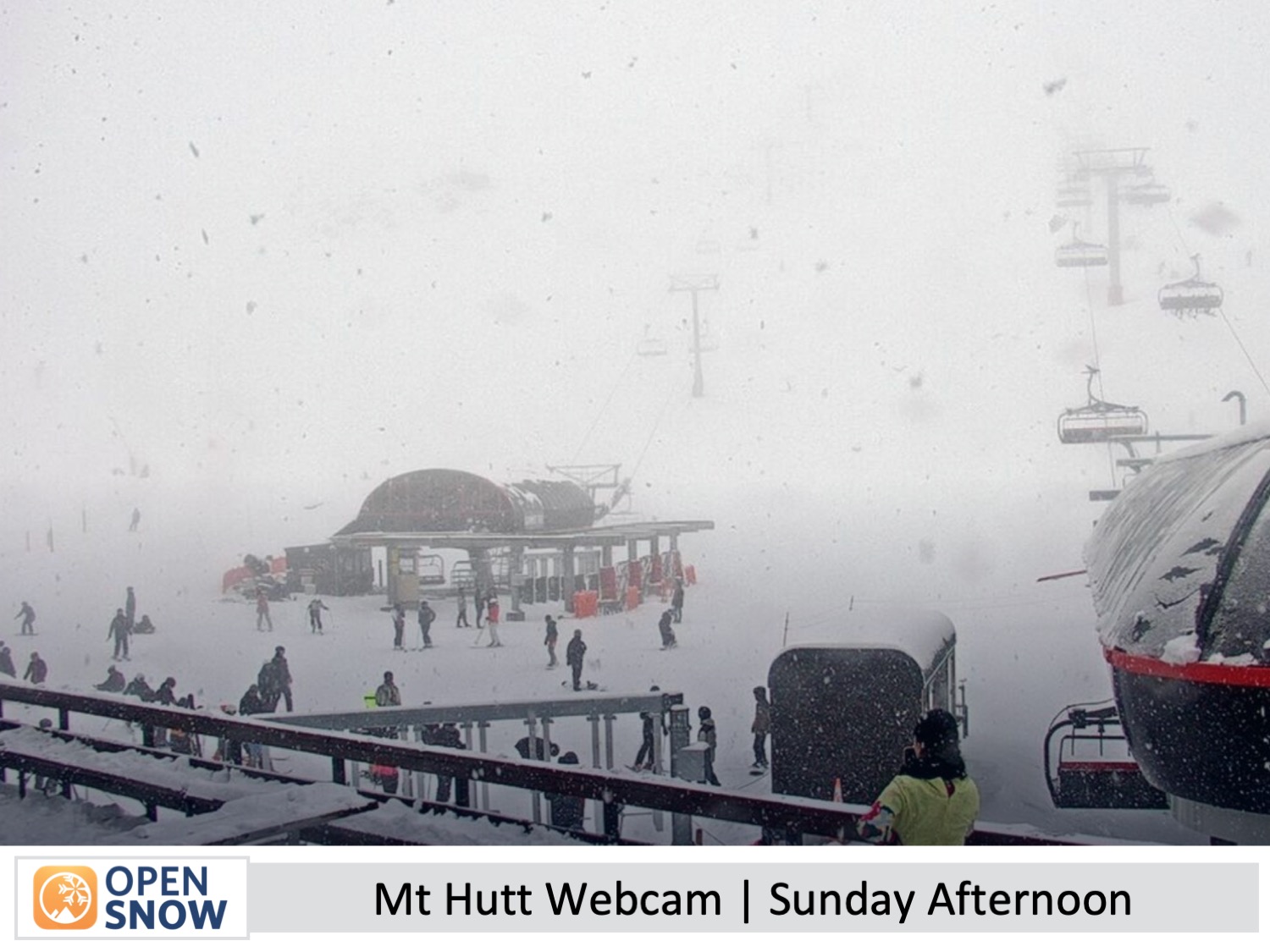
Canterbruy scored fresh powder on Sunday, Now the Murk Gradually Clears
Summary
Canterbury ski fields are looking great after a much-needed top-up on Sunday. Northeast winds continue to push in a swathe of low-level clouds, but that'll start to clear ski fields in the Southern Lakes on Tuesday, then in Canterbury on Thursday as winds turn to the northwest. Showers or rain and snow will then start to spill over the Main Divide on Friday.
Short Term Forecast
Current Conditions & Opening Dates
The rainband passed over the country as expected on Sunday, with Canterbury scoring a much-needed top-up of powder. Mt Hutt reported that 11cm had fallen by Sunday afternoon and it continued snowing lightly into the night, so a few more centimetres is expected to be added to that tally. Mt Ruapehu also picked up a light dusting, whereas the Southern Lakes didn't receive any new snowfall at the weekend as per the forecast.
The Remarkables, Coronet Peak, Cardrona and Mt Hutt are all open for the season. Treble Cone and Porter's Pass, as well as Whakapapa and Turoa up on the North Island's Mt Ruapehu are scheduled to open over the long holiday weekend of Matariki starting 28th June, marking the Maori new year. The remaining club fields will open thereafter as conditions allow.
Forecast for Monday & Tuesday (24th & 25th June)
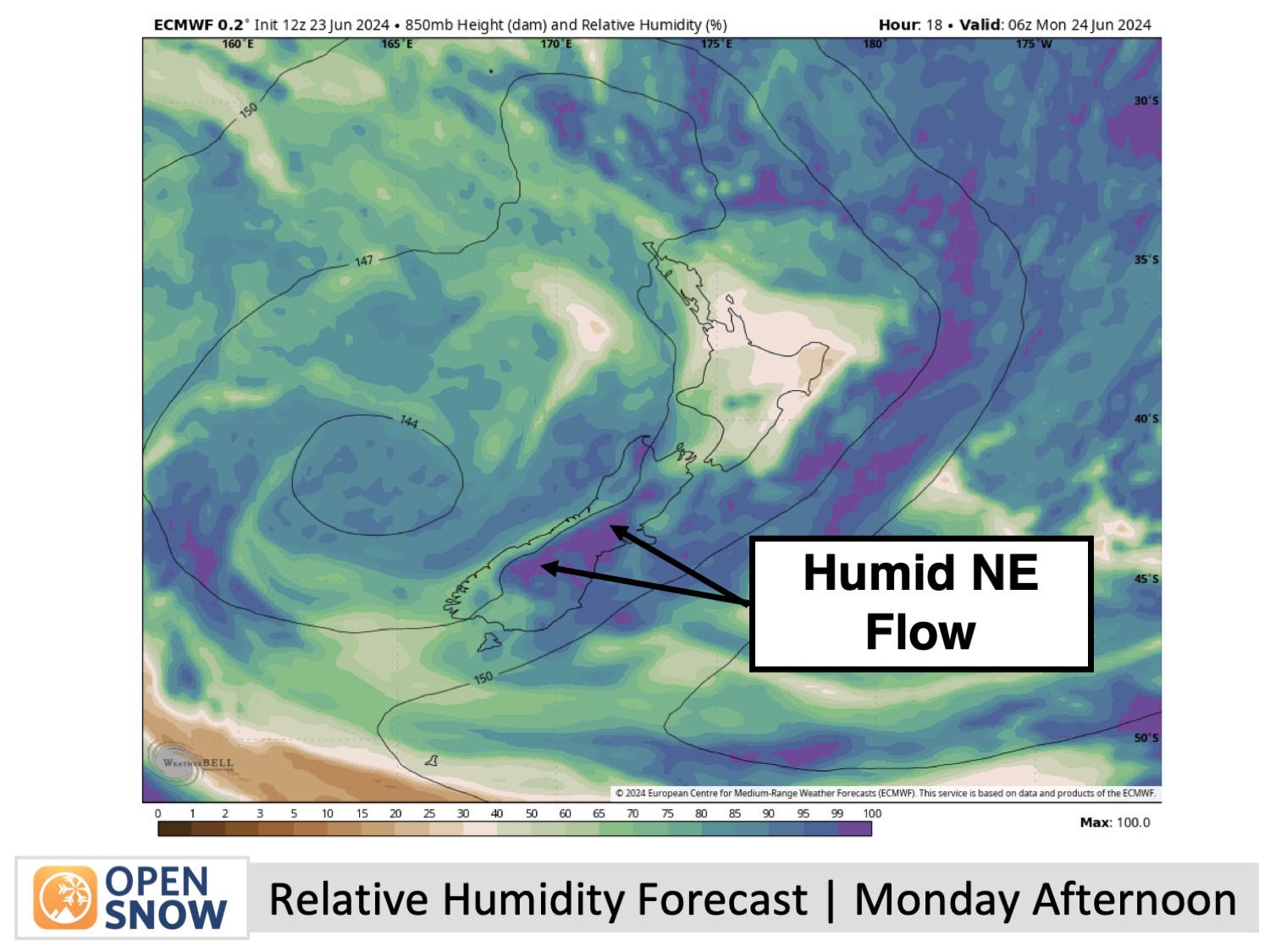
A humid northeast flow over the South Island pushes in a swathe of low-level clouds during this period, creating misty, foggy conditions with low visibility at times. However, the Southern Lakes will start to poke its head out of the gloom on Tuesday as the cloud sinks beneath the upper slopes leaving clear skies above. Canterbury will also see a few spots of drizzle, but that'll mostly be after hours on Monday evening.
Forecast for Wednesday & Thrusday (26th & 27th June)
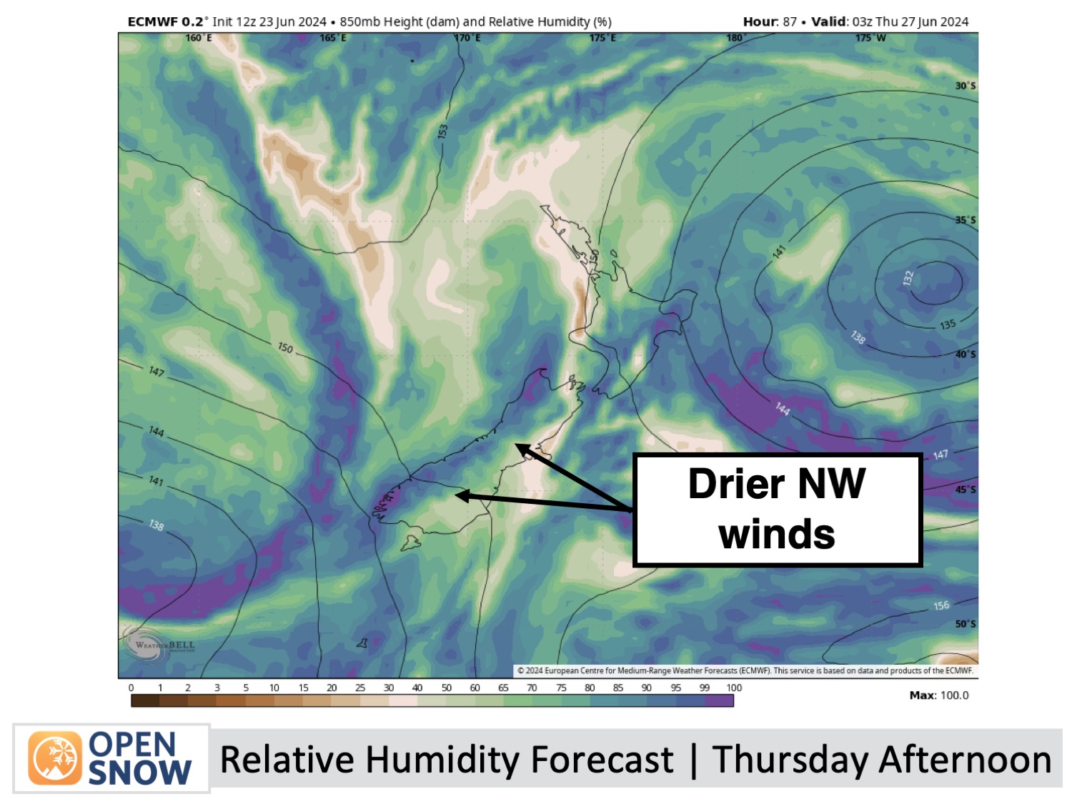
Canterbury will remain murky on Wednesday, with cloud and a spot of drizzle limiting the visibility at times, as a light northeast breeze continues to blow there. That will all clear up nicely on Thursday as the breeze turns to a drier northwest.
Meanwhile, down in the Southern Lakes, ski fields will be above any murk sitting above the lowlands, with nothing but crisp, clear air above. A northwest breeze will also develop there on Thursday before a few light snow showers turn up Thursday night as a weak front moves up the west coast.
Forecast for (Friday 28th June)
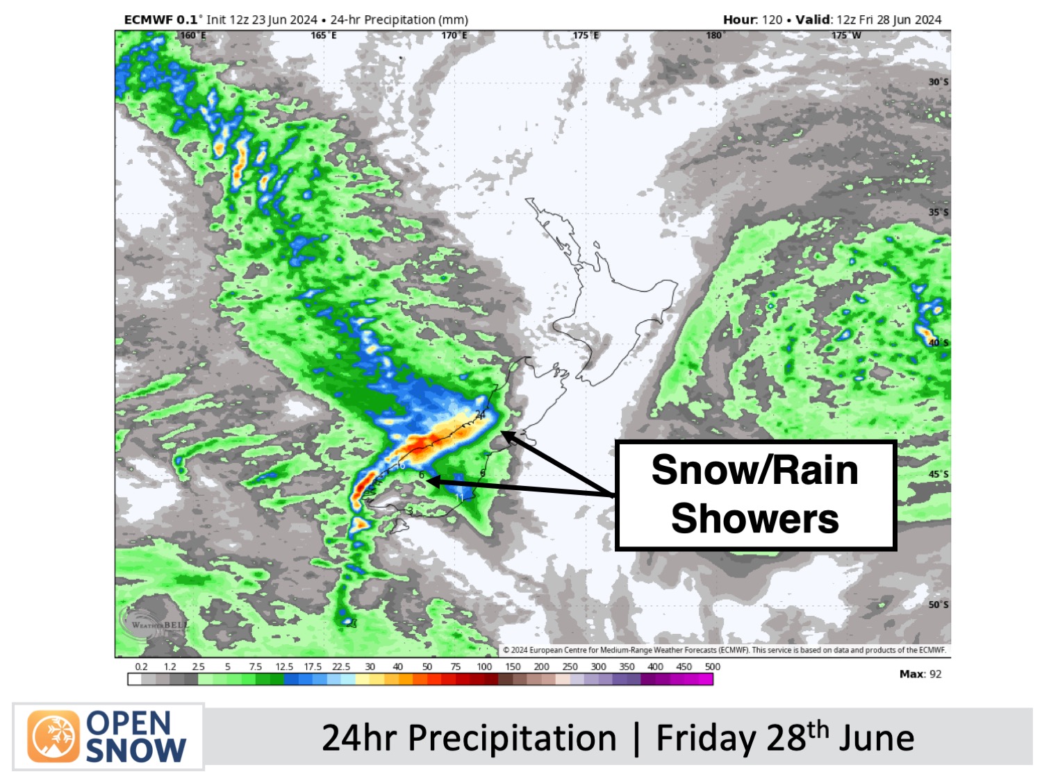
Northwest winds will see clouds and snow showers spilling over the Main Divide to reach South Island ski fields at some point. This is likely to build throughout the day, so the showers may not turn up until late, and temperatures will be marginal for the lower slopes where it'll likely be the wet type of precipitation.
Extended Forecast
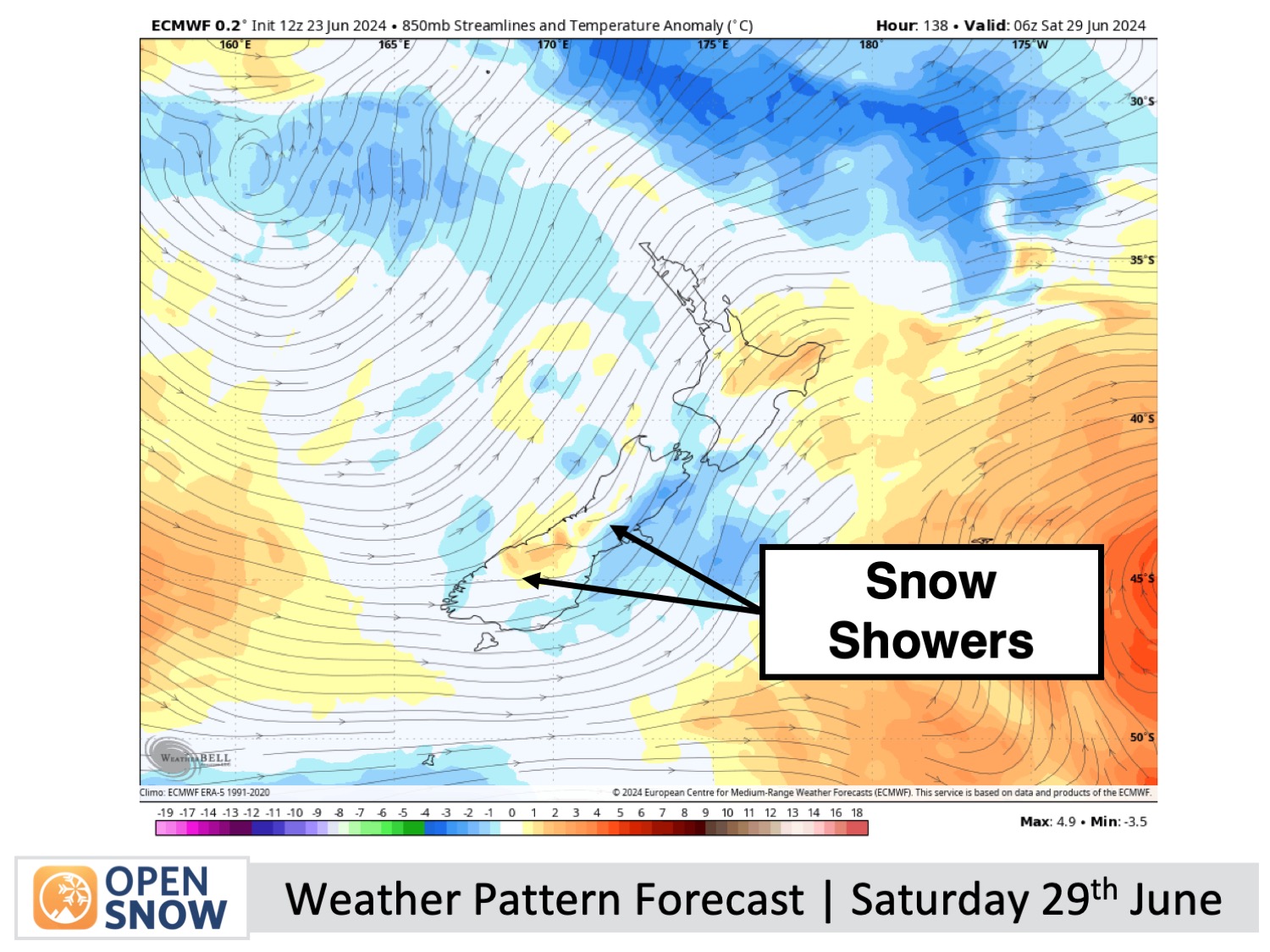
An active and more mobile storm cycle is expected to affect New Zealand during the extended outlook period. Starting with a cold southerly change on Saturday 29th June, we should see snow falling across the country throughout that weekend before clearing out Monday 1st of July.
The next storm is likely to follow close behind, hitting the country around Tuesday the 2nd of July and possibly lasting till around Thursday the 4th of July. Although snowfall is likely, it's too early to go into detail at this point in time.
Thanks for reading. I'll keep these forecasts coming every Monday, Wednesday & Friday throughout the southern hemisphere season.
Mike O'Connor
About Our Forecaster


