New Zealand Daily Snow

By Mike O'Connor, Meteorologist Posted 1 year ago June 25, 2024
Fresh Snow Up High Before More Ski Fields Open This Long Holiday Weekend.
Summary
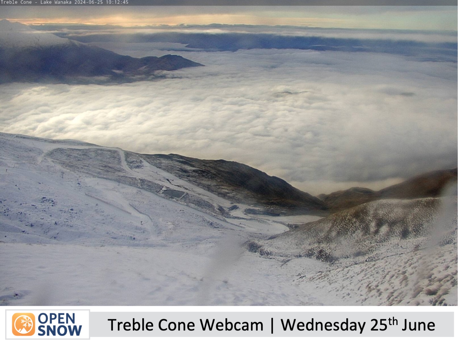
It's been a slow start to the New Zealand snow season, but Mt Ruapehu will score 15-30cm on Wednesday, just in time for Whakapapa and Turoa to open on Friday. Treble Cone could also receive up to 15cm before opening on Saturday, although that will fall as rain on the lower slopes. Other South Island ski fields will also receive a lighter dusting on Friday before clearing up for a sunny weekend.
Short Term Forecast
Current Conditions & Opening Dates
Canterbury scored a much-needed 10-15cm top-up of powder on Sunday, and Mt Ruapehu received a light dusting. Apart from that, it's been a slow start to the snow season down under, where ski fields have had to rely heavily on man-made snow for the first week and a half of the season. Thus skiable terrain is limited to the main groomers and leaner slopes while off-piste is still a no-goer.
This coming weekend is a long one, Friday being the Matariki public holiday marking the New Year in the Maori lunar calendar. Porter's Pass and Whakapapa and Turoa up on the North Island's Mt Ruapehu are scheduled to open on Friday, and Treble Cone on Saturday. The remaining club fields will open thereafter as conditions allow. The Remarkables, Coronet Peak, Cardrona and Mt Hutt are all open for the season.
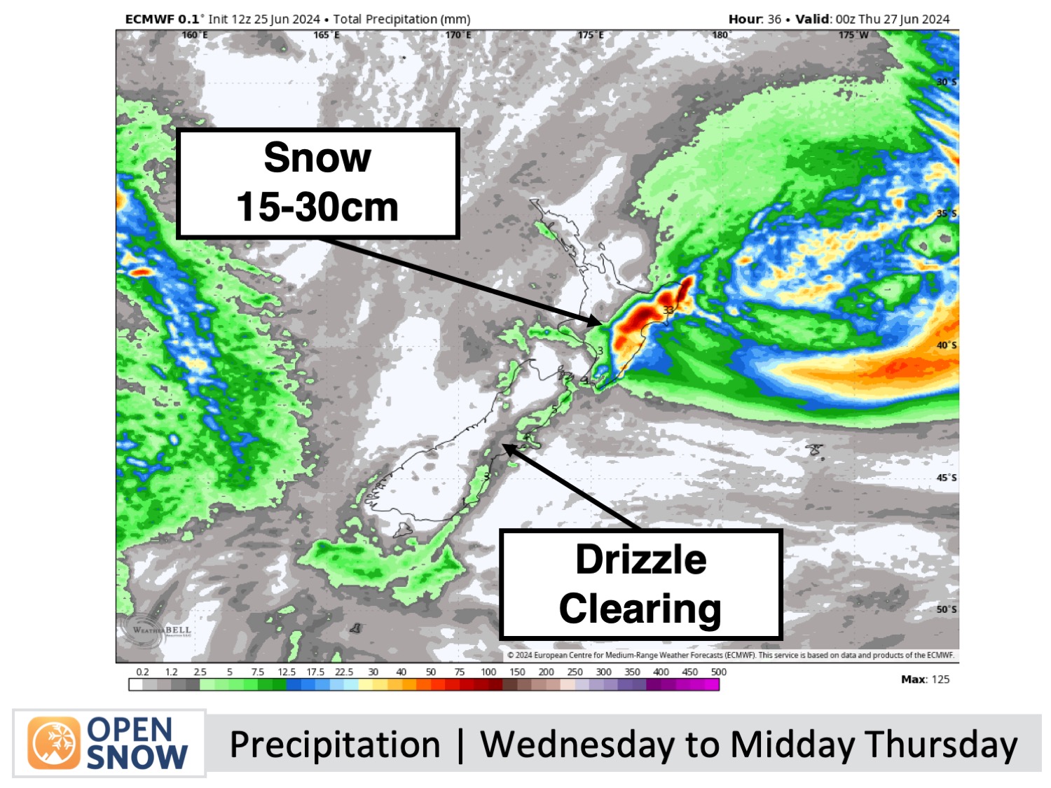
Forecast for Wednesday & Thursday (26th & 27th June)
A storm affecting the North Island will see Whakapapa and Turoa on Mt Ruapehu receiving between 15-30cm on Wednesday, although it'll be wet and dense about the lower slopes.
The Southern Lakes resorts will enjoy sunny skies above a layer of low-level cloud sitting over the lowlands. However, high clouds will start to build Thursday afternoon as northwest winds develop.
Visibility will again be limited in Canterbury on Wednesday morning due to low clouds and drizzle driven in by a light E-NE breeze. That should sink to, or below, base levels Wednesday afternoon, then clear up for a nice day on Thursday thanks to a drier northwest breeze.
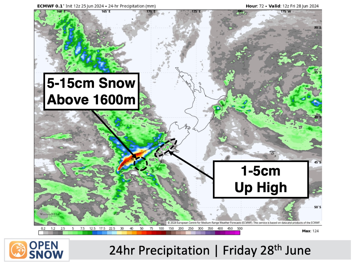
Forecast for Friday (28th June)
A front from the west passes over the South Island on Friday with a mix of snow and low-level rain spilling over the Main Divide in gusty northwest winds. The precipitation will start at Treble Cone and then extend to other Southern Lakes resorts, becoming heavier as a front moves over and then clears. Up to 5-15cm is expected to accumulate above 1600m, with Treble Cone taking the lion's share while the other resorts will be at the lower end.
The front won't reach Canterbury till late, with just a couple or a few centimetres expected about the tops Friday evening and a little rain below that.
Mt Ruapehu will be nice and fine for Opening Day at Whakapapa and Turoa.
Forecast for the weekend (29th & 30th June)
It'll be a mostly sunny weekend for the South Island, thanks to a passing ridge of high pressure, but clouds will gather over the Southern Lakes later on Sunday and northwest winds will strengthen as another front approaches from the west.
Extended Forecast
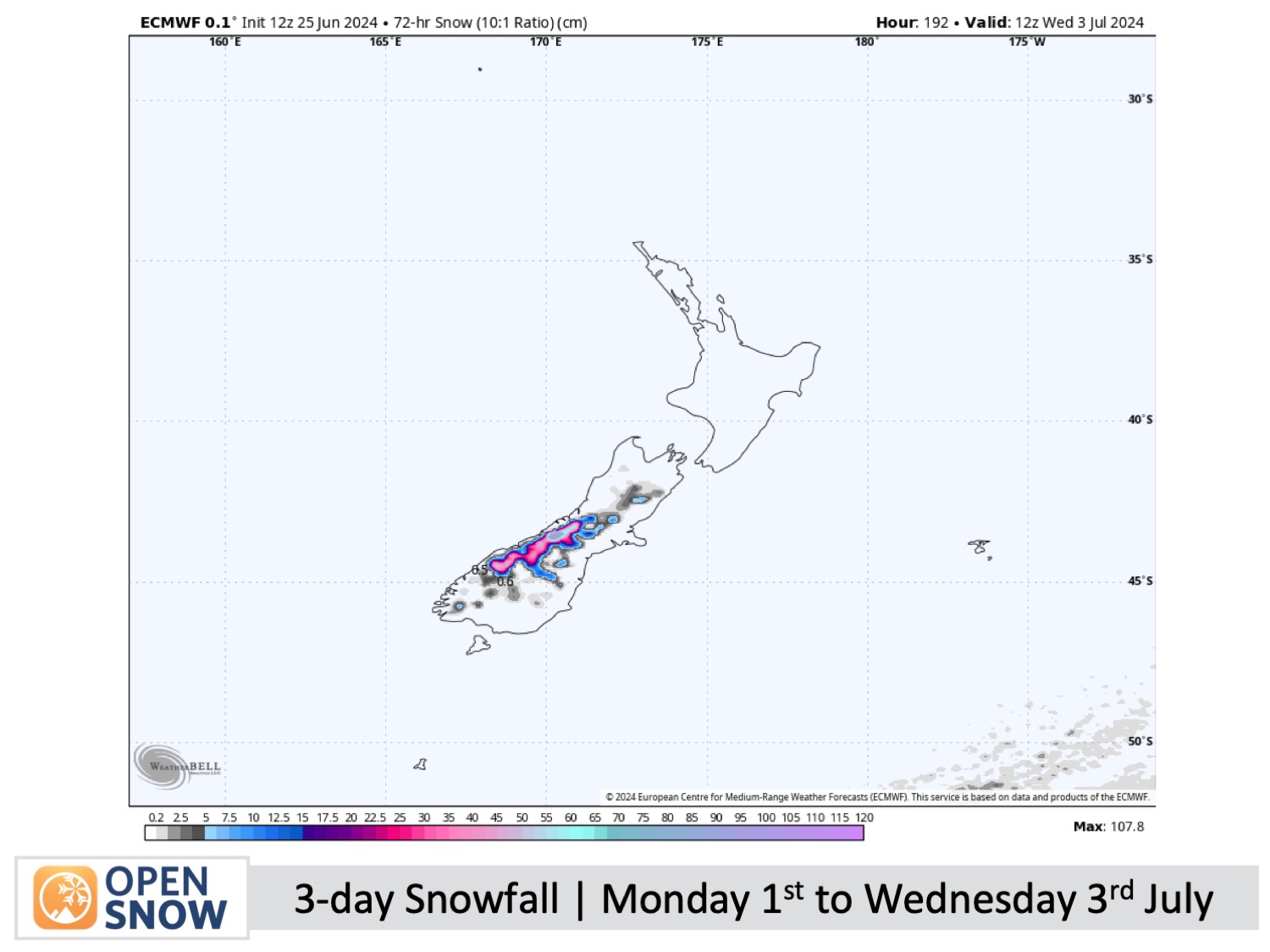
A storm is likely to bring a light to moderate load of snow during the first half of the week, starting Monday, July 1st. First, a front will roll in from the west bringing rain and high-level snow, followed by a cold southerly change on Tuesday, July 2nd, dropping snow to lower levels, before easing on Wednesday, July 3rd.
Thanks for reading. I'll keep these forecasts coming every Monday, Wednesday & Friday throughout the southern hemisphere season.
Mike O'Connor
About Our Forecaster


