New Zealand Daily Snow

By Mike O'Connor, Meteorologist Posted 1 year ago June 27, 2024
The Good, the Bad and the Ugly, We’ll see it all
Summary
We'll see it all over the next several days as conditions alternate between fine and stormy. Friday, 2-10cm of dense snow will fall over the Southern Lakes, but up to 15cm will fall on Treble Cone before it opens for the season on Saturday to clear calm weather. A stronger storm will bring heavy rain and high-level snow on Sunday before a strong cold southerly hits Monday with fresh snowfall.
Short Term Forecast
Forecast for Friday (28th June)
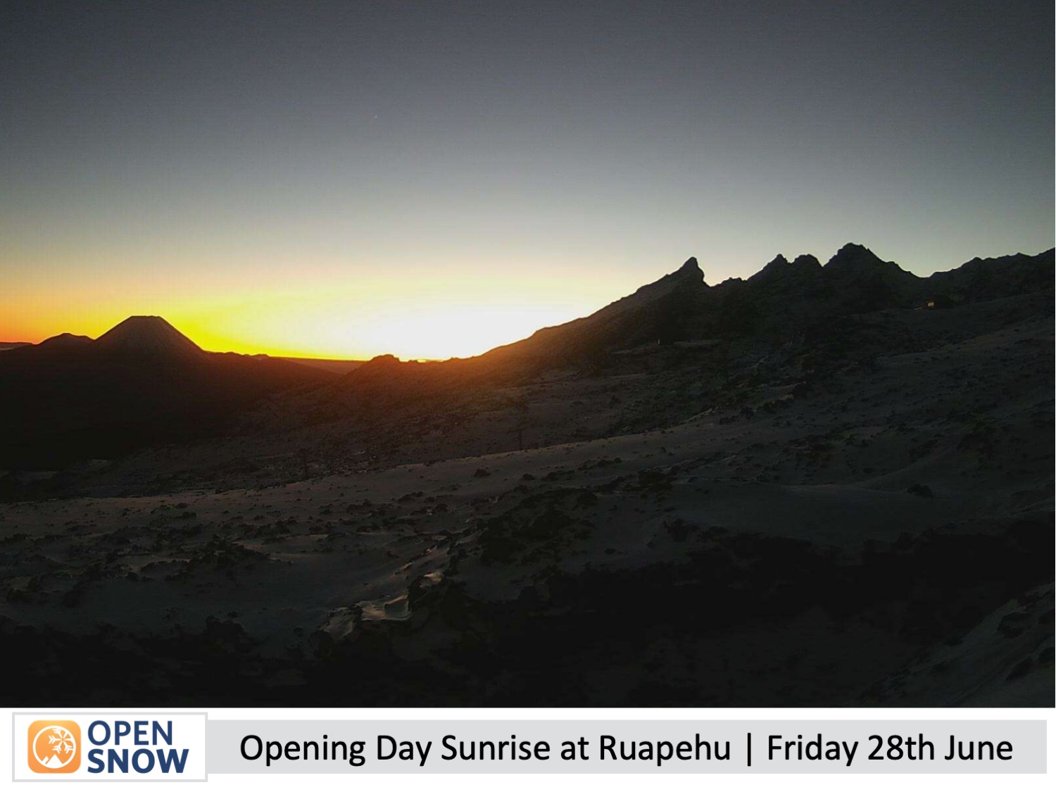
Friday is Matariki in New Zealand, a public holiday marking the new year in the Maori lunar calendar. There's lots going on throughout the country, including opening day at Whakapapa and Turoa on Mt Ruapehu in the North Island. Things are still running at low tide there, so terrain will be limited to manmade strips, but at least the weather will be perfect with clear skies and calm winds - a rarity for Ruapehu.
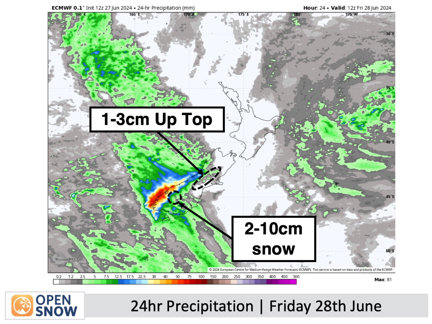
Down south, a front moving up the west coast will spill rain and snow over the Main Divide. The Southern Lakes ski fields should pick up 2-10cm, but temperatures will be marginal at base altitudes where it'll be wet and sleety, or just plain old rain. However, Treble Cone could see up to 15cm as it sits closest to the Divide.
The front passes over Canterbury in the evening, only giving the tops a light dusting while a little rain falls lower down. Before that, it'll be a rather nice day with increasing high clouds, but northwest winds will strengthen, possibly creating a few windhold issues. Porter's Pass was scheduled to open, but they need just a little more snow down low to get over the line.
Forecast for Saturday (29th June)
A ridge of high pressure will bring sunny, calm weather to the South Island on Saturday, which will be great for opening day at Treble Cone where there should also be a fresh layer of powder from the day before just waiting to be shredded.
Forecast for Sunday to Tuesday (30th June to 2nd July)
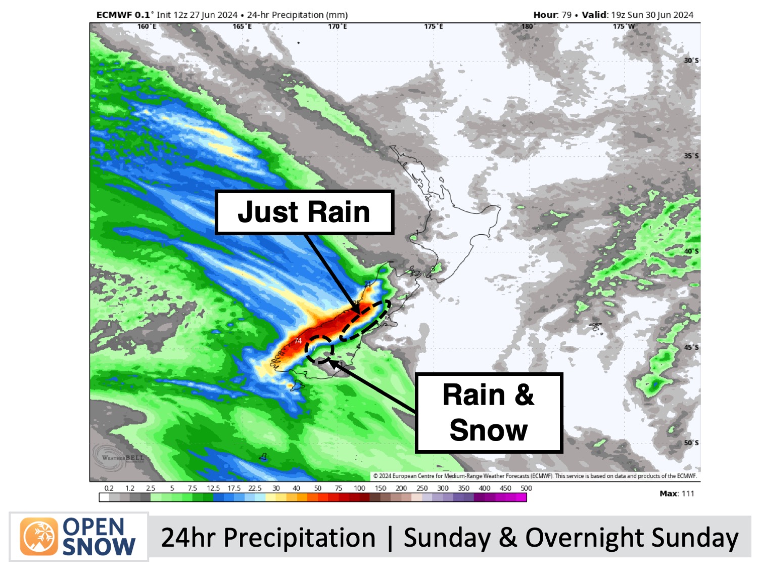
During this period a strong storm will move up the country, making for some adverse conditions which will likely affect ski field operations.
First, a band of heavy rain and snow will cross the South Island on Sunday, likely impacting the Southern Lakes for much of the day where snow levels may climb up to mid or upper slopes for a time. Canterbury will get hit later on Sunday through the overnight period with little to no snow expected, just heavy rain. Northwest winds will be very strong, possibly reaching severe gale force, which would likely limit or close lift operations.
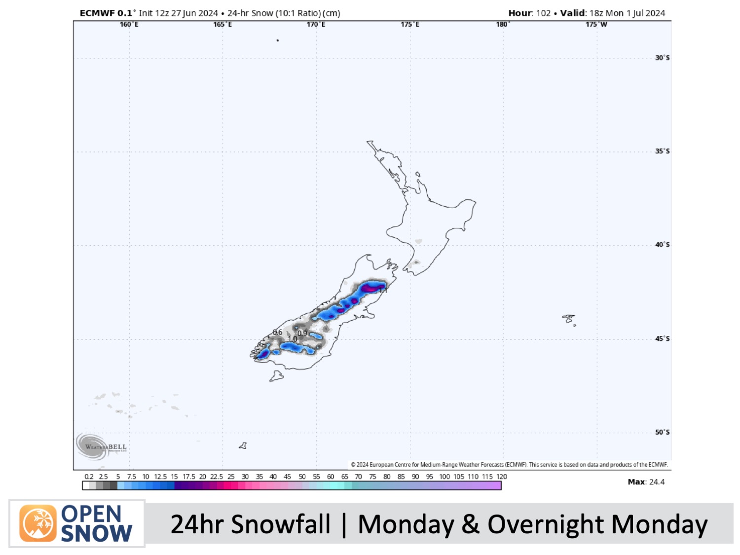
On Monday, a strong cold southerly wind will sweep up the South Island, bringing a burst of snowfall to low levels before pinning back to lighter snow showers which will continue into Tuesday. There's still a lot of uncertainty around this, but Canterbury stands to gain the most with a decent load of powder, which should get Porter's Pass going, while the Southern Lakes will likely take home a small top-up.
Extended Forecast
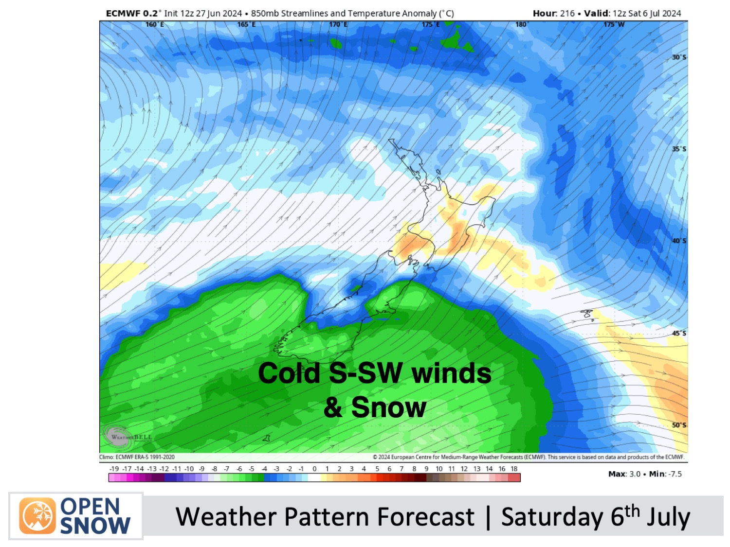
After the Sunday-Tuesday storm, a ridge of high pressure should keep things nice and settled for two or three days starting Wednesday 3rd of July. Model forecasts then hint at more cold unsettled weather over the weekend of the 6th & 7th of July, with potentially good snowfall which would hopefully open up off-piste areas and get the season cranking.
Thanks for reading. I'll keep these forecasts coming every Monday, Wednesday & Friday throughout the southern hemisphere season.
Mike O'Connor
About Our Forecaster


