New Zealand Daily Snow

By Mike O'Connor, Meteorologist Posted 1 year ago June 30, 2024
Deep Powder for Southern Lakes as a Powerful Storm Crosses the Country
Summary
It was beautiful and calm for Opening Days at Treble Cone, Whakapapa, and Turoa on the weekend. Change was in the air on Sunday, however, and come early Monday (the time of writing), we have heavy snow falling over the Southern Lakes. This storm will work its way up the country, leaving deep totals in the Southern Lakes and a mixed bag in Canterbury. Skies will then clear up from later Tuesday.
Short Term Forecast
Forecast for Monday & Tuesday (1st & 2nd July)
During this period, a strong storm system will pass over the country. First, a front bringing heavy rain and dense mid-high level snow and strong gusty northwest winds will move up the country, followed closely behind by a strong, freezing southerly flow and higher quality snowfall to low levels. Conditions will be adverse at times and lift operations may be affected, so come storm prepared and you'll score some powder.
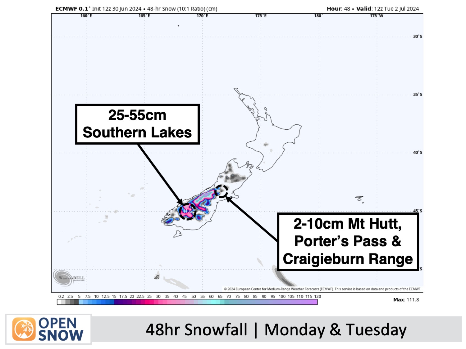
For the Southern Lakes, the heavy rain will turn to snow Monday morning as the cold southerlies start to wind up. Snowfall will ease to snow showers Monday afternoon, reaching low levels and affecting some roads such as the Crown Range between Wanaka & Queenstown by the end of the day.
The snow showers will clear Wanaka resorts Tuesday morning, and then Queenstown Tuesday afternoon. Snowfall totals will likely range from 25-55cm, although the bulk of that will fall prior to the cold air hitting, so a lot of it will be dense with a lighter, fluffier layer on top.
In Canterbury, heavy rain, dense high-level snow and strong northwest winds will ease Monday afternoon. Mt Hutt and Porters Pass will unlikely see any of that high-level snow as it'll be too warm there, but the other Club fields should see a decent load amongst the rain. The cold southerlies get underway Monday night with between 2-10cm falling to low levels before clearing Tuesday morning and becoming fine later in the afternoon.
Forecast for Wednesday to Friday (3rd to 5th July)
Wednesday and Thursday will be the days to head up for some fresh powder turns as the weather will be mostly fine above a layer of low-level cloud, although some of that will affect Canterbury ski fields on Wednesday. Temperatures will still be freezing mind you, so wrap up warm as icy southerly breezes continue to ease.
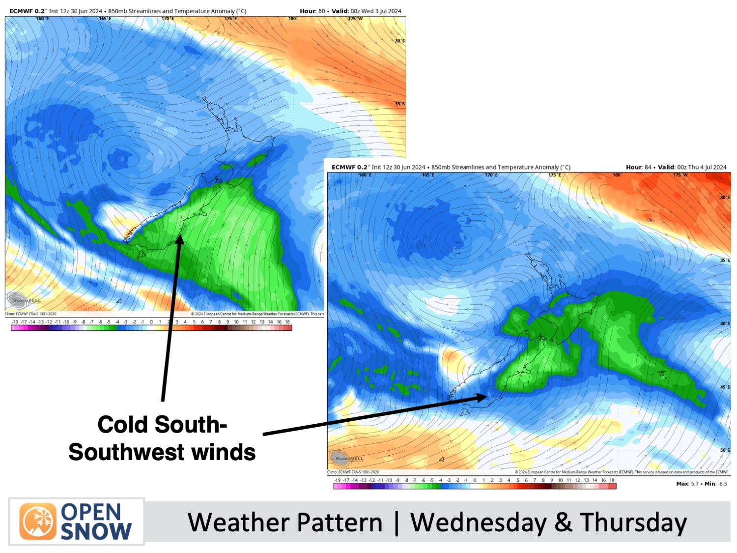
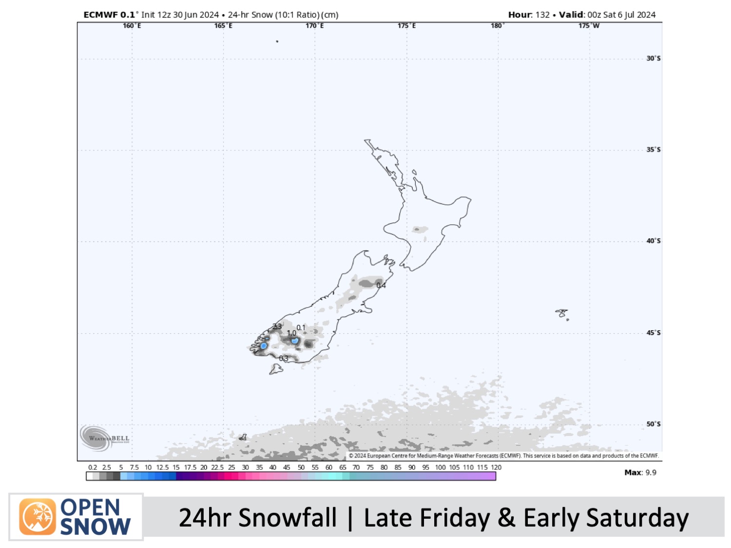
The winds will turn westerly and strengthen over the South Island on Friday as another cold front approaches from the south. The front will bring snowfall to low levels late Friday into early Saturday, giving all ski resorts a small top-up of high-quality powder.
Extended Forecast
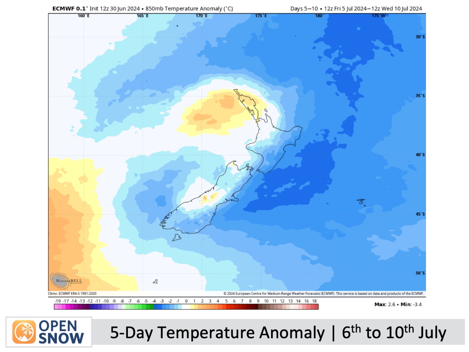
Snow showers across the country should clear up on Saturday 6th July, leaving several days of fine weather through until at least the middle of the following week as high-pressure moves in, allowing cold south-to-southwest winds to eventually ease.
Thanks for reading. I'll keep these forecasts coming every Monday, Wednesday & Friday throughout the southern hemisphere season.
Mike O'Connor
About Our Forecaster


