New Zealand Daily Snow

By Mike O'Connor, Meteorologist Posted 1 year ago July 4, 2024
A Light Dusting Friday Night Amongst a Prolonged Settled, Dry Spell
Summary
Monday and Tuesday's snowstorm has significantly improved things just in time for the school holidays, which start Saturday and run for two weeks. Apart from a 1-5cm dusting Friday night, the weather will be mostly clear and dry for the rest of this week and next week, although cold southwest winds will blow this weekend, especially on Sunday, making for significant wind chill.
Short Term Forecast
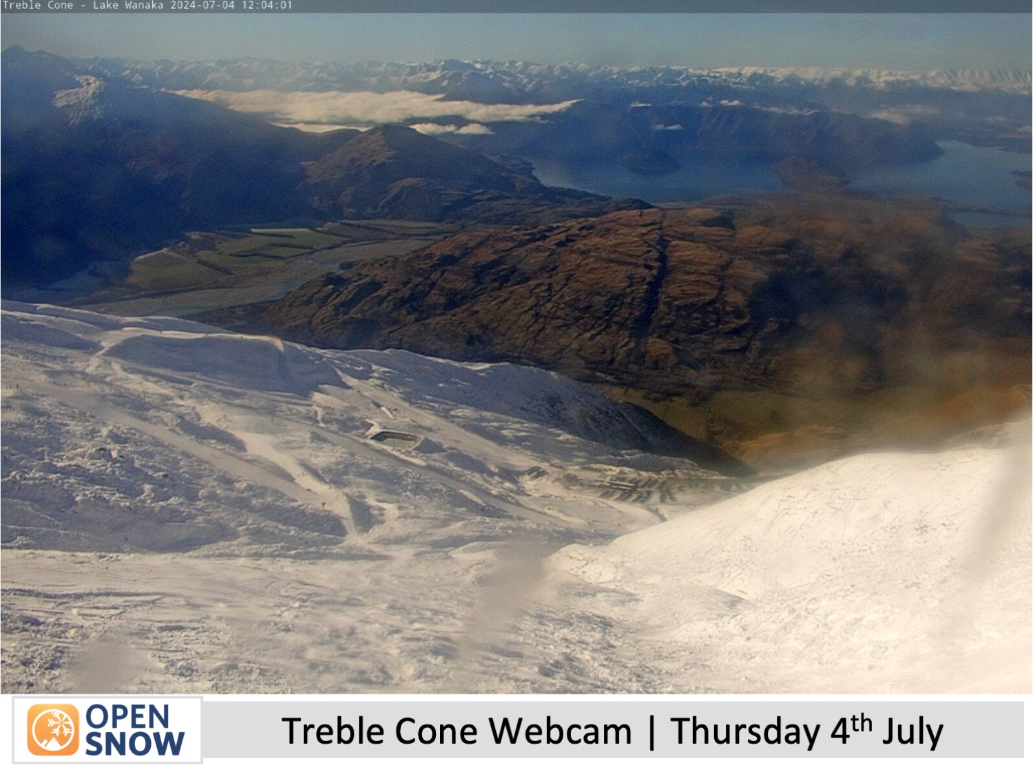
Current Conditions
A snowstorm hit the country on Monday and Tuesday which has significantly improved things for New Zealand ski fields and opened up a lot more terrain. It's great timing as Kiwi kids will all be on school holiday for the next two weeks starting Saturday.
Up to half a metre of powder was dumped onto the Southern Lakes resorts, while the small club fields in MacKenzie Country (cental-southern Canterbury) were also served up a healthy serving of cream, with Ohau and Round Hill scoring 60cm and 30cm respectively.
All other ski fields throughout New Zealand received a nice top-up, with 15cm for both Mt Hutt and Porter's Pass and 5-15cm for Whakapapa and Turoa on the North Island, alongside extensive snowmaking.
Forecast for Friday and the weekend (5th to 7th July)
Friday will be another great day, with mostly clear skies. But westerly winds will strengthen over the Southern Lakes where it will kick up some clouds in the afternoon.
A weak, fast-moving cold front will then move up the country, passing over the Southern Lakes Friday night and then over Canterbury in the early hours of Saturday before reaching Mt Ruapehu around the middle of Saturday. The front is expected to bring a dusting of just 1-5cm across the country, the Queenstown ski fields likely at the upper end of that range, while the Wanaka and Canterbury ones will likely be at the lower end.
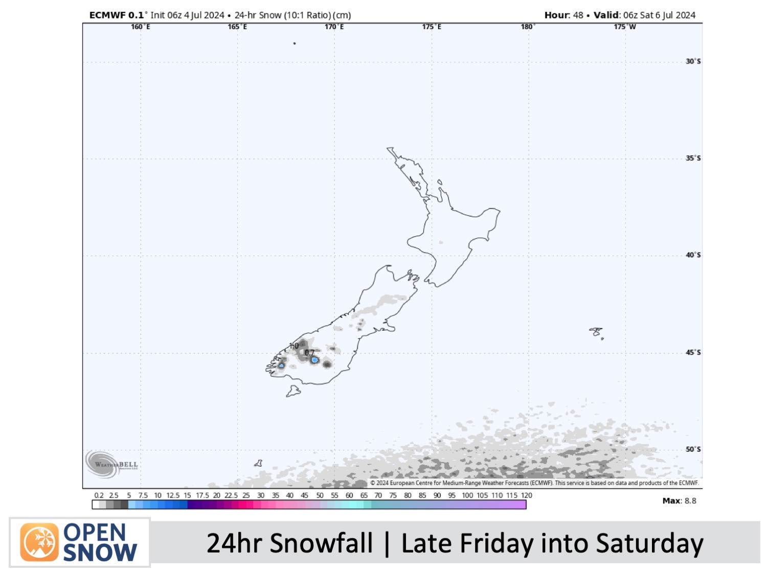
The rest of the weekend will remain partly cloudy/mostly sunny for the Southern Lakes, and the skies will be clear over Canterbury. However, cold southwest winds will be quite strong, especially on Sunday when they'll be up around 60-80km/h in some exposed areas. So wrap up warm because wind chill will be a major factor.
Forecast for Monday & Tuesday (8th & 9th July)
Monday and Tuesday will be great for the kids, with nice, sunny weather as high pressure drifts onto the country. The chilly southwest winds will ease on Monday, with just light westerly breezes for the South Island on Tuesday.
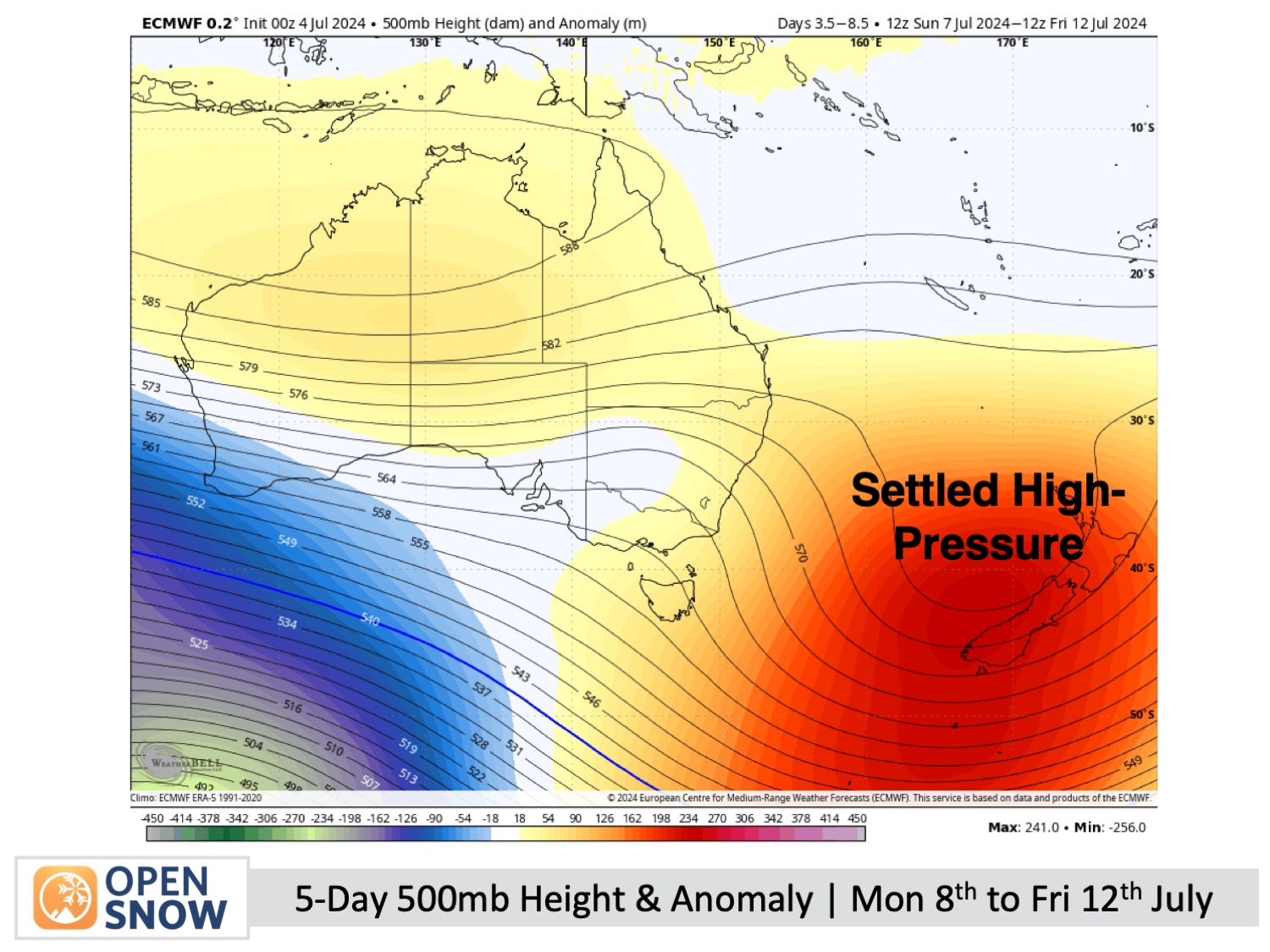
Extended Forecast
New Zealand will remain under the yolk of high pressure for the remainder of next week, with dry and mostly clear weather. While there's a slight possibility of a weak front bringing some snow to the South Island on Wednesday, July 10th, and Thursday, July 11th, this remains uncertain at the moment so I wouldn't bet on it. By Friday, July 12th, northwest winds are expected to develop over the South Island as a front nears and then halts west of the country.
Thanks for reading. I'll keep these forecasts coming every Monday, Wednesday & Friday throughout the southern hemisphere season.
Mike O'Connor
About Our Forecaster


