New Zealand Daily Snow

By Mike O'Connor, Meteorologist Posted 1 year ago July 7, 2024
High Pressure Brings a Full Week of Clear Skies for the School Holidays
Summary
Kiwi ski resorts are set to enjoy a full week of superb weather, with clear skies and mostly light winds thanks to a dominant high-pressure system. It's perfect timing as the school holidays are in full swing.
Short Term Forecast
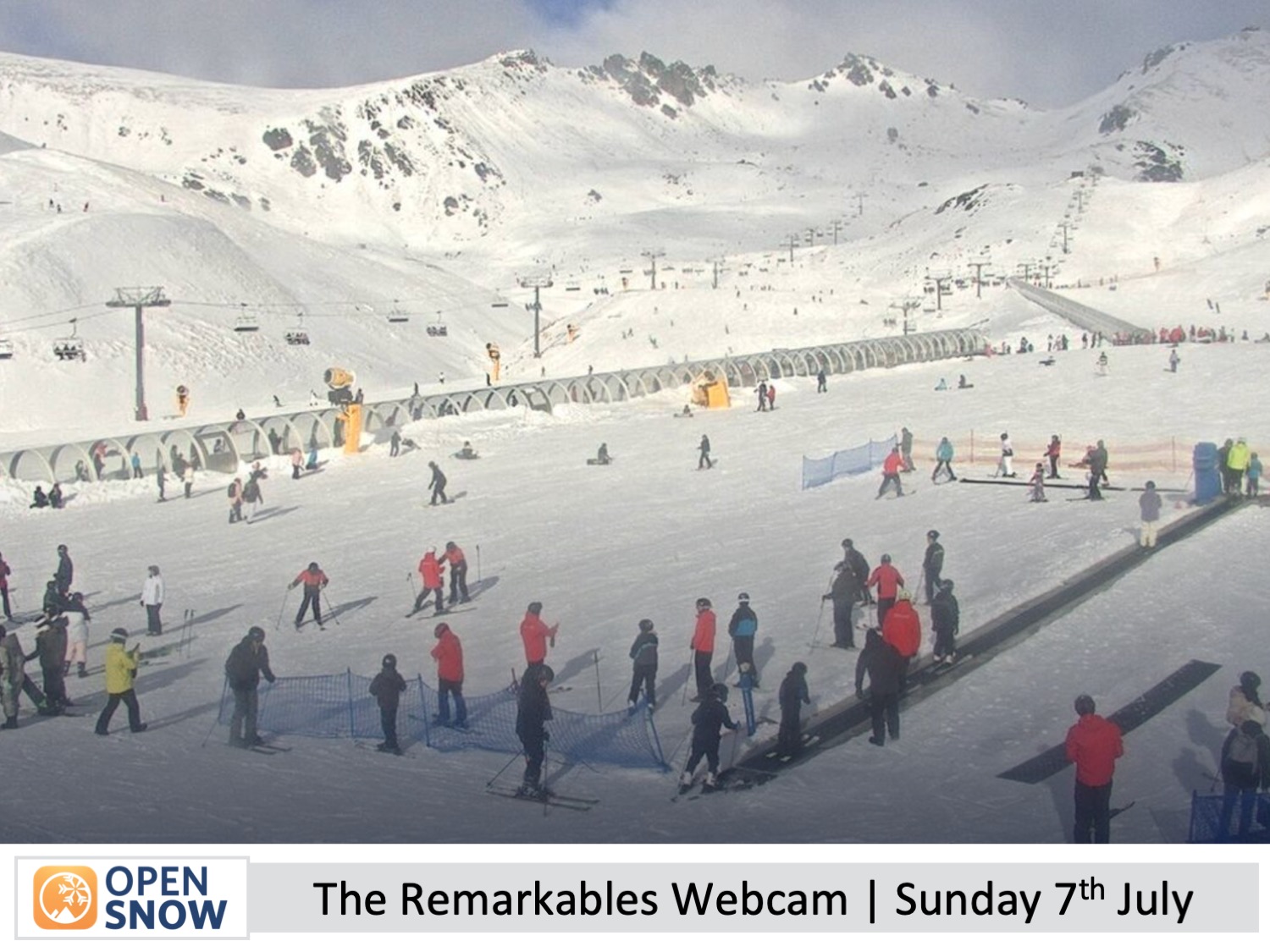
A weak front passed over the South Island Friday night, but only The Remarkables reported fresh snow on Saturday morning with 3-4cm of it. However, I could see from webcams at the other ski fields that a light dusting of snow had settled on some of the hardware that wasn't there the day before - it must've been 1cm or less!
Skies were mostly clear over the weekend, but there was a cold southwest wind that had people bundled up. This allowed ski fields to continue making snow, adding to the snowpack which is now nice and thick on the groomed runs, but still thin and bony off-piste despite that big dump last week.
Forecast for Monday to Friday (8th to 12th July)
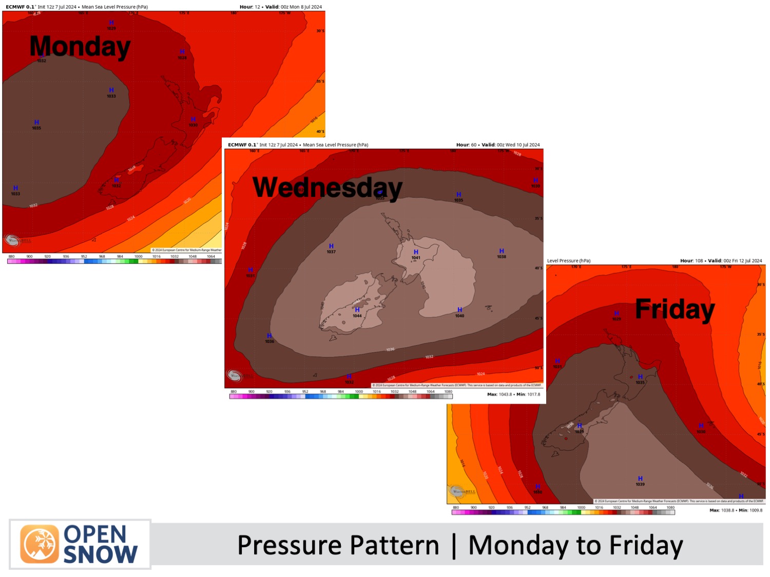
Well, this may be the simplest and shortest forecast I write this season. A big high moves onto the country on Monday where it'll sit tight until moving off to the southeast on Friday. So the weather at all Kiwi ski fields will be clear and sunny this entire time, despite low-level clouds that will sometimes sit below base levels.
Cold southwest winds over the country will ease on Monday, with light winds for Tuesday and Wednesday. Southeast winds will develop over Mt Ruapehu on Thursday, and then north-to-northeast winds pick up over the South Island on Friday, but they won't be strong enough to cause any problems or much discomfort.
It'll be a great week for the kids on mid-year holidays at the moment, and below-zero overnight temperatures will see more snow being made.
Extended Forecast
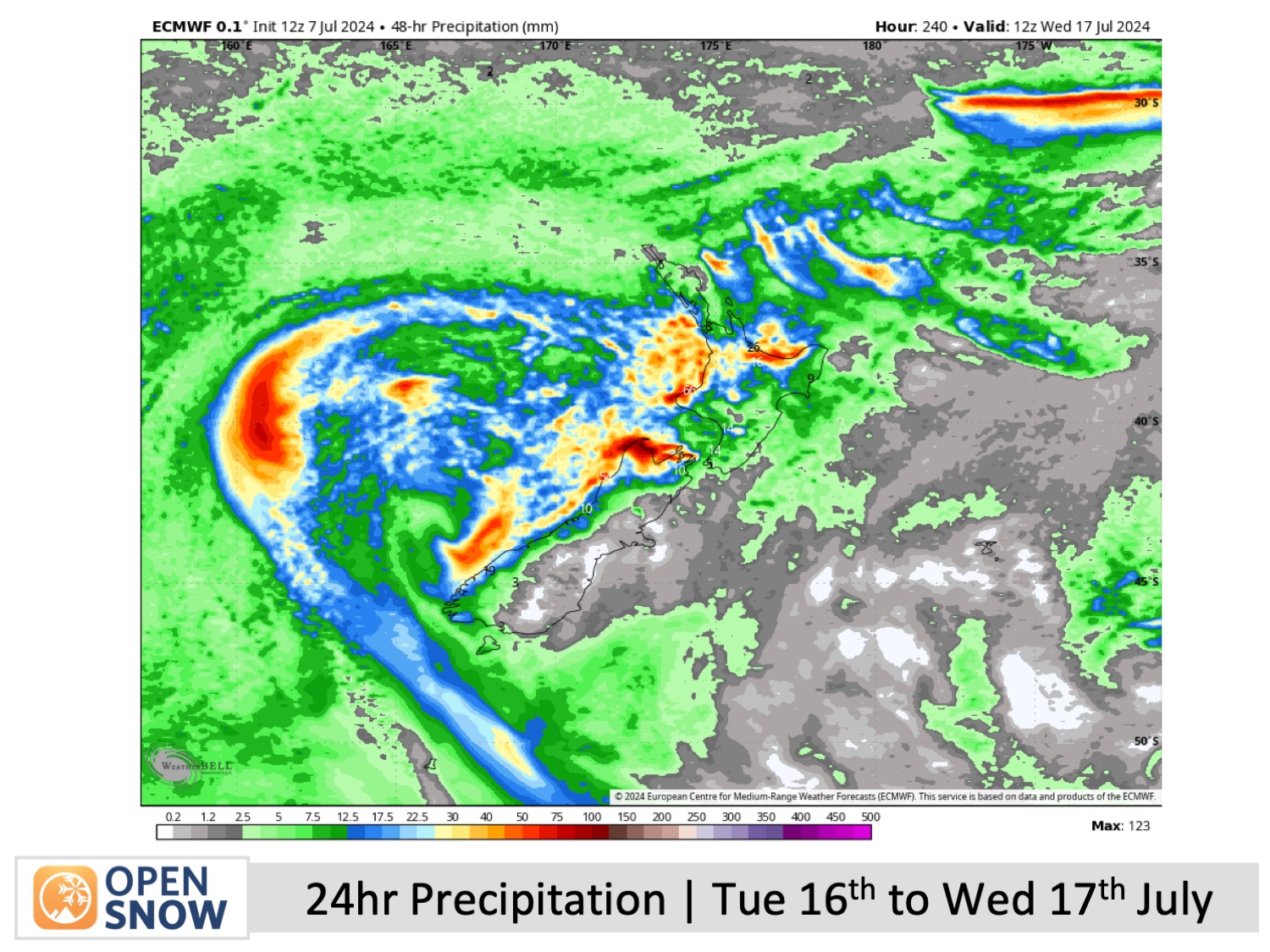
The weather's looking good for the weekend too, but northerly winds will pick up a bit more across the South Island as a front in the Tasman Sea grinds to a halt just west of the country. This front will weaken by the time it crosses over around Tuesday, July 16th, and Wednesday, July 17th, with just a light amount of snow expected at higher altitudes. From then on, models suggest the weather will remain unsettled with good chances for more snow.
Thanks for reading. I'll keep these forecasts coming every Monday, Wednesday & Friday throughout the southern hemisphere season.
Mike O'Connor
About Our Forecaster


