New Zealand Daily Snow

By Mike O'Connor, Meteorologist Posted 6 days ago July 24, 2025
Settled Spell Ends With Warm, Wet Storm Early Next Week
Summary
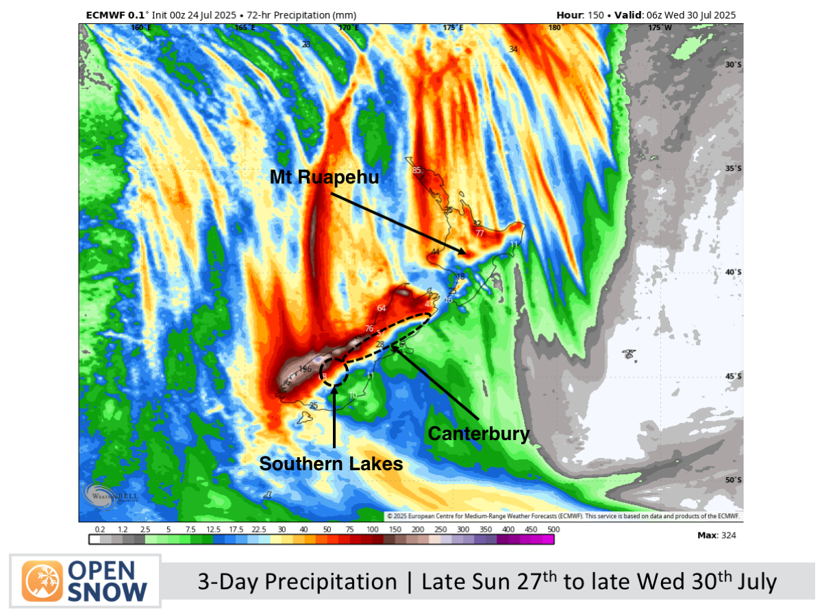
A fine week is ending as strong northwest winds build ahead of a front in the Tasman Sea. Now delayed by 24 hours, the system will bring heavy rain from late Sunday in the Southern Lakes, reaching Canterbury Monday and Mt Ruapehu Tuesday. Winds will be warm and very strong. Best to hit the slopes today or this weekend before it arrives.
Short Term Forecast

Forecast for Friday 25th to Sunday 27th July
Friday will be fine across the country, with increasing northwest winds over the South Island and some high cloud in the Southern Lakes. Saturday brings more cloud to the Southern Lakes, while other ski fields stay mostly clear; winds ease through the day. On Sunday, a slow-moving front brings cloud, showers, and strong winds to the South Island, with rain reaching the Southern Lakes after dark.
Forecast for Monday 28th to Wednesday 30th July
Heavy rain and strong northwest winds hit the Southern Lakes on Monday, spreading to Canterbury and Mt Ruapehu later in the day. The system intensifies on Tuesday as it reaches the North Island, before easing to showers and high snow on Wednesday with a cooler northwest change.
Extended Forecast
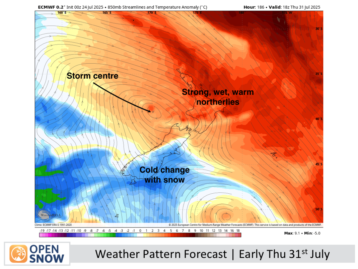
Another storm is set to arrive around Thursday 31st July or Friday 1st August, likely bringing rain, especially to the North Island and upper South Island, followed by a cold change and snow, though details remain uncertain.
Thanks for reading. The next forecast will be out on Monday.
Mike
About Our Forecaster


