New Zealand Daily Snow

By Mike O'Connor, Meteorologist Posted 2 days ago July 27, 2025
A Wet & Windy Start to the Week, But a Cold Finish
Summary
A great weekend on New Zealand slopes, which defied forecasts, as a storm stalled west of the country. A stronger system arrives late Monday with heavy rain and strong northerlies. Conditions ease on Wednesday, then light snow hits the South Island. Mt Ruapehu faces more rain, wind, and some upper-slope snow later in the week.
Short Term Forecast

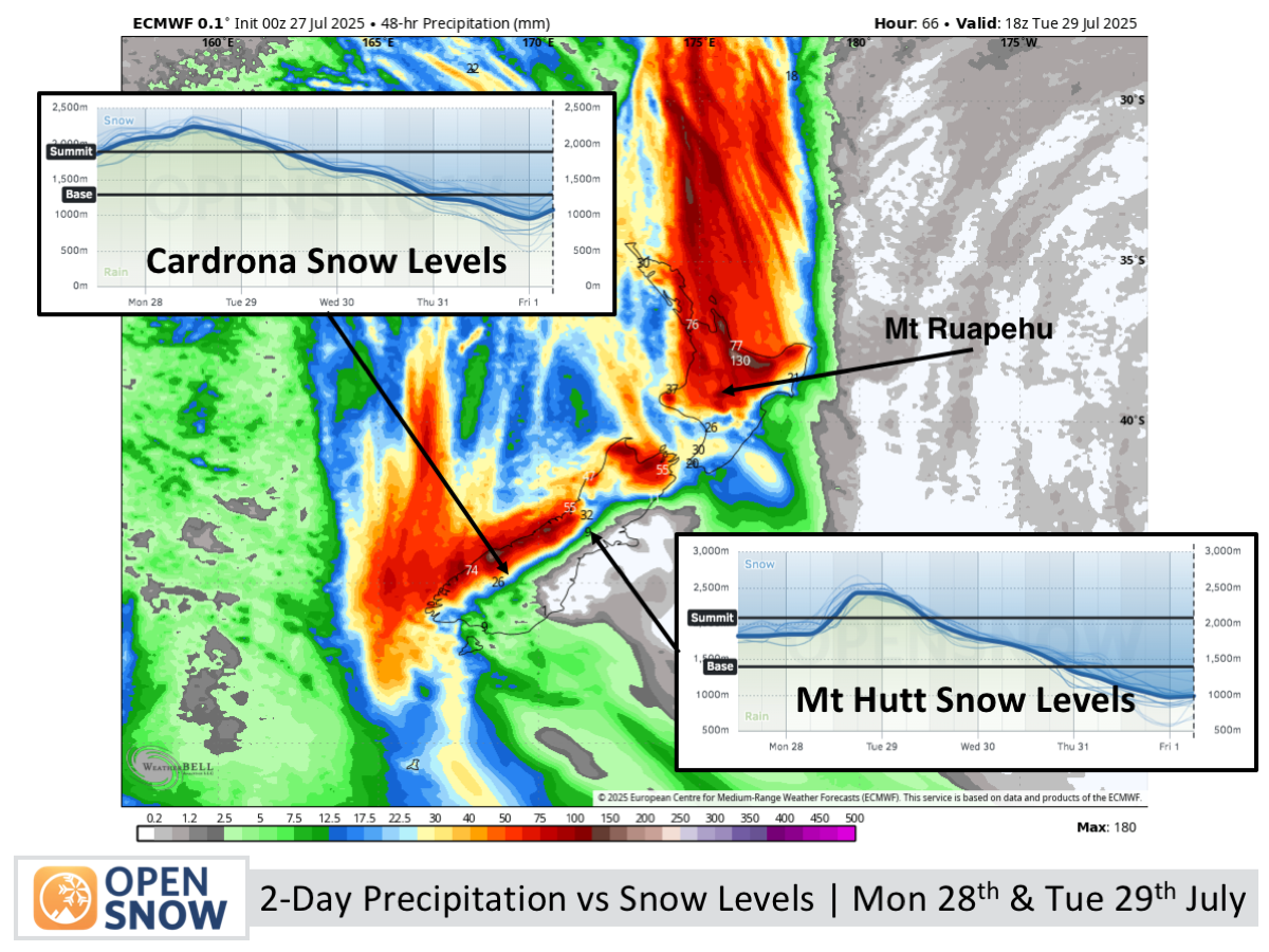
Forecast for Monday 28th & Tuesday 29th July
Monday will be cloudy with strong northwest winds and possible morning showers at Treble Cone, followed by heavy rain at night in the Southern Lakes and Mackenzie Basin. Tuesday brings wild weather with heavy rain and gale-force northerlies, easing later in the day with light snow on the upper slopes.
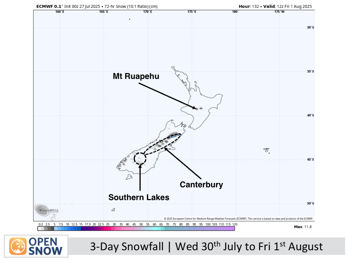
Forecast for Wednesday 30th July to Friday 1st August
Wednesday starts clear and sunny on South Island ski fields, with snow showers arriving after hours as a chilly southerly moves in. Thursday sees cloud and light flurries in the Southern Lakes, with snow showers in Canterbury under a cold southeast breeze. By Friday, conditions improve as cloud and snow ease and winds die down.
Extended Forecast
A strong, cold southerly brings light snow from late Saturday through Monday. A low may follow, and if it tracks close, heavy snow could hit Mt Ruapehu and Canterbury; otherwise, skies will stay mostly clear.
Thanks for reading. The next forecast will be out on Wednesday.
Mike
About Our Forecaster


