South America Daily Snow

By Luke Stone, Forecaster Posted 1 year ago June 17, 2024
So, So, So Much More Snow On the Way
Summary
The northern zone and parts of the central zone are still digging out from last week's monster storm that dropped well over 1 m of snow in several locations. At least two and maybe three more storms are lined up and poised to strike the Andes with many more days of heavy snow.
Short Term Forecast
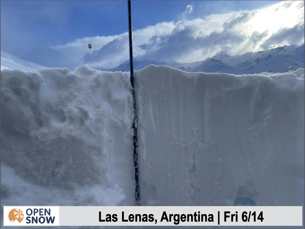
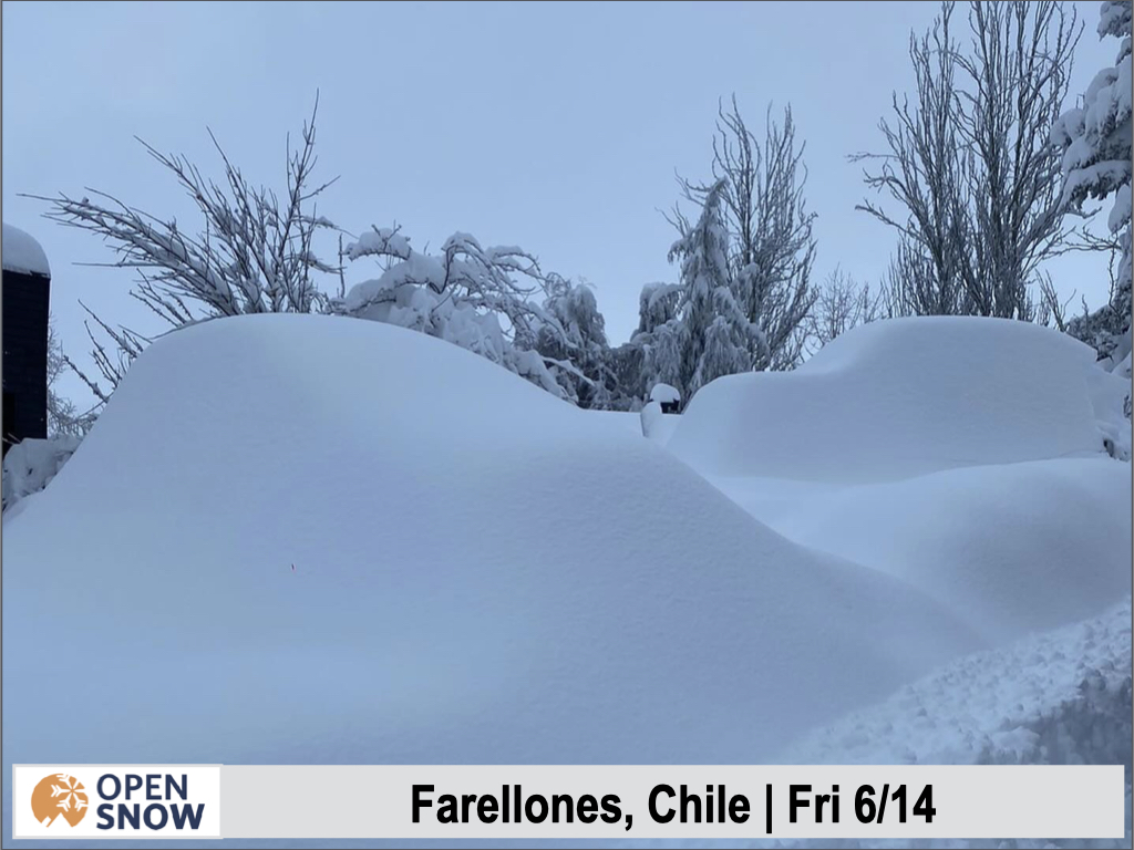
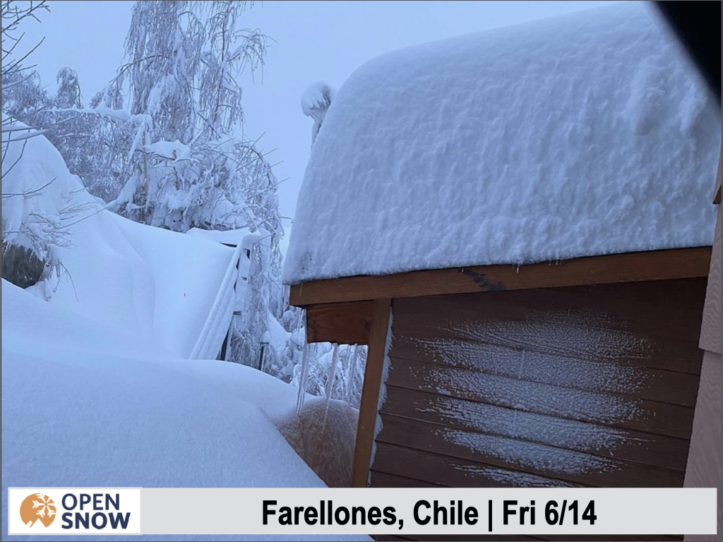
The final snow totals for the last storm were truly impressive. Below are the final tallies and some pictures of the aftermath.
- Valle Nevado: 175 cm (69 in)
- La Parva: 160 cm (60 in)
- Farellones: ~ 100 cm
- Portillo: 130 cm (52 in)
- Las Lenas: 105 cm (41) base, ~300 cm upper mountain.
- Corralco: 40 cm (16 in)
The huge snow totals will allow Las Lenas to open up a few days early, on Thursday of this week instead of Saturday, weather permitting.
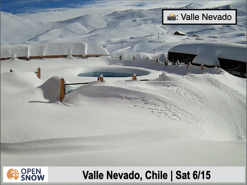
The pictures below are courtesy of PowderQuest.


Two to three more storms are lined up in the South Pacific and will add to the already huge snow totals in the Andes this month. The first storm is underway this (Monday) morning and will continue through Wednesday with cold temperatures. The next storm moves in Wednesday night and will be accompanied by a warm front, raising snow levels a bit, but they will fall again on Thursday. This storm will continue through the weekend with the third potential storm arriving Sunday night.
With so much going on in the next seven to ten days I will keep the details focused on storm number one of three. As mentioned, this storm will continue in the central and southern regions Monday morning and quickly spread into the northern zone. Snow levels climbed a bit on Sunday, but not too high, and are already falling this morning.
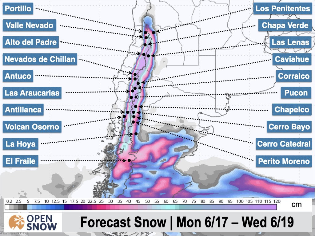
This is yet another intense and long-duration storm, with very heavy snowfall expected Monday through Tuesday evening, and perhaps Wednesday morning in the northern zone. We're looking at another .5 - 1 m in the higher elevations in the northern part of the central zone, with totals closer to the 40 - 80 cm range further south and east. In the north and at Nevados de Chillan, we should see another .5 - 1.5 m. Nevados de Chillan looks like the jackpot for this one. We will see strong winds out of the west-northwest on Monday as well.
The latest snow forecast from the American model is shown below.
Light to moderate snow will continue on Wednesday and without much of a break, the next storm will be moving in Wednesday night, though the temperatures will start to warm during the afternoon. Snow levels will climb through around Thursday morning, but should stay below all base elevations. By the time this storm winds down on Saturday, we will see some of the coldest temperatures of the year.
This system will be fueled by another atmospheric river, and a lot of moisture will fall during this event. Snow totals look to be in the .75 - 1.5 m range for many with 2 m + not out of the question for resorts like Portillo and Nevados de Chillan.
Extended Forecast
Another major storm is possible from around Sunday night to the middle of the following week. We may see a break in the storm activity toward the end of the week but the signal isn't too strong either way. Let's focus on the next three major storms for now.
Next update on Wednesday.
Thanks for reading the South America Daily Snow!
Luke Stone
Forecaster, OpenSnow
Announcements

NEW: Current Global Radar
Track storms worldwide with our new "Current Global Radar" map overlay.
- Tap the "Maps" tab.
- Tap the overlay button.
- Tap "Current Global Radar".
- Scrub the bottom slider.
The radar data is updated every 10 minutes to help you track ongoing precipitation for the past 2 hours.

Make sure you're updated to the latest version of the OpenSnow app (App Store / Google Play > OpenSnow > Update) or visit the OpenSnow website (OpenSnow.com).
View → Current Global Radar
About Our Forecaster


