South America Daily Snow

By Luke Stone, Forecaster Posted 1 year ago June 24, 2024
The Most Incredible Start to the South American Season in 20+ Years
Summary
Although official snowfall records in South America are not well maintained, seasoned locals and long-time visitors agree that the start of this winter is the best in at least 20 years. The northern zone has continued to see heavy snow over the last week, and there's still more in the forecast. Overall the pattern stays active but not as cold as the last few weeks.
Short Term Forecast
Despite the lack of precise and comprehensive historical data, the collective experience and observations of those who have spent many winters in the area strongly suggest that this is the deepest start to the season in decades, heralding what could be an outstanding winter season. Unusually heavy snowfall and consistent favorable weather patterns have delivered exceptional early-season conditions, heralding a potentially remarkable winter season ahead.
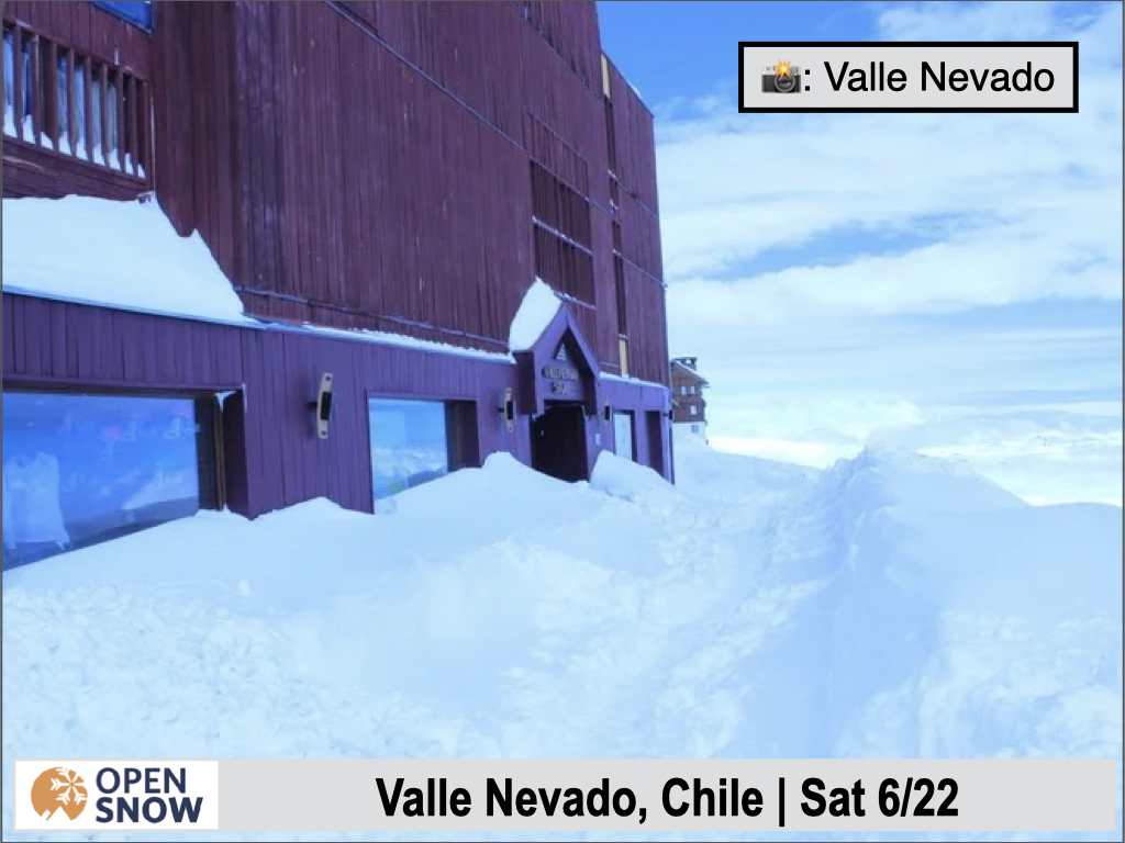
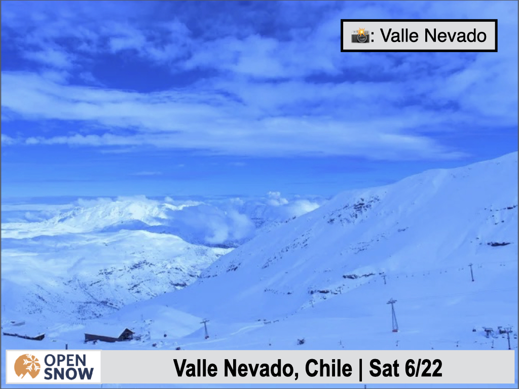
I've gathered as much information as possible about the miraculous month of June and the season so far and I will summarize that below. Chapa Verde is reporting a base of 2 to 2.5 m, which is historic according to their Instagram page. Valle Nevado has received over 5 m (509 cm / 16.5 ft) to date, including 106 cm (42 in) from Friday to Saturday. Their average snowfall is 6.1 m, so they have received 83% of their seasonal snowfall already. Below are a few shots from Valle Nevado this weekend.
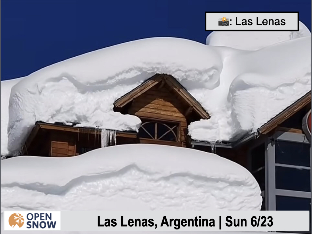
Las Lenas has snow depths over 3 m (9.8 ft) at the base and approximately 7 m (23 ft) up high. Below are a few pictures of the recent snow at Las Lenas.


Portillo has received ~5 m (16 ft) so far, which is the most in 30 years according to a spokesperson.
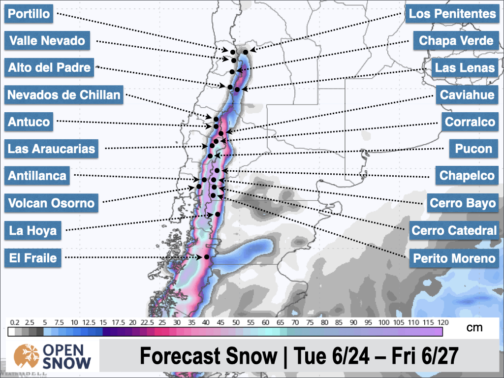
We have seen additional snowfall Sunday night into this (Monday) morning, primarily in the northern zone, although accumulations aren't anything like some of the recent storms. This smaller storm in the north will linger today and continue through much of Tuesday as well. Expect 5 - 15 cm in the north, except for Portillo and Valle Nevado where more significant accumulations in the realm of 15 - 40 cm are possible. Additional snowfall through Tuesday in the northern zone is shown below.
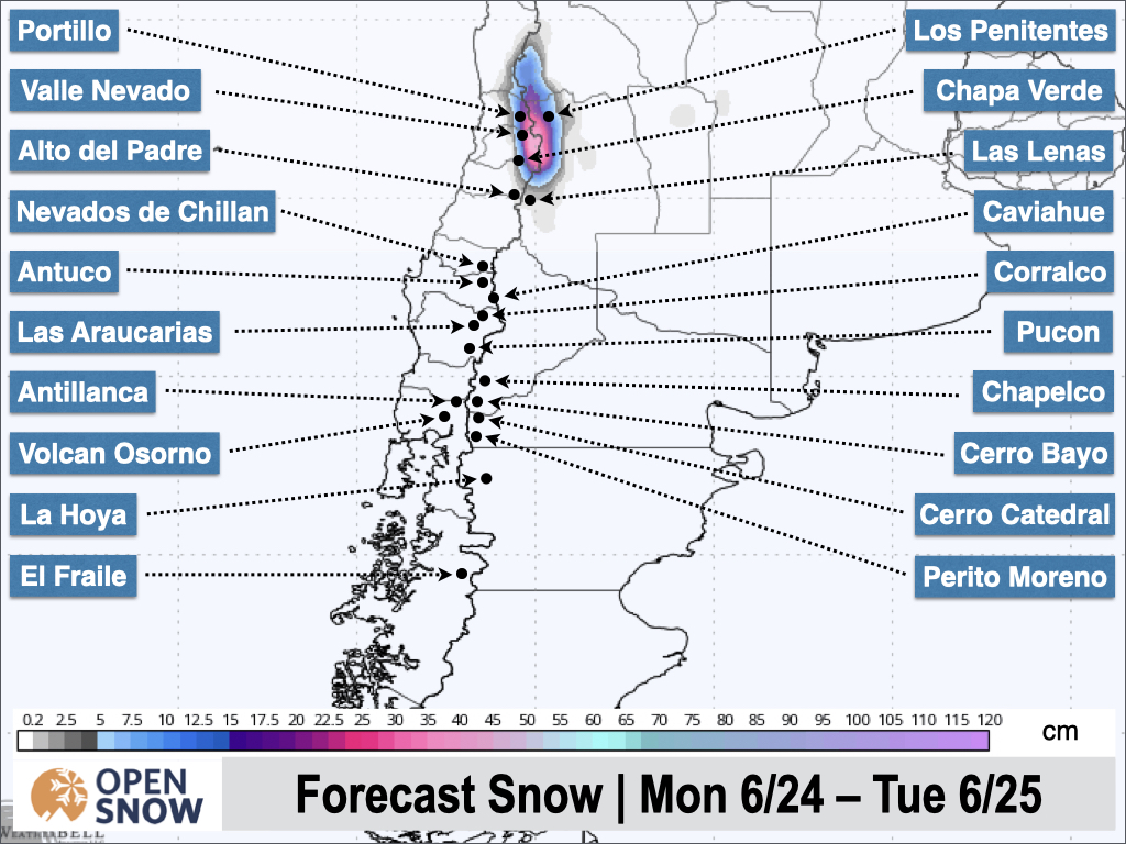
On Tuesday, the first of two southerly storms will move into the southern Andes, bringing heavy precipitation and rising snow levels. These two storms will favor the southern zone and the southern half of the central zone. While temperatures will climb through Wednesday, snow levels should not get too much higher than most base elevations. A cold front Wednesday night will begin to lower snow levels and continue to do so through Friday when snow will come to an end.
This will be a major storm with strong winds for resorts like Volcan Osorno, Antillanca, Pucon, and Las Araucarias, where 40 - 80 cm + is possible, with higher amounts expected near Volcan Osorno and Antillanca. An early look at snow totals from the American model is shown below. Totals in the north won't be overly impressive from these two storms, but another 10 - 30 cm is possible.
Things will quiet down a bit Friday afternoon and Saturday, but another storm is expected on Sunday. This looks to take a more southerly track as well, but another round of significant accumulation is likely for the central and southern zones. I'll have more details on this storm in a future update.
Extended Forecast
Next week's storm may stick around for much of the week, with additional systems possible thereafter. The pattern should stay active through at least the first week of July.
Next update on Wednesday.
Thanks for reading the South America Daily Snow!
Luke Stone
Forecaster, OpenSnow
Announcements

NEW: Global Weather Stations
Get the latest temperature, wind, and snow data from over 50,000 global weather stations with our new “Weather Stations” map overlay.
- Tap the “Maps” tab.
- Tap the overlay button.
- Tap “Weather Stations”.
- Select any chip at the top of the screen.
- Tap any station to view current and historical data.

Make sure you're updated to the latest version of the OpenSnow app (App Store / Google Play > OpenSnow > Update) or visit the OpenSnow website (OpenSnow.com).
View → Weather Station Map
About Our Forecaster


