Winter Park Daily Snow

By Joel Gratz, Founding Meteorologist Posted 2 years ago November 7, 2022
Sunny for three days, then a storm
Summary
Monday through Wednesday will be sunny and warm, then snow will return on Wednesday night and Thursday.
Update
Sunday was another cloudy day with soft snow in the morning thanks to the snow showers and a few inches of accumulations during Saturday night and Sunday morning.
Then Sunday midday and afternoon were dry with some breaks of sunshine.
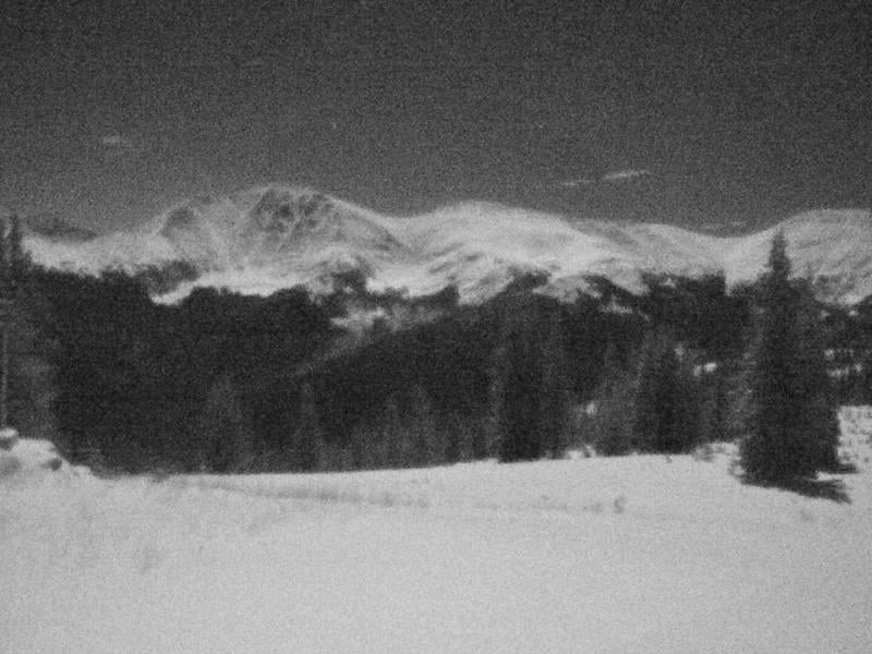
Finally, on Sunday night, the clouds cleared and the nearly full moon lit up the fresh snow cover on mountains along the continental divide just to the east of Winter Park. The mountain cam image below was captured at night:-)
Looking at the week ahead, Monday, Tuesday, and Wednesday will be dry with partly-to-mostly sunny skies and warmer temperatures that should reach the 40s. Winds might be gusty at times along the higher peaks, generally above the currently open terrain.
Our next storm will then bring snow from Wednesday night through Thursday with moderate snow accumulations, maybe in the 3-6 inch range. The snowfall from this storm will be limited by the fast movement of the system. A few of these inches should fall during a short period of time likely very early on Thursday morning as a cold front moves across Colorado, then snow showers should continue on Thursday and we could see a few more inches of accumulation.
The timing of this storm means that Thursday should offer softer turns and maybe a bit of powder, and temperatures on Thursday will be chilly with highs in the teens.
Looking further ahead, we should see cool temperatures through mid-November, and though I do not see any strong storms after November 10, a few little storms would be just fine, and that might be what we'll see between November 13-22.
Thanks for reading!
JOEL GRATZ
Meteorologist at OpenSnow.com
Snow conditions as of Monday morning
New snow mid-mountain:
* 1” (24 hours Sunday 500am to Monday 500am)
* 0” (Overnight Sunday 400pm to Monday 500am)
Last snowfall:
* 13” Thursday to Sunday (Nov 3-6)
Terrain
* 4 of 23 lifts
* 5 of 166 trails
* Latest update
Snowpack compared to the 30-year average:
* 134%
About Our Forecaster


