News

By Joel Gratz, Founding Meteorologist Posted 11 years ago October 21, 2013
The weather pattern this week: 10/21 to 10/27/2013
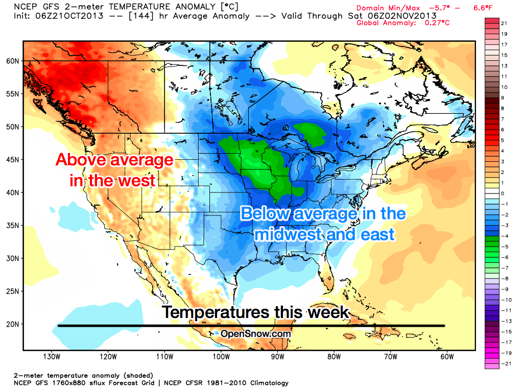
Weather forecasts are not perfect, but they are pretty good at predicting the general weather pattern at least five days into the future. And for the next five days, all the action will be in the central and eastern part of the US.
Temperatures will run 5-10 degrees cooler than average in the midwest and east, while the west will be a few degrees warmer than average.

Source: Map by WeatherBell.com, analysis by OpenSnow.com.
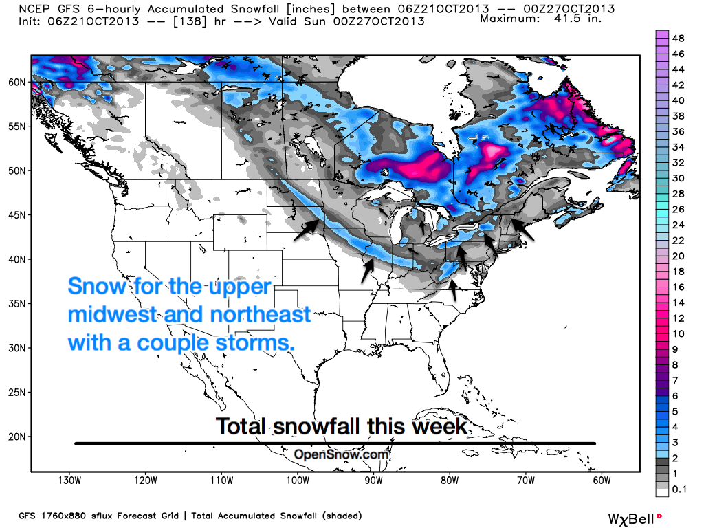
With cold temperatures in the east, I expect many of the mountains to see a few periods of snow this week as multiple storms move through. The mountains of New England and the central Appalachians are favored (see West Virginia and Maryland colored in blue in the map below?!). Also, since the Great Lakes are still rather warm, the cold air rushing over them will create lake-effect snow. This is why the snow forecast below shows quite a bit of snow just to the right of each lake, where the winds will deposit the snow.

Source: Map by WeatherBell.com, analysis by OpenSnow.com.
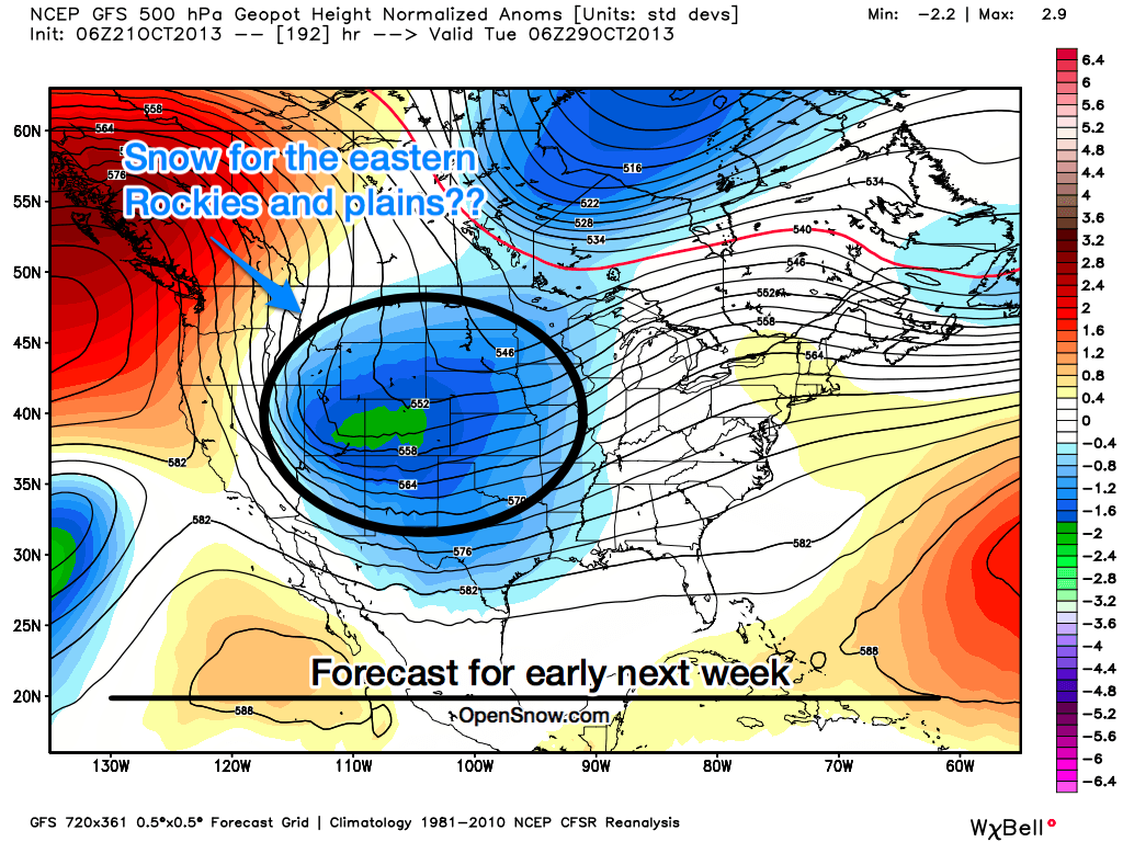
By early next week, there's a chance that the cool air and storminess may push just a bit further west and bring snow to the Rockies and especially the eastern foothills and plains of Wyoming and Colorado. Eight-day forecasts are on the edge of being trustworthy, but all of the world's top computer models -- European, American, Canadian -- are now showing this storm, so my confidence is increasing.

Source: Map by WeatherBell.com, analysis by OpenSnow.com.
There is skiing to be had on a daily basis as Loveland and Arapahoe Basin in Colorado are both open. I hope that the cold weather in the east will allow top snowmaking resorts like Killington and Sunday River to get a nice start to their snowmaking efforts as well!
As always, check our Powder Finder to see the most detailed and up-to-date forecast for snow at ski areas across the country.
JOEL GRATZ
About The Author


