News

By Sam Collentine, Meteorologist Posted 11 years ago January 9, 2014
Weather for the weekend - Jan 10 to Jan 12, 2014
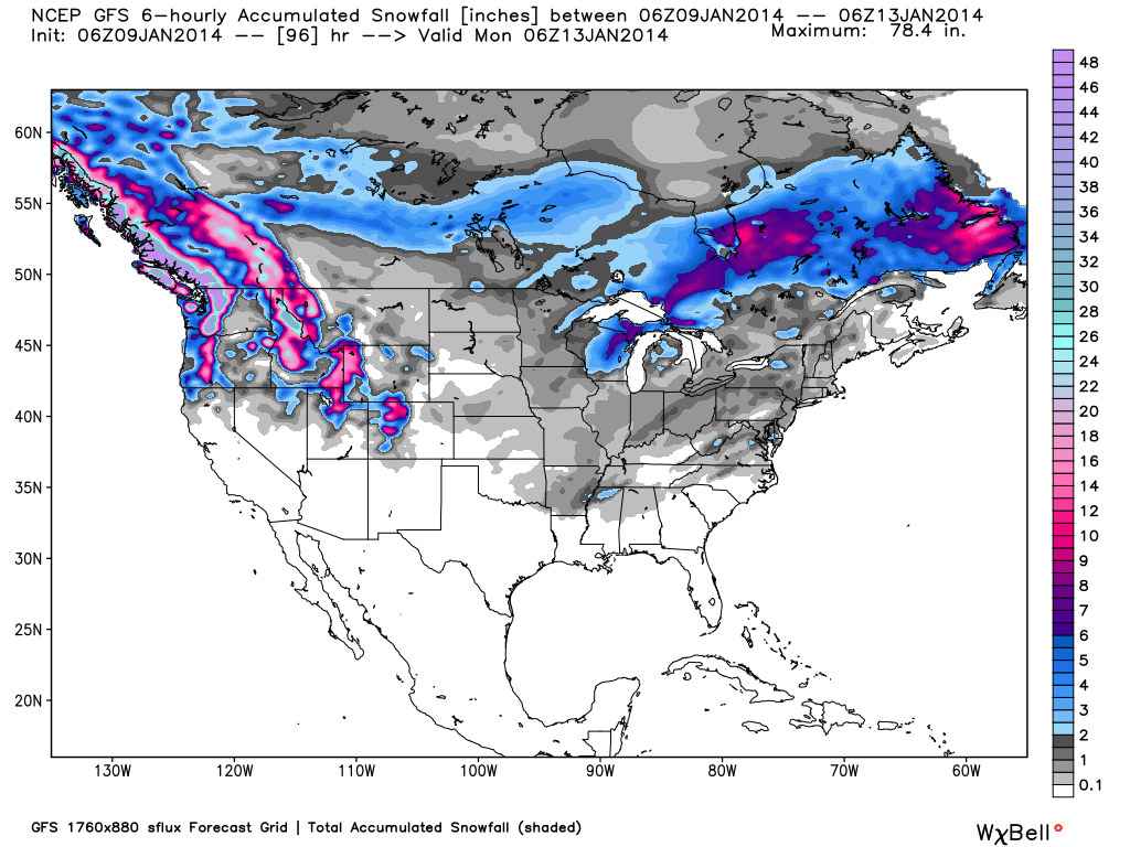
For this weekend, the dominating snow pattern will move to the Pacific Northwest as well as the northern and central Rockies. The Pacific Northwest will likely be measuring their total snow accumulation not in inches but in feet by the time Sunday night rolls around. This is great news for many areas of Oregon and Washington where their current snowpack compared to average sits well below 50 percent.

Total accumulated snowfall, according to the American GFS, through Sunday night. Source: WeatherBell.com
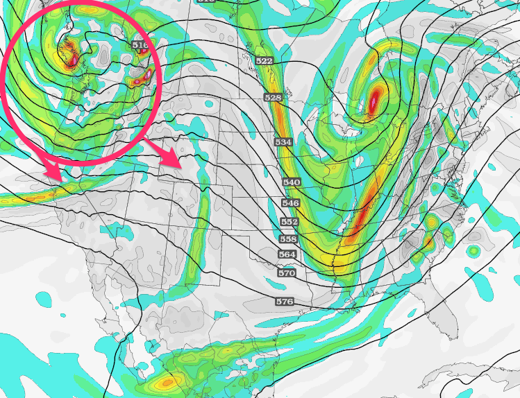
This weekend's storms will be broken up into a series of shortwave troughs through Friday then into a well defined storm system through Sunday. The first shortwave trough will dive down from the Pacific Northwest into the northern and central Rockies through Friday morning. The combination of deep Pacific mositure, orographic lift, and storm energy will allow for heavy accumulations all across the Pacific Northwest and within the northern and central Rockies. Friday should be a tremendous powder day across most of the West. There will then be a slight break until the next system begins to move in off the Pacific on Saturday. A strong system will then bring heavy snowfall throughout the day Saturday for almost all mountain areas of the Pacfic Northwest along with our friends to the north in British Columbia. This system will then move across the West bringing deep accumulations to the Wasatch of Utah, the Tetons of Wyoming, and to the Rocky Mountain ranges of Colorado. Sunday will be an amazing powder day so load up and head to the hills if you can!
The Lake Tahoe region will also likely see several inches as the front of Saturday's system moves inland off the Pacific. It may only range from 4 to 8 inches depending on the location but they will take anything they can get with a snowpack compared to average lingering around 20 percent. Brian, Evan, and Joel will have all the details in the Tahoe, Utah, and Colorado Daily Snows throughout the entire weekend.

Well defined low pressure trough, via the GFS 500mb vorticity model, as of Saturday afternoon. Source: TwisterData.com, analysis by OpenSnow.
For the Midwest, the trough that brought the lowest temperatures in decades is pushing to the north and east. Mild temperatures will be in place on Friday before the next system moves in from the West on Friday night bringing light accumulations to northern Wisconsin and Michigan through Saturday morning. Our Upper Midwest Meterologist Andrew Murray will have the latest details throughout the weekend in The Upper Midwest Daily Snow.
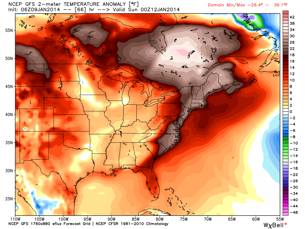
As for New England, above average temperatures will be in place throughout the weekend. This will cut-off any chances for snow and instead will likely bring rain to the region Saturday and into Sunday. Check out The New England Daily Snow throughout the weekend for the latest details.

Temperature anomaly, according to the American GFS, as of Saturday afternoon. Source: WeatherBell.com
When you're up on the hill this weekend post pictures and updates using "LiveSnow", one of the features of our new iPhone app. If your haven't already, download it here. Android coming soon!
Always check our Powder Finder and the forecasts for each mountain throughout the weekend for more details.
Sam Collentine | Twitter: @SamCollentine - Email: [email protected]
About The Author


