News

By Sam Collentine, Meteorologist Posted 11 years ago November 27, 2013
Weather for the weekend - Nov 29 to Dec 1, 2013
This weekend is shaping up to be generally quiet across most of the United States. The storm that affected much of the East over the Thanksgiving holiday will clear but a cool trend will stay in place through the weekend. This is great news for snowmaking at resorts of the midwest and northeast.
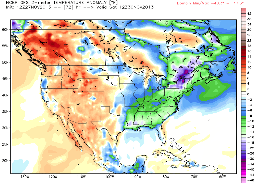
Temperature anomaly, according to the American GFS, on Saturday morning. The term temperature anomaly means a departure from the long-term average. Source WeatherBell.com
The only potential for snow for this weekend is a quick-moving storm that will advance across the Northwest on Saturday and the Northern Rockies late Saturday night into Sunday. This is what meteorologists call a shortwave trough. It is a crinkle embedded in the general flow that creates energy (vorticity), which often ignites precipitation.
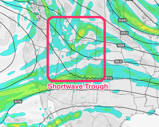
The quick-moving storm, or shortwave trough, according to the American GFS as of Saturday night. Source: TwisterData.com, analysis by OpenSnow.
Areas of Washington, Montana, Idaho, Utah, and Wyoming could see a quick 3 to 6 inches of snowfall with the northern mountains of Colorado also having the potential to pick up a swift 2 to 4 inches.
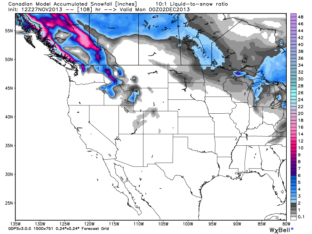
Total accumulated snowfall, accordiing to the GEM (Canadian model), through Sunday afternoon. Source: WeatherBell.com
Looking ahead into early next week, a pattern of cold and storminess is projected to settle over the West. This will be a big change compared to the relatively mild weather the West has seen this week. If the models stay on track, next week looks primed for snowfall all across the western United States.
Check our Powder Finder, forecasts for each mountain, and our Daily Snow posts throughout the weekend for more details.
SAM COLLENTINE
About The Author
