News

By Sam Collentine, Meteorologist Posted 11 years ago December 9, 2013
Weather for this week - Dec 9 to Dec 13, 2013
After a very cold and powder filled past week, we will finally begin to see Old Man Winter loosen his grip upon the United States in the latter half of this week. The Arctic airmass that brought record low temperatures and abundant snowfall will begin to push east ushering in drier conditions to the inner West. Even though the temperatures have been brutally cold over the past 5 days, it has allowed many resorts the gift of around-the-clock snowmaking. This, along with copious amounts of natural snow, will do marvels in opening more terrain just in time for the Christmas holiday.

Temperature anomaly, according to the American GFS, as of Friday. Source: WeatherBell.com.
British Columbia, along with the northern regions of the US, will be the main areas of interest over the next five days. The New England region will begin to see snowfall on Monday with it lasting through early Wednesday. Accumulations will be on the lighter side with totals ranging from 1 to 5 inches. Our New England Meteorologist Brian Clark has named the White Mountains of New Hampshire the sweet spot for this storm so head there if your searching for fresh tracks in the northeast.
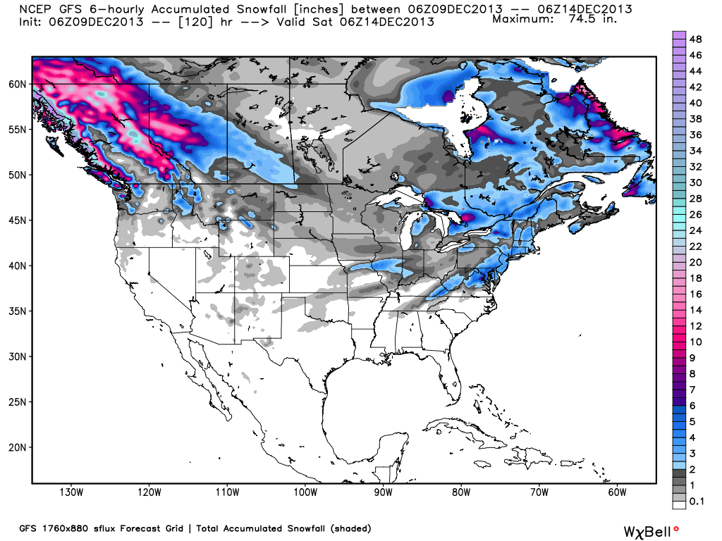
Total accumulated snowfall, according to the American GFS, through Friday. Source: WeatherBell.com.
December is historically British Columbia's snowiest month and the next five days seem to agree. The Coast Mountains and the Canadian Rockies of British Columbia will likely have the deepest powder this week. Snow is also forecasted to stretch down into the northern regions of Washington, Idaho, and Montana. Mt. Baker will likely have the highest totals if you're looking to stay within the continental US.
The final area of interest over the next five days will be the northern regions of the Upper Midwest. The storm that is currently exiting the West will make it's way across the Upper Midwest bringing decent snow accumulations across the region. Expect the northern resorts of Michigan to come away with the biggest totals through Wednesday morning.
Always remember to check our Powder Finder, forecasts for each mountain, and our Daily Snow posts throughout the week for more details.
SAM COLLENTINE Follow @SamCollentine
About The Author


