Australia Daily Snow

By Mike O'Connor, Meteorologist Posted 1 year ago June 27, 2024
Wet, Windy & Wild this Weekend as a Strong Storm Lashes the Australian Alps
Summary
Australian resorts picked up some wet, dense snow this week. Friday will be your best chance to get amongst it as the weather will get wild this weekend as a strong storm crosses the Australian Alps. Strong winds, heavy rain and mid-high level snow will lash resorts on Saturday, followed by colder southerlies and lighter snow showers on Sunday. Next week looks cold, calm and dry.
Short Term Forecast
Snow showers from earlier in the week have left up to 15cm of fresh on mid-upper level slopes, but dense snow lying about the resorts in New South Wales. Temperatures were marginal, a little too marginal for Victoria where resorts only picked up 1-6cm of wet slush. However, temperatures dropped nicely Thursday night with skies mostly clearing allowing all of it to freeze into a solid base that will serve us well for the season ahead.
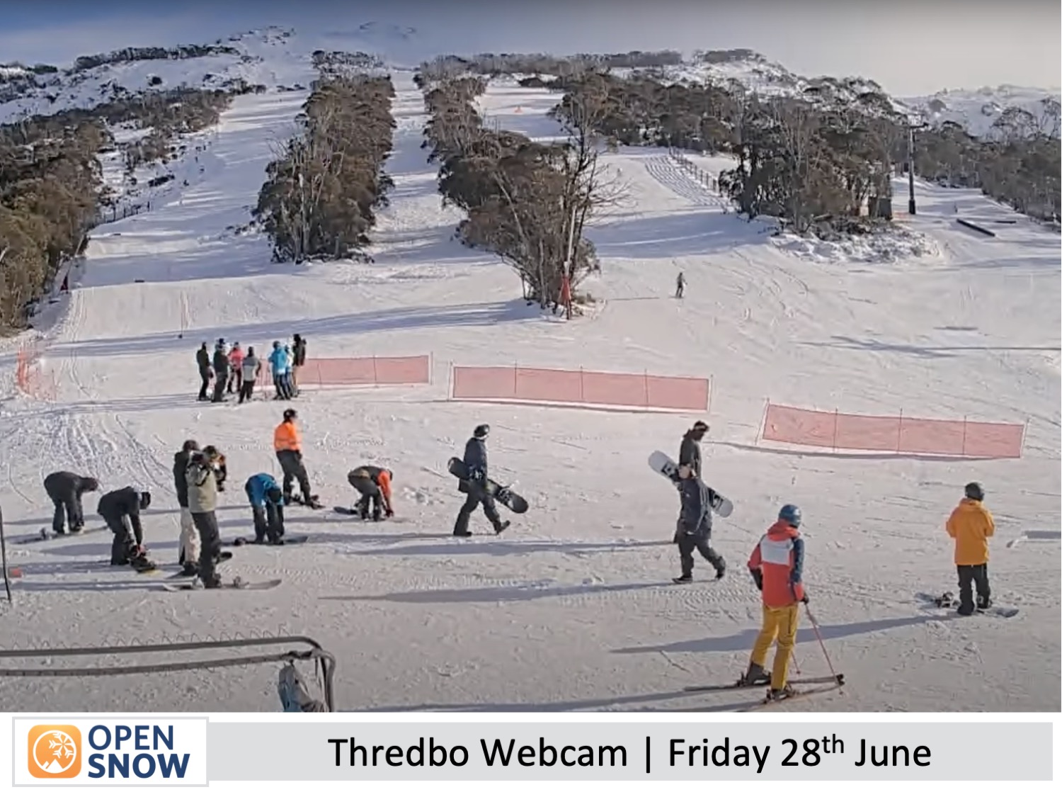
Forecast for Friday (28th June)
Northwesterlies will get quite strong up high on Friday, possibly affecting some lift operations. The winds will continue to push clouds into Victoria where there'll also be a little drizzle, making for murkier conditions. New South Wales will be mostly clear.
Forecast for the Weekend (29th June & 30th June)
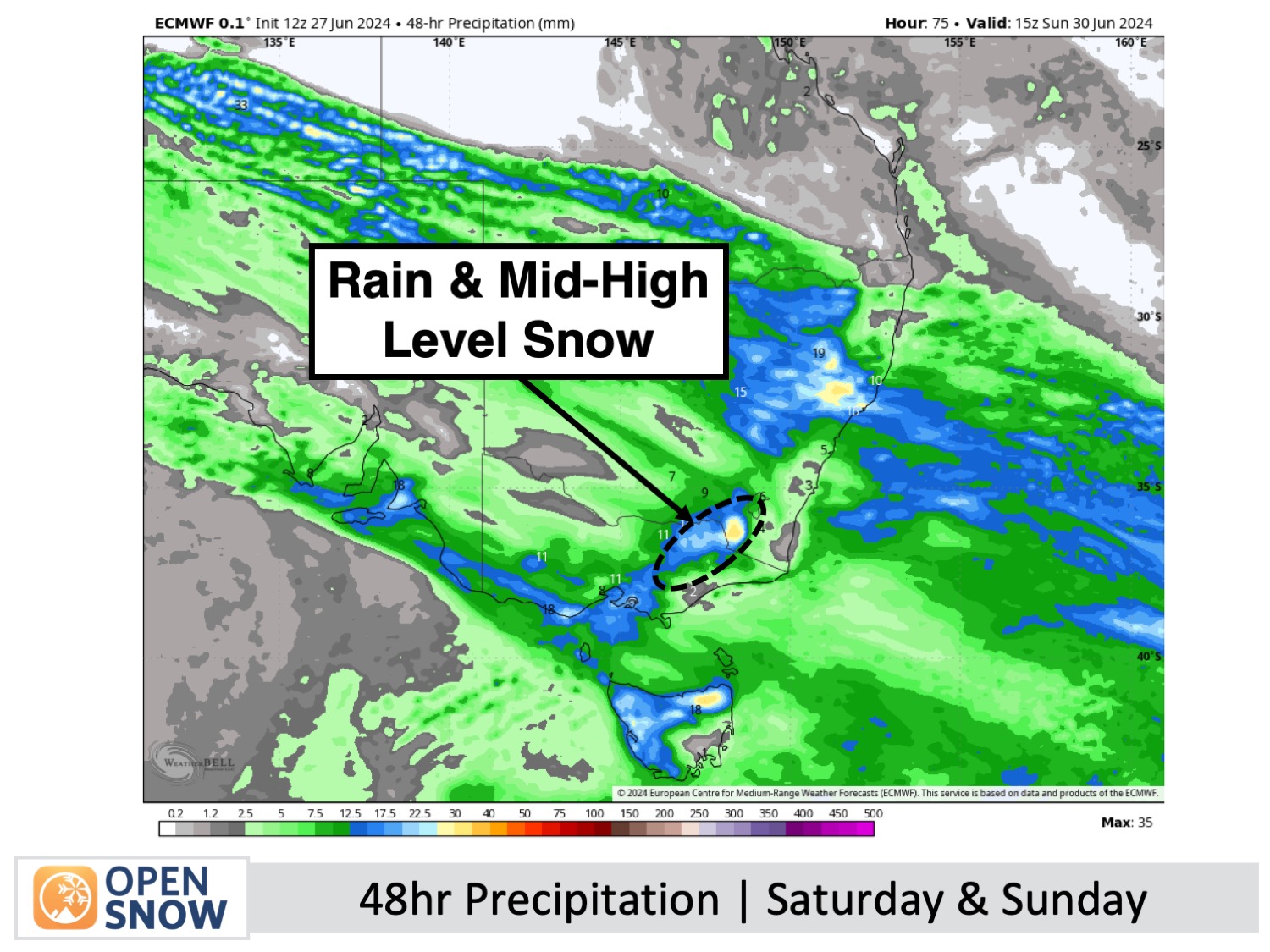
This weather will be wild this weekend as a storm crosses the Aussie Alps. Heavy precipitation will lash the Australian Alps on Saturday, falling as dense snow to mid-high elevations with strong northwest winds gusting up to 100-120km/h, which will likely close or limit lift operations.
A change to colder southerlies during the predawn hours of Sunday will see things ease back to light snow showers down to low elevations before gradually clearing later in the day.
The tally for this storm is a difficult one as there'll be a huge difference between the top and bottom. Looking at precipitation figures it looks as though 15-30cm will fall about mid-upper elevations (above about 1700m), most of it on Saturday, and 5-10cm or less down lower, most falling early Sunday. I wouldn't be surprised if this storm throws up a few surprises, especially concerning snow levels which could easily be higher or lower than what I think.
Extended Forecast
Forecast for next week starting Monday the 1st July
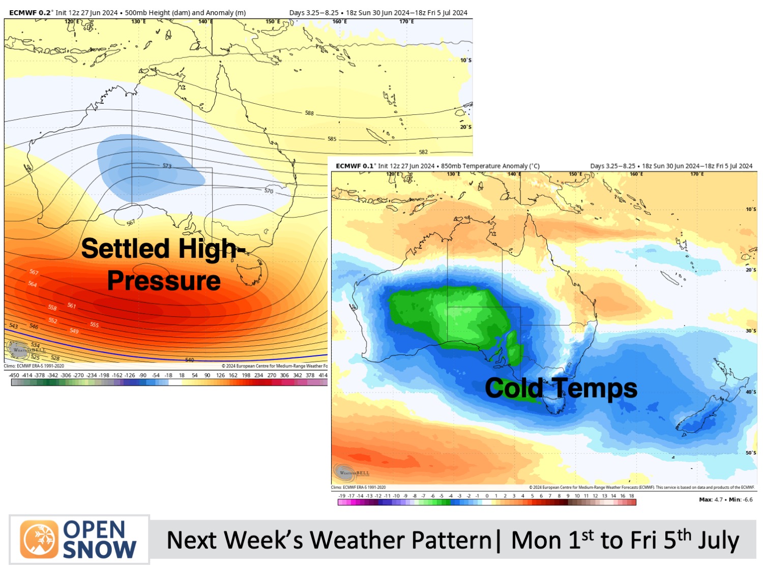
A slow-moving high-pressure ridge is expected to maintain stable conditions across the Australian Alps next week. Cold easterly winds from Monday, July 1st, through Thursday, July 4th, should allow extensive snowmaking.
Thanks for reading. I'll keep these forecasts coming every Monday, Wednesday & Friday throughout the southern hemisphere season.
Mike O'Connor
About Our Forecaster


