Australia Daily Snow

By Mike O'Connor, Meteorologist Posted 1 year ago June 26, 2024
A Small Boost for the Snowpack before a Bigger Storm Arrives this Weekend
Summary
Snow showers on Wednesday and Thursday will provide a small, but much-needed boost to the Australian snowpack which is still running at low tide. A stronger storm arrives this weekend and is set to continue into early next week, promising to deliver a significant amount of snow to higher elevations, while lower levels will receive considerably less.
Short Term Forecast
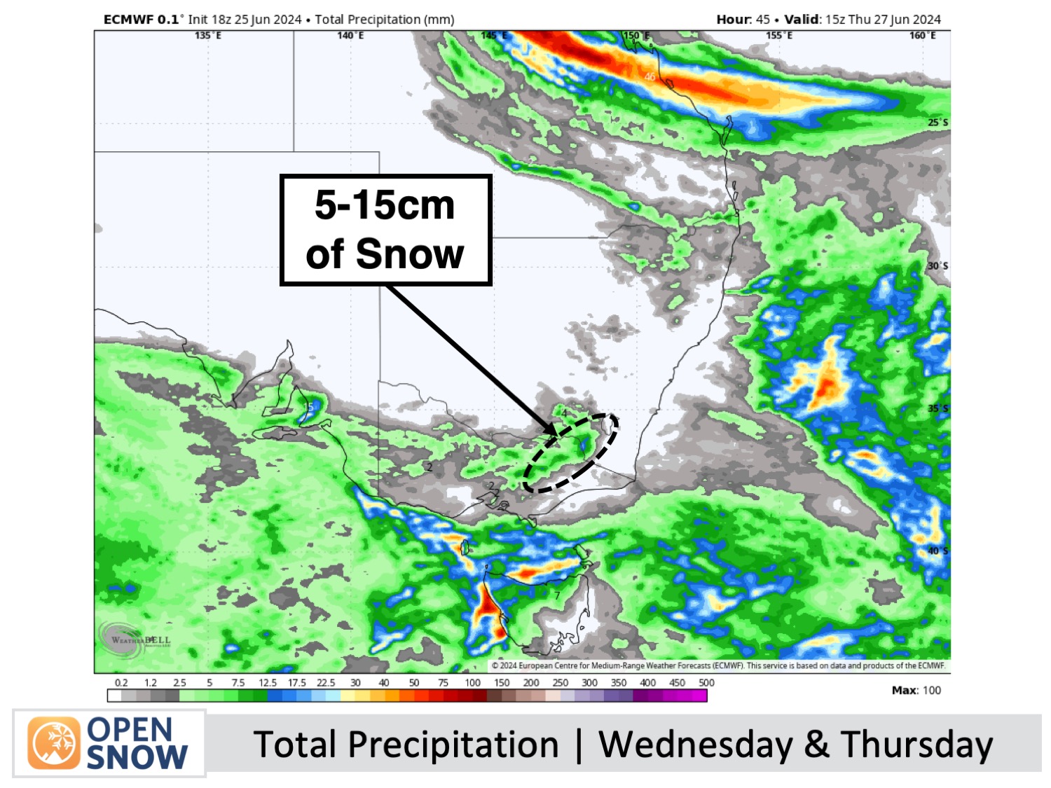
Forecast for Wedneday & Thursday (26th & 27th June)
A storm arrived in the Australian Alps on Tuesday, bringing a mix of rain and snow showers which has continued to fall into the early hours of Wednesday. Temperatures have been too marginal, however, so only one or two centimetres has accumulated up high so far.
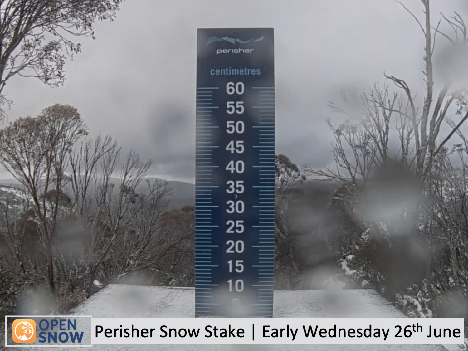
The snow showers will continue throughout Wednesday before gradually easing and clearing later on Thursday. Fortunately, a colder airmass will arrive Wednesday morning so snow levels will drop to around 1400m, which is near to base levels of most resorts although it'll be wet and dense there. About 5-10cm is expected in total, but up to 15cm could accumulate in some areas.
Wind chill and restricted visibility will be a factor as northwesterlies will be strong, so come prepared and you'll score some fresh chalk.
Forecast for Friday (28th June)
There'll be fresh snow from the previous days lying around waiting to be shredded. Humid northwesterlies will continue to push in clouds, but this will mostly affect Victorian resorts where there'll also be a little drizzle, making for murkier conditions. New South Wales should be mostly clear.
Extended Forecast
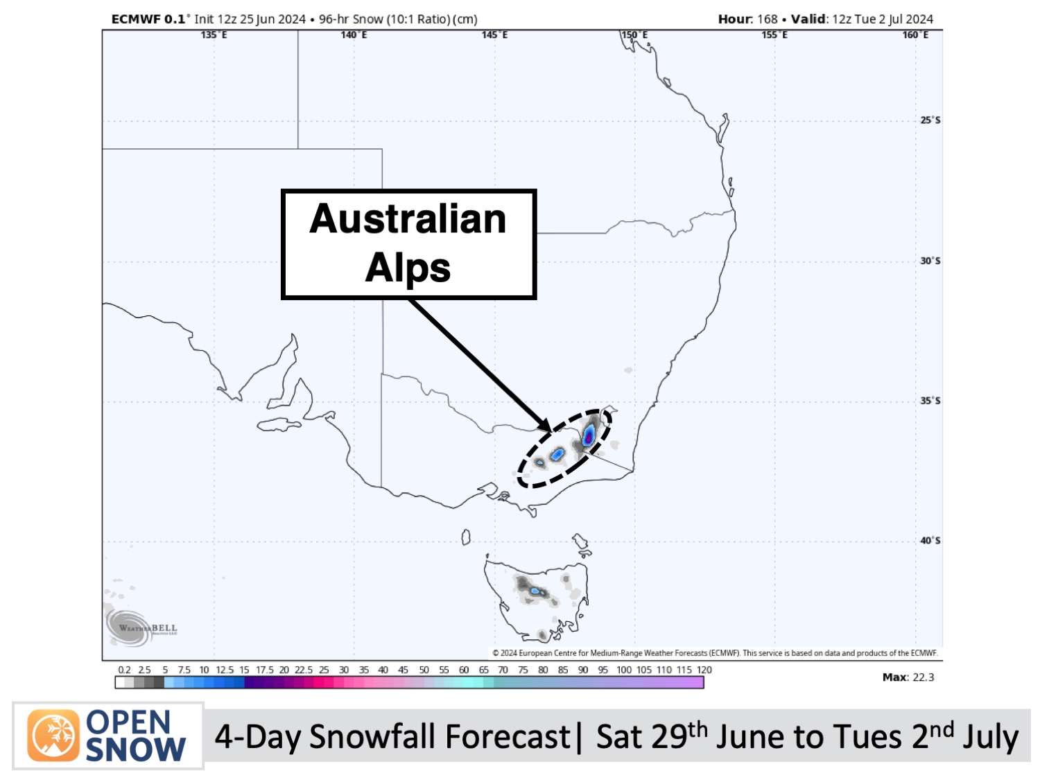
Forecast for the Weekend and Early Next Week (29th June to 2nd July)
The upcoming weekend and the start of the new month will bring a decent snowfall event. The action begins on Saturday 29th of June with some wild weather as very strong northwest winds and heavy precipitation lash the Australian Alps, falling as dense snow up high.
It'll get colder on Sunday 30th June, allowing snow showers to reach low levels and continuing through Monday 1st of July and possibly into Tuesday the 2nd as well. The tally for this storm is likely to be moderate-to-heavy up high, but fairly light down low. Still, it should go a fair way to improving things.
Thanks for reading. I'll keep these forecasts coming every Monday, Wednesday & Friday throughout the southern hemisphere season.
Mike O'Connor
About Our Forecaster


