Australia Daily Snow

By Mike O'Connor, Meteorologist Posted 1 year ago June 23, 2024
Up to 5-15cm expected from Light Snowfalls Tuesday to Thursday
Summary
After a nice spring-like Monday, a weak storm will bring light snowfalls to the Australian Alps from Tuesday to Thursday with up to 5-15cm likely to accumulate. Another more significant snowfall event is likely at the turn of the month between Sunday 30th June to Tuesday 2nd July.
Short Term Forecast
Current Conditions
The snow showers turned up on Friday, but only New South Wales resorts reported any significant accumulations of 5-7cms. Victorian resorts did see snowflakes, but accumulations were negligible. It was a fantastic weekend to be on the slopes as the weather was mint and overnight temperatures allowed the snowmakers to add some more chalk to the main tracks. All resorts are open in some form or another on limited, mostly man-made terrain.
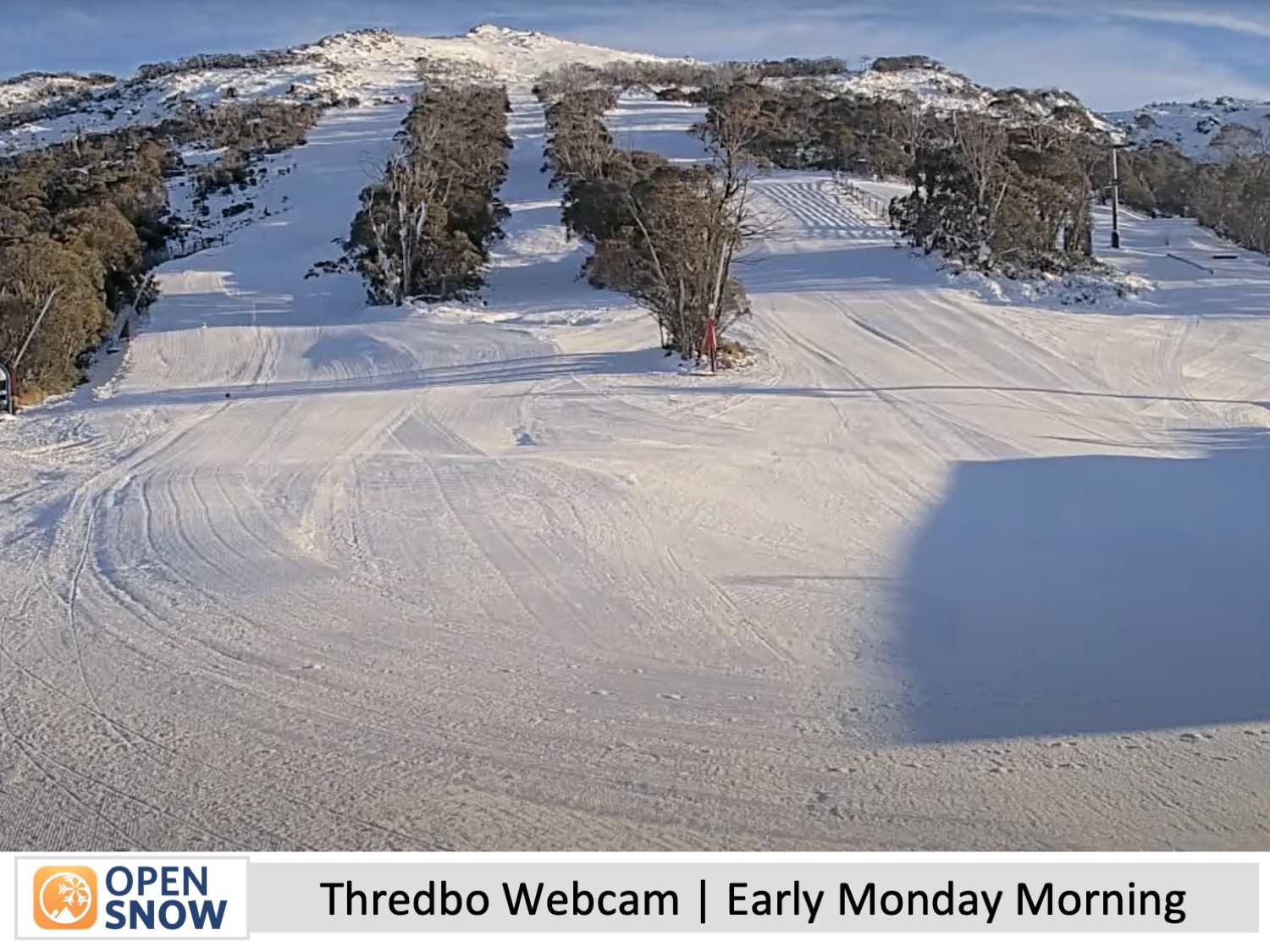
Forecast for Monday (24th June)
Monday will be a very spring-like day as the ridge of high pressure drifts away to the east. The day will start clear, crisp and firm, before warming and softening as northwest winds develop and high cloud increases.
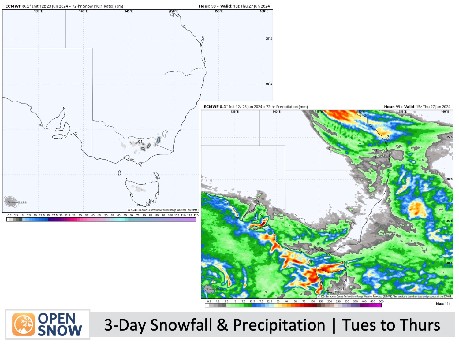
Forecast for Tuesday to Thursday (25th to 27th June)
A storm system drifting eastwards over the Southern Ocean will bring chilly, moderate-strong northwest winds and light snowfalls to the Australian Alps during this time. The snow will mostly fall over Victoria on Tuesday, becoming more widespread on Wednesday before easing late Thursday.
Around 5-10cm should accumulate above 1400m, although snow will likely fall to 1300m at times, and up to 15cm is possible about the high terrain. Wind chill and restricted visibility will be a factor, so come prepared and you'll score some fresh chalk.
Forecast for Friday (28th June)
A weak ridge passes over the Australian Alps, but fresh west-to-northwest winds will continue to push in a bit of cloud and the odd light flurry. Despite not being a perfectly blue-bird day, there'll be fresh snow from the previous days lying around waiting to be shredded.
Extended Forecast
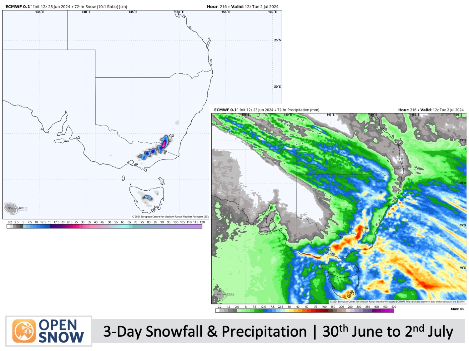
It looks like the upcoming weekend and the start of the new month will bring a significant snow event. The action begins on Sunday, June 30th, following a rain front on Saturday night. Expect considerable snowfall to continue into Monday, July 1st, then gradually diminish on Tuesday, July 2nd. This promising and timely snowfall will take the season up a few notches, allowing more terrain and lifts to open, with off-piste areas potentially opening up too.
Thanks for reading. I'll keep these forecasts coming every Monday, Wednesday & Friday throughout the southern hemisphere season.
Mike O'Connor
About Our Forecaster


