South America Daily Snow

By Luke Stone, Forecaster Posted 2 years ago June 9, 2023
Final Wave of Snow on Friday Before A ~ Week-Long Break
Summary
We have one more round of snow on tap for today (Friday), as the final storm in this series traverses the Andes. Snow will linger through Saturday morning before tapering off, ahead of an upper level ridge that will close the door to storms for the next week or so. Models are hinting at active weather returning around June 15th.
Short Term Forecast
Rain turned to snow during the day on Thursday, as I saw snow on many resort webcams when I checked around noon. Moderate to heavy rain fell prior to that, unfortunately. With high pressure settling in after this storm, chances for base building look slim the next 7 to 10 days. Let's hope the long range data trends to a wetter and snowier pattern with resorts planning to open later this month.
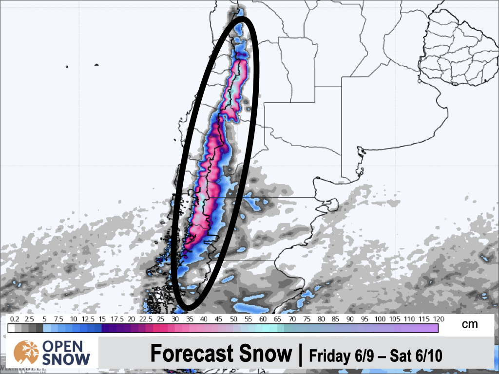
Forecast for Friday 6/9 - Saturday 6/10
Snow will continue Friday morning as the final upper level low comes onshore. This storm starts out colder than the previous two, due to Thursday's cold front, so expect mainly snow for this event. We will see moderate to heavy snow through midnight on Friday, before it becomes more showery overnight, and tapering off on Saturday. Temperatures will continue to drop on Friday, lowering snow levels and bringing snow to all elevations.
Not too much has changed as far as snow totals go, with 20 - 40 cms likely for many areas. Perhaps Antillanca, Corralco, Las Araucarias, Pucon, and Volcan Osorna could exceed 50 cms.
Below is the latest European forecast for total snowfall for this portion of the storm (including last night).
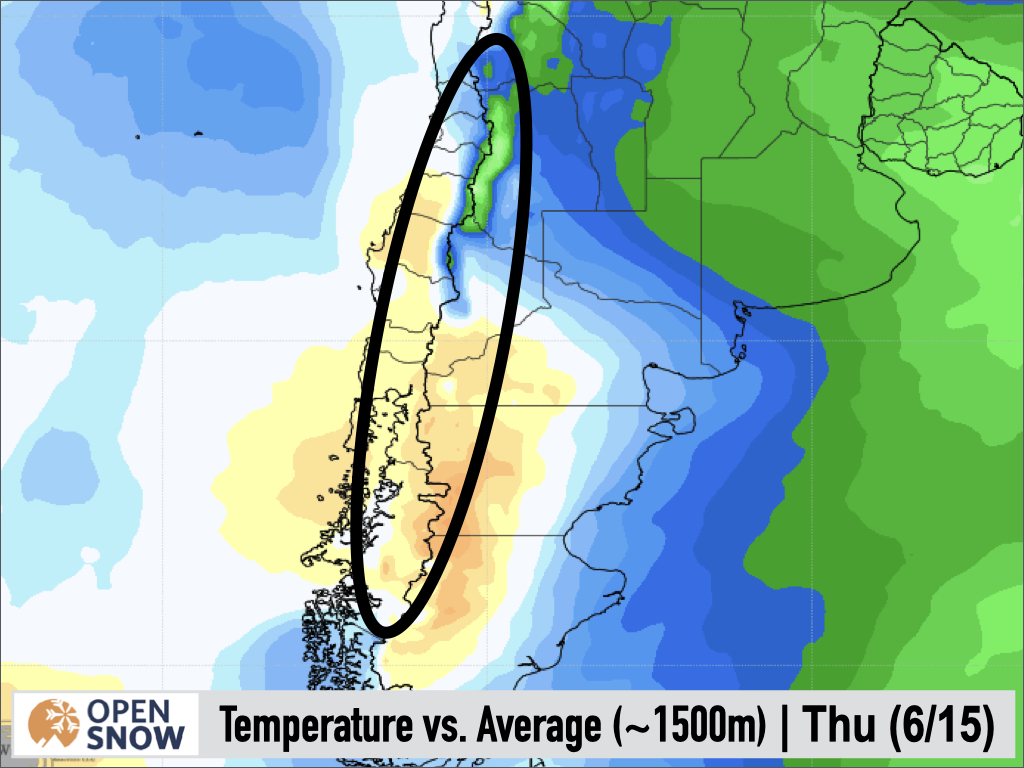
Forecast for Sunday 6/11 - Wednesday 6/14
A ridge of high pressure is expected to settle in for next week, closing the door to any storms. Temperatures should be slightly above normal in the southern part of the region, and slightly below normal in the north, as seen below. This map shows the temperature anomalies averaged for the five days ending Wednesday.
Extended Forecast
Outlook for Thursday 6/15 - Monday 6/19
Good news! The major models are showing storms returning to the Andes of Chile/Argentina around Wednesday night or Thursday. The models have this storm tracking pretty far south, which could limit impacts for the northernmost resorts. However, since this event is still more than a week away, there's still plenty of time for these smaller details to change.
Thanks for reading the South America daily snow! Follow me @lstone84 on Instagram to check out some new content I will be creating for the North American summer months. Let me know what you think.
About Our Forecaster


