South America Daily Snow

By Luke Stone, Forecaster Posted 2 years ago June 19, 2023
Showery Period Followed By Another Round of Warm Storms
Summary
The first part of the week will be cool and showery, with minor accumulations. On Wednesday, the first in a series of stronger but warm storms arrives, with rain and high elevation snow. The weather looks to remain active through the weekend and possibly into early next week as well. Keep reading for more details!
Short Term Forecast
Forecast for Monday 6/19 - Tuesday 6/20
On Monday and Tuesday, a few weak waves of moisture will impact the northern resorts in Chile and Argentina. It will be cold enough for mostly snow, with showers in the north Monday morning, central Monday afternoon, and back to the north Tuesday and Tuesday night. Expect up to 10 cms over the course of the two days.
Forecast for Wednesday 6/21 - Sunday 6/25
On Wednesday, the first stronger storm arrives, beginning as mostly snow across the region. Temperatures will begin to rise with the onset of precipitation though, quickly bringing snow levels above the base elevations of most resorts. Accumulations during this period will mainly be confined to the higher elevations of the northern resorts, which significant snow will fall. At places like Portillo, La Parva, and Valle Nevado, the upper elevations could see between 30 - 60 cms. El Colorado, Alto del Padre, and Los Puquios can expect 15 - 25 cms at upper elevations. Elsewhere, and especially the father south you move, expect just a few to 10 cms.
While these totals are certainly overdone due to the failure of the models to capture much of this snow falling as rain, the Canadian model shows where the highest upper elevation totals will likely be.

Extended Forecast
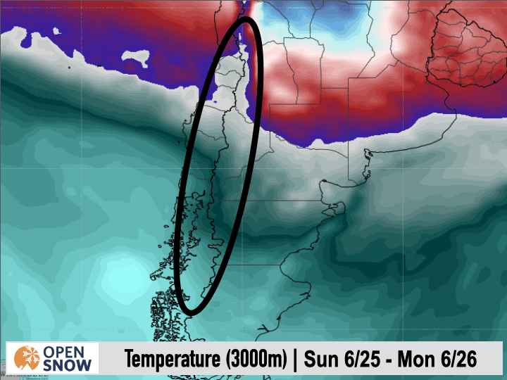
Outlook for Monday 6/26 - Friday 6/30
Similar to the last round of storms, the models show a final wave moving through early next week. Once again, this looks like the coldest in the series, with the potential to bring solid snow to the base elevations of most resorts. The models show a strong cold front arriving Sunday night, dropping snow levels, with snow continuing potentially through Tuesday morning. As always, I will have more details in this part of the storm cycle in my next post. In the GIF below, you can see the American model's latest depiction of the timing of the cold front.
Thanks for reading the South America daily snow! Follow me @lstone84 on Instagram to check out some new content I will be creating for the North American summer months. Let me know what you think.key
About Our Forecaster


