South America Daily Snow

By Luke Stone, Forecaster Posted 1 year ago May 31, 2024
Snow This Weekend, More Chances Next Week
Summary
A decent storm will bring accumulating snow Friday through Sunday, though temperatures will be on the warm side at the outset. After the cold front arrives there will be a period of moderate to heavy snow, especially in the southern half of the central zone. After a break early next week, we'll have more chances for snow midweek and potentially extend for the next week to ten days.
Short Term Forecast
The two major May storms have allowed many resorts to open up, and that trend continues this week. Valle Nevado is opening up today, May 31st, and will operate through the weekend. Portillo will be open for the first three weekends of June as well. Cerro Catedral will reopen for the season on June 7th. There have been so many early openings this season and we are loving it. We have more active weather ahead with additional chances for snow on the horizon.
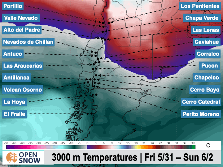
Our next storm gets underway today, Friday, as an upper-level area of low pressure moves into the southern part of the continent. The southerly track and the high pressure in place ahead of the storm will keep temperatures warm to start. We could see some rain during the day as snow levels range from 1500 m to 2100 m before the cold front moves through Friday night. In the GIF below, you can see the cold front moving into the Andes later this afternoon, and spreading north overnight.
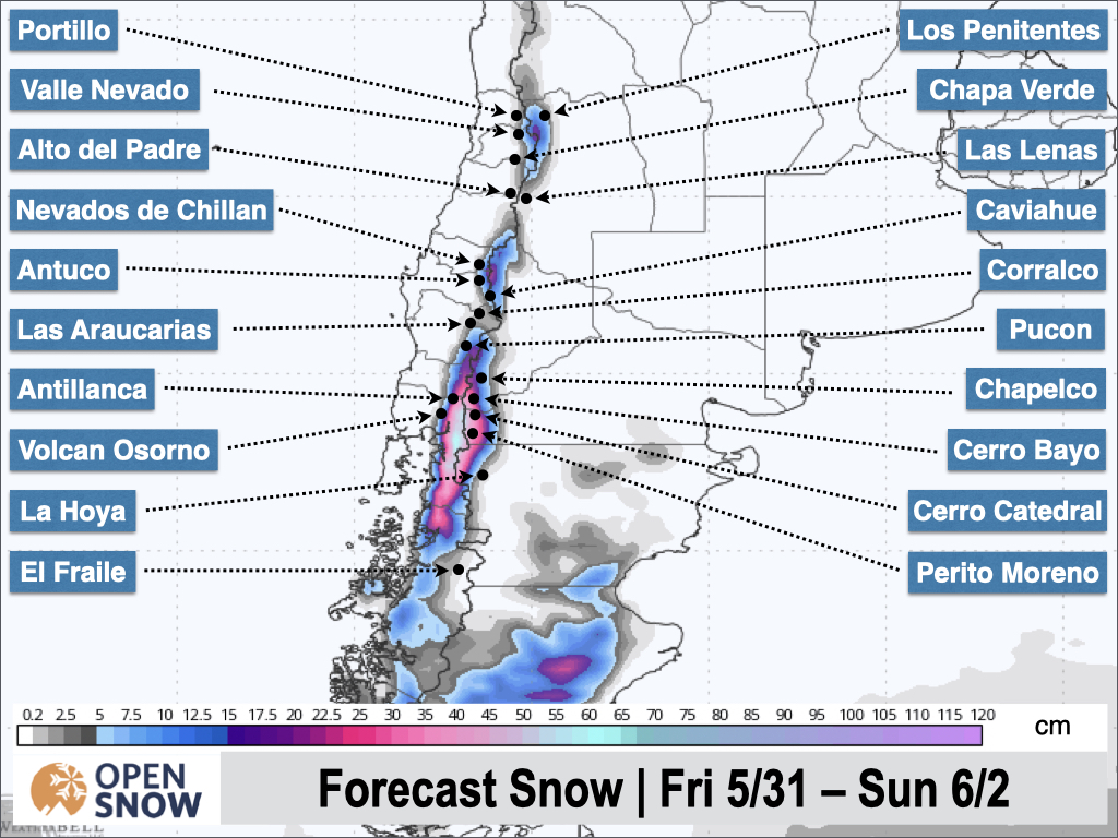
Rain at mid and lower elevations will transition to snow and will continue off and on through Sunday morning. Expect 10 - 20 cm in the southern half of the central zone by Sunday morning, though totals could be much less at lower elevations. In the northern part of the central zone as well as the northern zone, expect 5 - 15 cm over the weekend. The latest snow forecast from the American model is shown below.
The storm should wrap up Sunday morning and the early part of next week should be dry and considerably warmer.
Extended Forecast
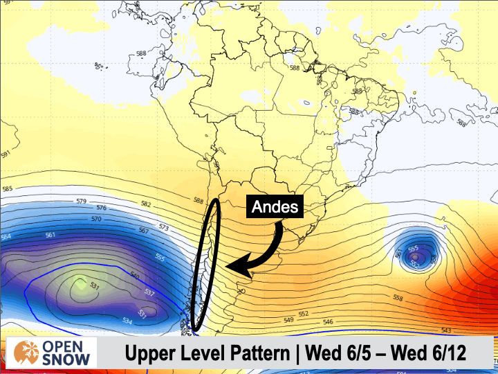
After a brief period of ridging next week, the models show an extended period of active weather. Check out the GIF below, where storms, represented by the blue colors, keep moving into the region through the middle of next week. The time period shown is from Wednesday the 5th through Wednesday the 12th.
Thanks for reading the South America Daily Snow!
Next update on Monday.
Luke Stone
Forecaster, OpenSnow
Announcements

About Our Forecaster


