News

By Joel Gratz, Founding Meteorologist Posted 9 years ago August 31, 2015
El Nino Part 3: How will El Nino impact snowfall for the 2015/2016 ski season?
Let’s look at a few long-range snow and weather forecasts for the upcoming 2015/16 winter.
Keep in mind that the forecasts I will show here were made in August of 2015, which means that these are 4-6 month forecasts. How accurate are forecasts for half a year in advance? In short, not very accurate. However, during a strong El Nino, these long-range forecasts can be more accurate than normal because the effects of El Nino are generally well understood (though there are no guarantees!).
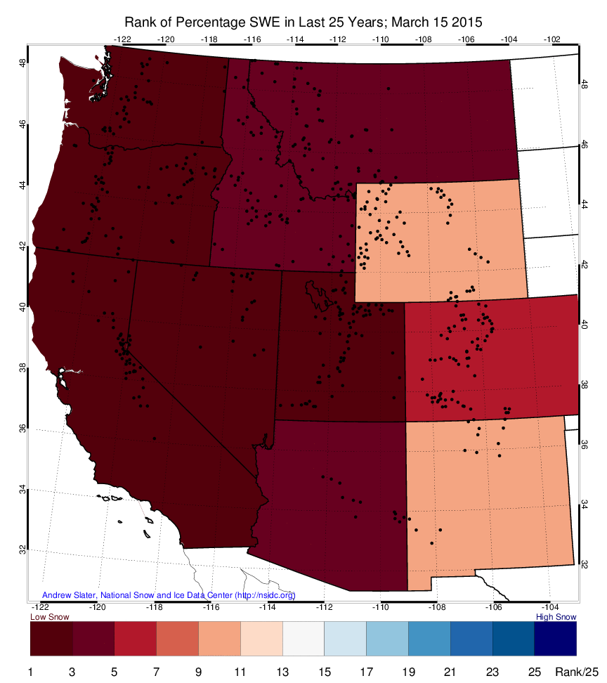
Before looking at the upcoming year, how was last season’s snowfall in the western US?
In short, it wasn’t very good. This image shows last season’s rank among the previous 25 winters. As of March 15, 2015, many western states experienced snowfall that was in the bottom five of the last 25 seasons.
Now let’s look at the forecast, and hope it's better than last season. First, the forecast from NOAA.
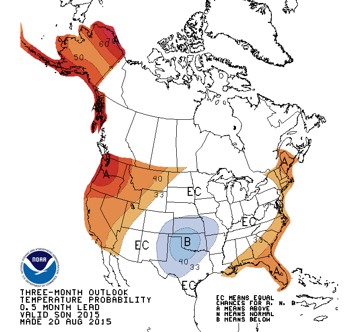
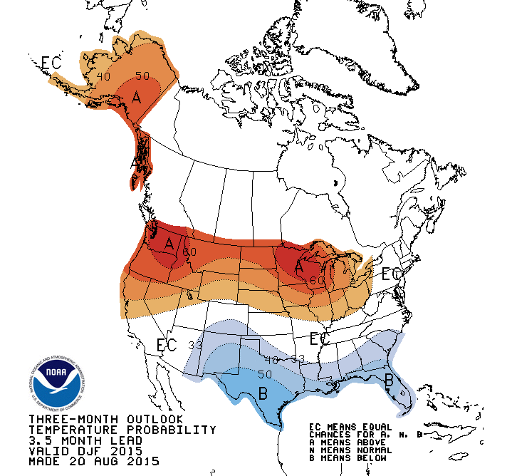
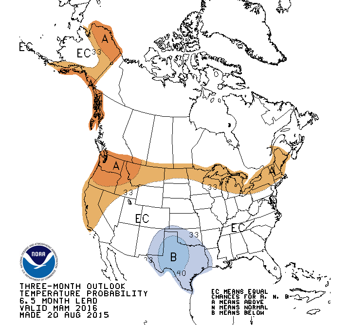
The scientists at NOAA (the US government agency that measures and forecasts environmental conditions) look at many forecasts and historical weather patterns to arrive at their long-range winter forecast. Here is the forecast separated by season (fall, winter, spring), and variable (temperature, precipitation).
Temperatures during Fall: September, October, November.
Temperatures during Winter: December, January, February.
Temperatures during Spring: March, April, May.
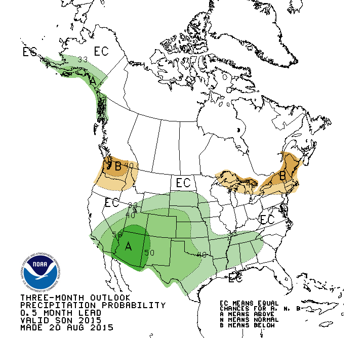
Precipitation during Fall: September, October, November.
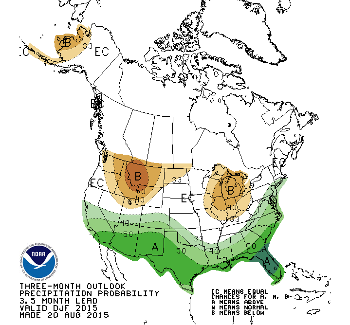
Precipitation during Winter: December, January, February.
Precipitation during Spring: March, April, May.
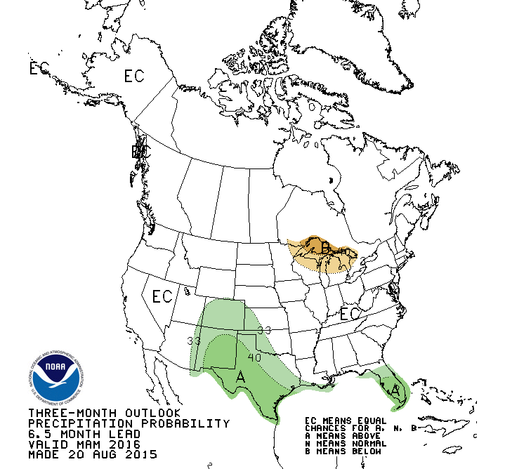
This NOAA forecast shows the typical weather we would expect during an El Nino winter, with stormy conditions in the southern US (more precipitation and cooler temperatures) and less stormy across the north (less precipitation and warmer temperatures).
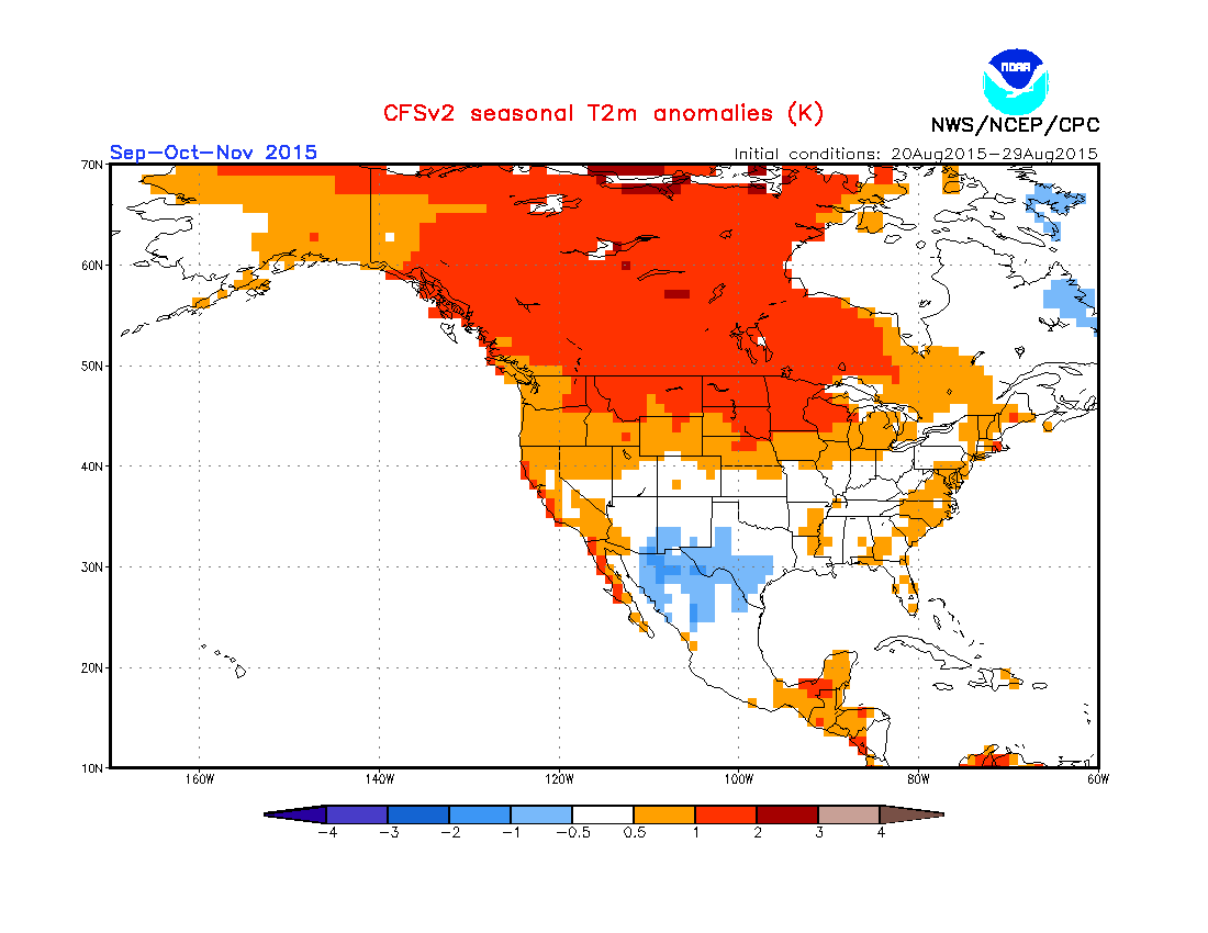
How about the forecast from the CFSv2 long-range model?
This is just one long-range model, and it is NOT my go-to choice. I am only showing this model because it’s fun to look at a variety of models. In general I do NOT trust the CFSv2.
Temperatures during Fall: September, October, November.
Temperatures during Winter: December, January, February.
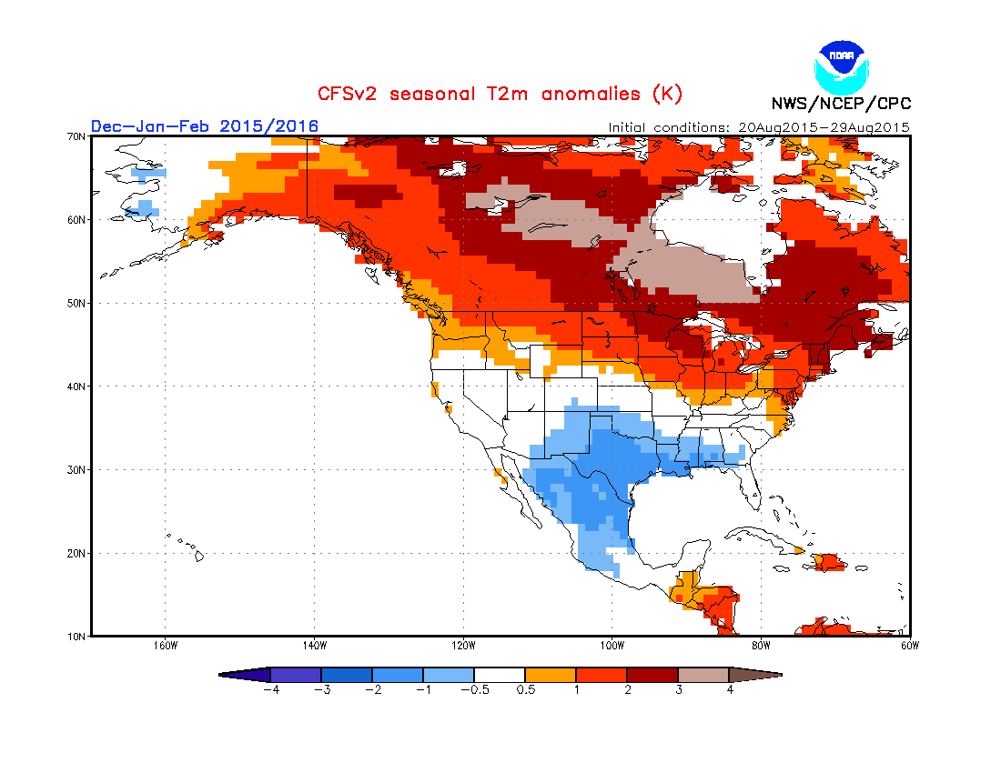
Temperatures during Spring: February, March, April.
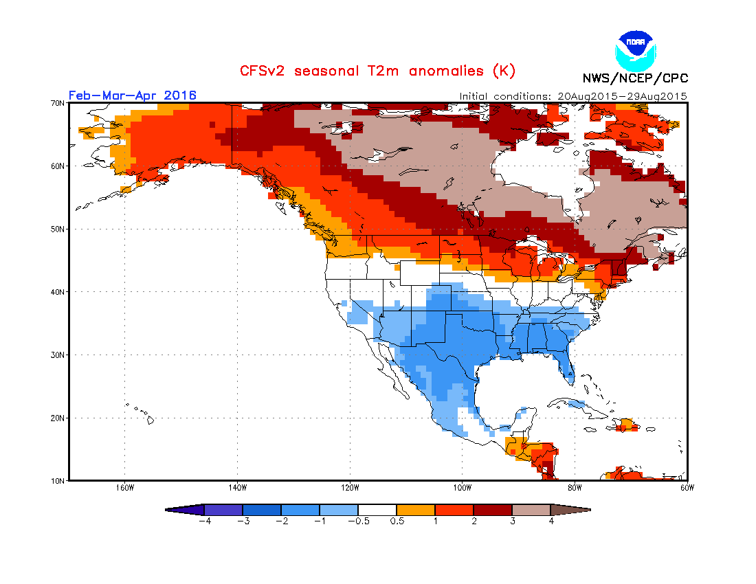
Precipitation during Fall: September, October, November.
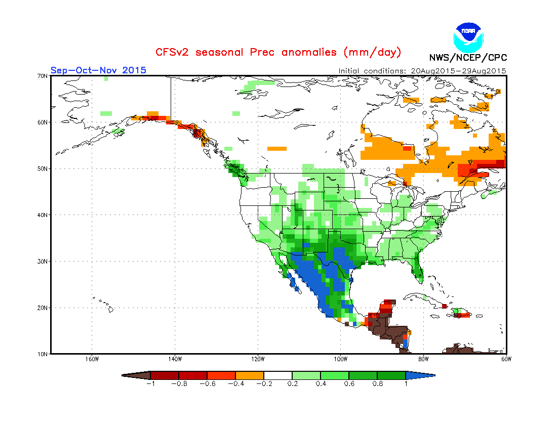
Precipitation during Winter: December, January, February.
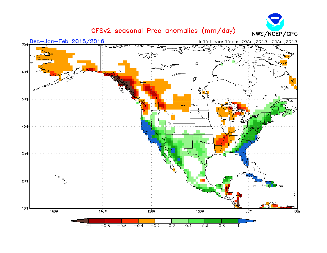
Precipitation during Spring: February, March, April.
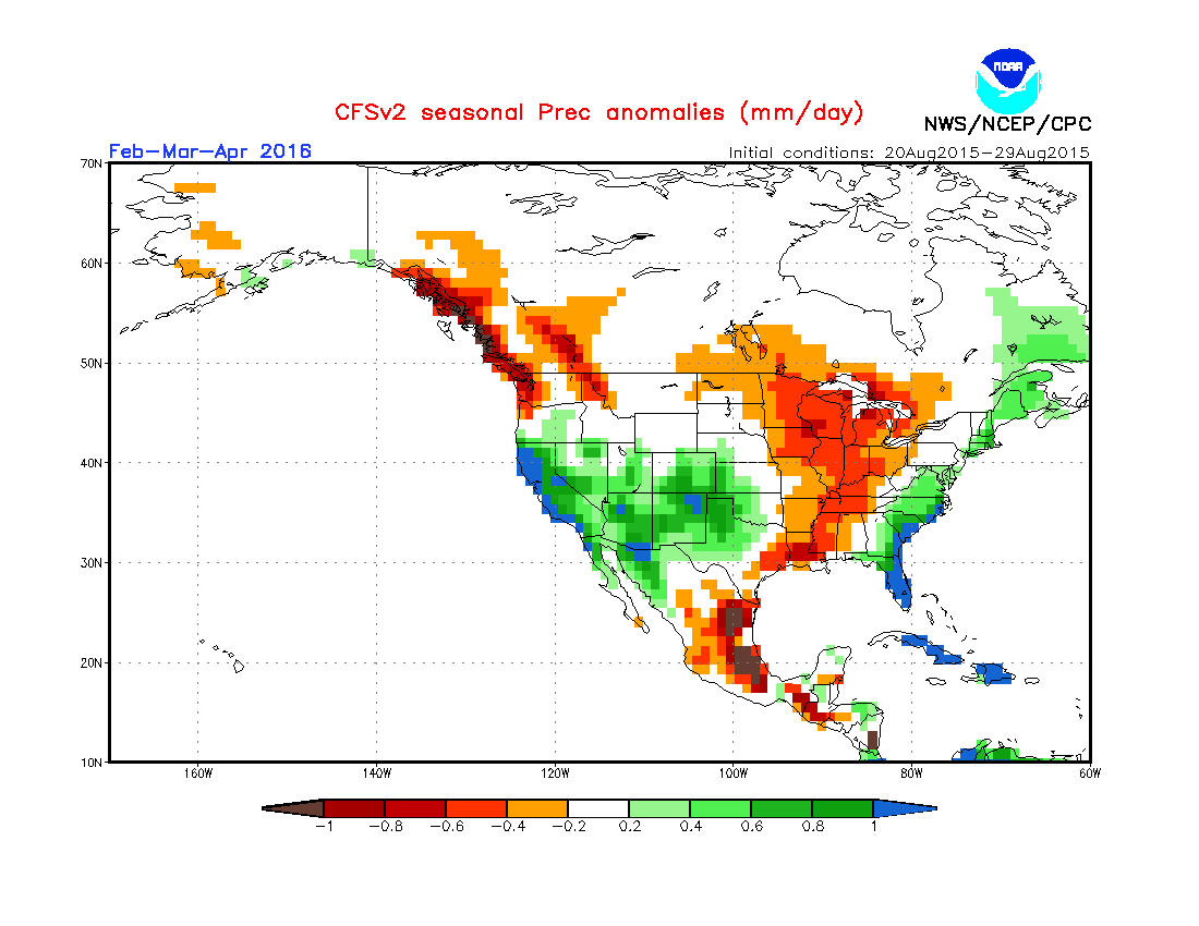
The CFSv2 is showing a similar story as the NOAA forecast. There are a few subtle changes from season-to-season, as I notice the model forecasting solid spring precipitation across the southwestern US extending into Colorado, and also good precipitation along the northwest coast during the fall.
We should not peg our hopes or doubts on only one model, and we definitely should not play favorites with the CFSv2 model. But it is fun to see the similarities and differences between this forecast and the NOAA forecast.
Now, a more reliable model, the Japanese JAMSTEC.
Unlike the CFSv2 that I showed above, I do hold the Japanese JAMSTEC model in high regard. Is it perfect? No. No model is perfect. Should we trust one model? Absolutely not! But, the JAMSTEC does seem to be more accurate and more consistent, more often, than the American CFSv2 model.
The graphics below are worldwide, so you’ll need to squint to see the details for North America. I did not crop the images because I think it’s useful to see the global perspective.
Temperatures during Fall: September, October, November.
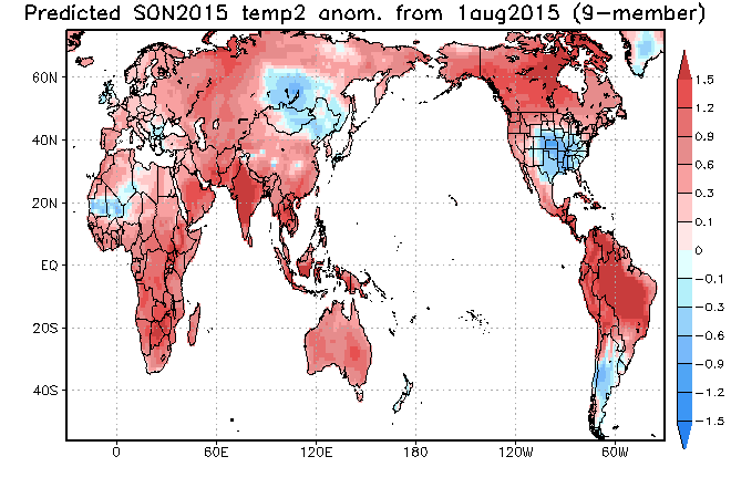
Temperatures during Winter: December, January, February.
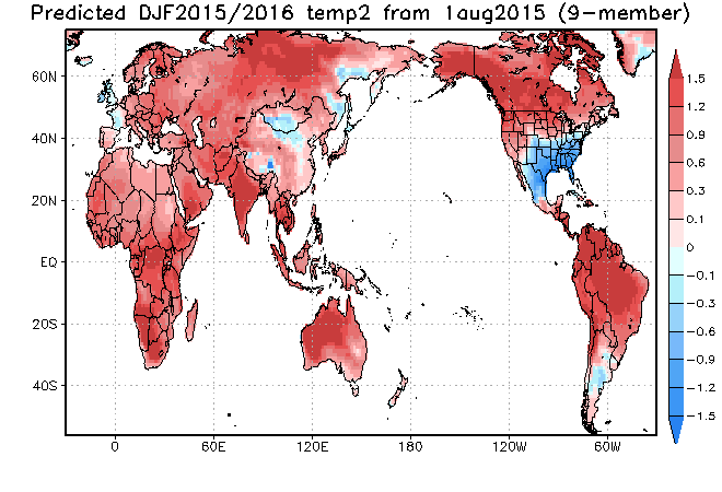
Temperatures during Spring: March, April, May.
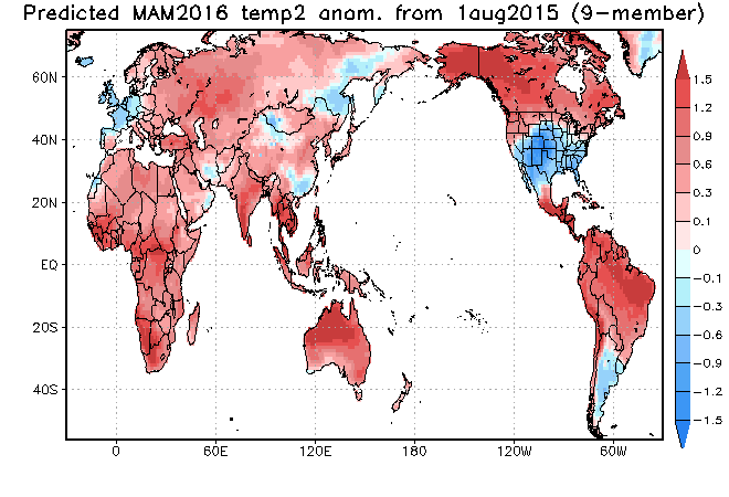
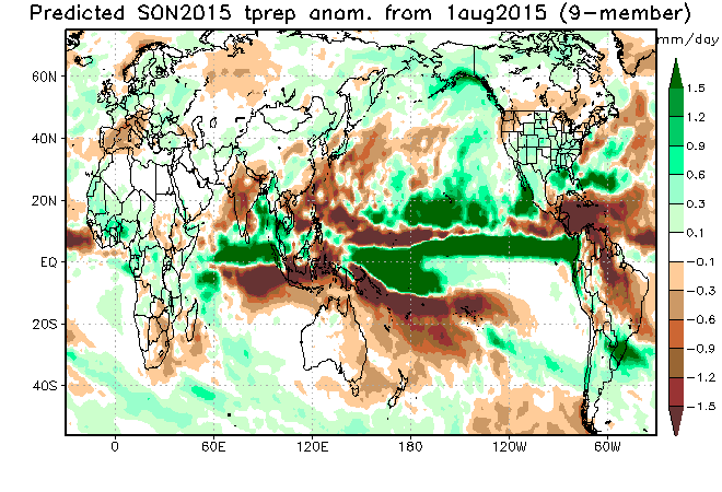
Precipitation during Fall: September, October, November.
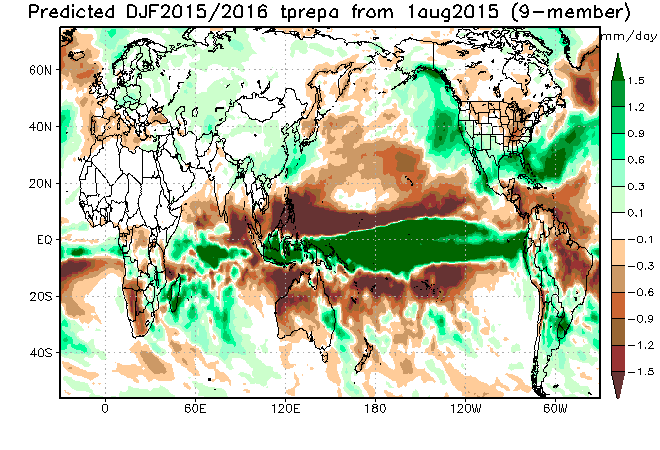
Precipitation during Winter: December, January, February.
Precipitation during Spring: March, April, May.
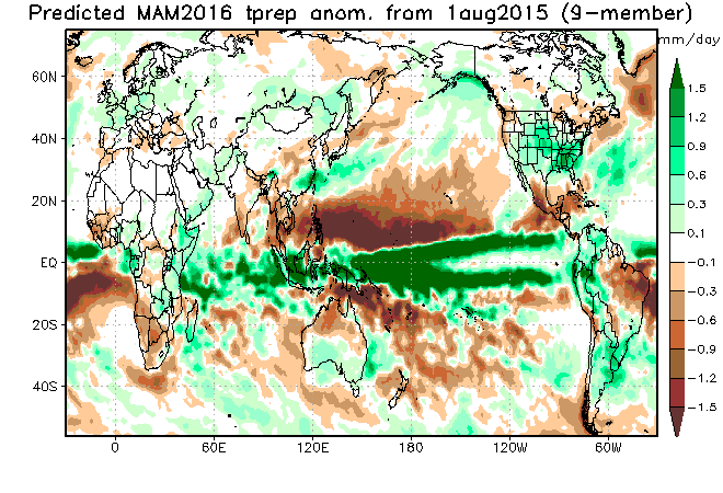
What stands out to me about the JAMSTEC is the above-average precipitation along the northwestern Canadian coast and into Alaska, healthy precipitation around Tahoe during the middle of winter and a signal toward more precipitation in the spring for the northern and central Rockies.
And finally the NMME, a collection of many models.
The NMME stands for the North American Multi-Model Ensemble. Like the word “ensemble” suggests, this model is actually a collection of multiple models.
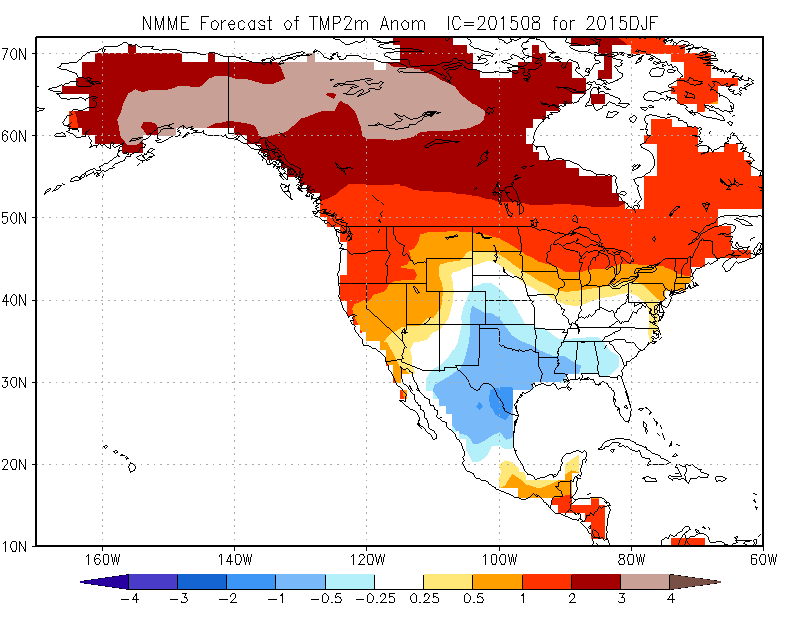
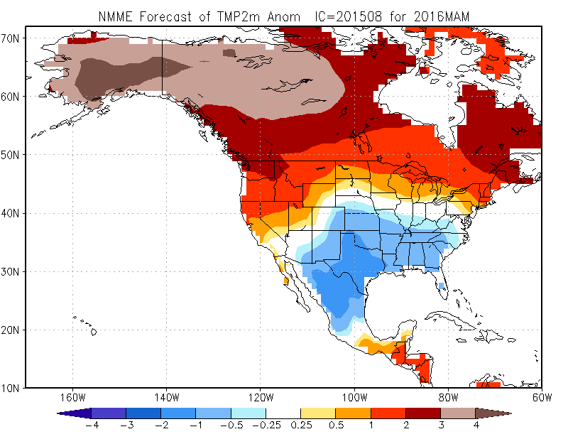
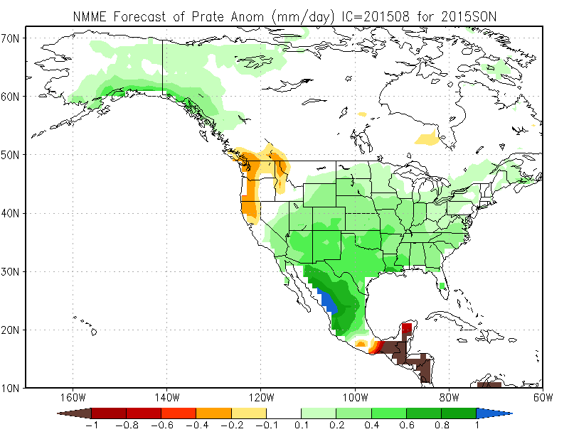
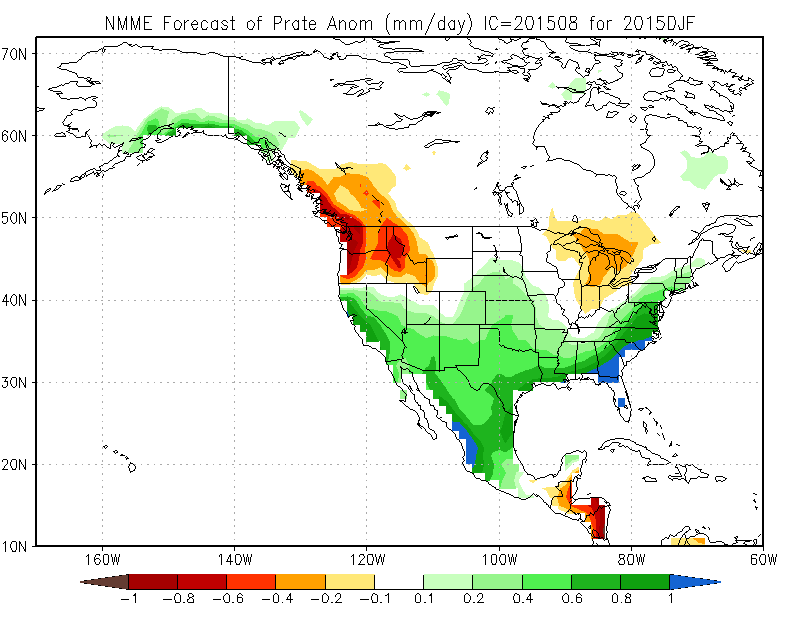
Here are the precipitation forecasts for fall, winter, and spring.
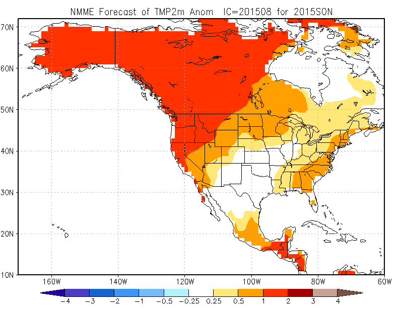
Temperatures during Fall: September, October, November.
Temperatures during Winter: December, January, February.
Temperatures during Spring: March, April, May.
Precipitation during Fall: September, October, November.
Precipitation during Winter: December, January, February.
Precipitation during Spring: March, April, May.
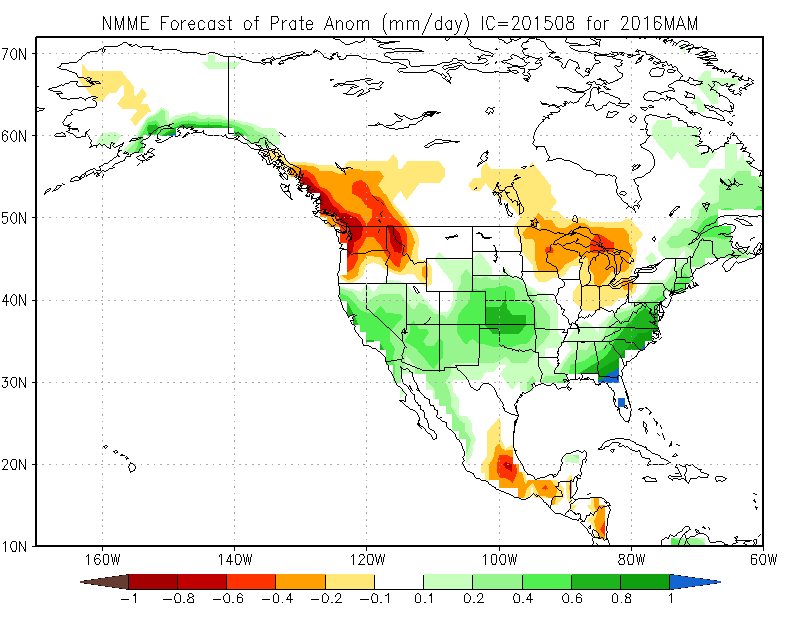
The NMME looks similar to most of the other models...
Summary
My main takeaway from these forecasts is to expect more precipitation in the south and less in the interior of the North American Rockies and into the Northwest.
That generalization is useful because it would point you toward Southern California, Arizona, and New Mexico as the US regions that will most likely see above-average precipitation. Also, note that temperatures are forecasted to be near or above average for many areas along the west coast and into the northwest, which could lead to higher snow levels and more rain at low and mid elevations.
Sweeping generalizations aside, there are subtle differences in the models when it comes to precipitation in Tahoe, along the coast of Washington, British Columbia, and Alaska, and also seasonality, where some months are drier while others are snowier. You could look at these maps for many minutes (hours?!) and discover nuances that you initially missed.
The many maps in this article can lead to information overload. So the quick, quick summary is that most models show above average precipitation in the southwestern US while the northern Rockies of the US and Canada may see below average snowfall. For all other locations, the forecast is tough to pin down.
Caveats
In much of the western US and Canada, about 10% of the storms produce half of the winter’s snowfall.
This means that just a few big storms are responsible for the majority of snow, so the absence or addition of just one or two storms can change the outcome of the winter when it comes to snow totals and the quality of ski conditions.
When you think about it this way, the enjoyment of speculating about the long range forecast is tempered by the problem that these same long-range forecasts cannot pinpoint the timing or location of the big storms or the stormiest periods. If you want to hit a powder day, you’ll need to keep track of each storm as it rolls through your region.
Previous articles
If this is the first El Nino story you read about the 2015/16 winter, take a moment to go back to the first article which talks about the basics of El Nino, and the second article which discusses how much snow fell during previous winters with a strong El Nino.
Next article
All of the graphics I showed above do not specifically forecast snowfall (only temperature and precipitation, which is rain + snow). Here at Opensnow, we’re working hard at creating long-range snow forecasts for each ski area across the US, and we hope to share these forecasts with you soon. These long-range snow forecasts won't guarantee you a powder day, but they will allow you to see which mountains have higher odds of seeing the most powder. If you want us to email you when we post our long-range winter snow forecast for each ski area, sign up for our newsletter here.
Thanks for reading!
JOEL GRATZ
About The Author


