South America Daily Snow

By Luke Stone, Forecaster Posted 2 years ago June 26, 2023
Heavy Snow Shifts South, Significant Snow Inbound
Summary
With the first storm that favored the northern mountains out of the way, we can now focus on the next significant snow producer for the central resorts. We'll have a break for the rest of the week with all eyes shifting to early next week, when another deep storm is possible.
Short Term Forecast
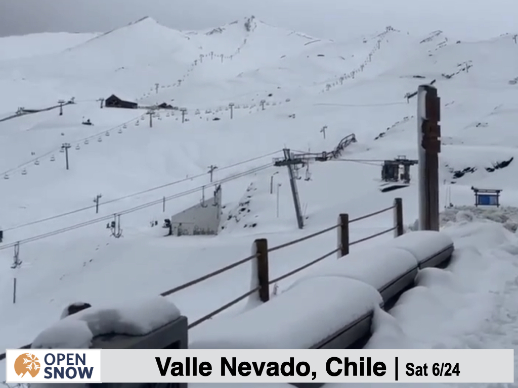
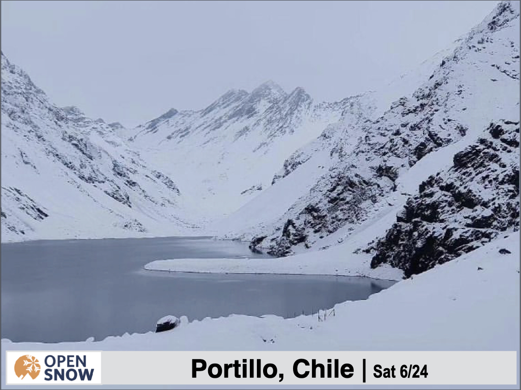
The first delivered for the northern resorts, with Portillo and Valle Nevado doing ver well. I saw reports of over 70 cms at Portillo, who is know reporting a 45 cm base down low and 75 cm base at mid elevations. Meanwhile, at Valle Nevado, around 50 cms fell at lower elevations. Check out some shots from the last few days.


Farther south, resorts didn't fare so well, with mainly rain falling throughout this storm. Some resorts have had to push back their opening day due to a lack of snow. Hopefully the next storm, and also the potential system next week, will turn things around.
Forecast for Monday 6/26 - Tuesday 6/27
Snow is already underway for the central and southern resorts, with snow levels below the bases. The main difference for this storm in the latest models as an This is the first storm this season with below normal temperatures. Moderate snow will continue through the day on Monday, becoming heavy in the evening. Snow showers will linger though the day on Tuesday as well. Temps will drop further with a cold front pushing through Monday afternoon/evening.
All in all, this should be a very productive storm for the Chilean resorts, Nevados de Chillan through Volcan Orso, and especially Corralco, Las Araucarias, Pucon, Antillanca, and Volcan Osorno. Here, 50 - 100+ cms are possible, with 20 - 50 cms elsewhere. Farther north this storm won't be as impactful, with only 2 - 8 cms expected. For the central Argentinian resorts, expect 10 - 20 cms, including Chapelco, Cerro Bayo, and Cerro Catedral.
Below is the snowfall forecast for the next two days from the European model.
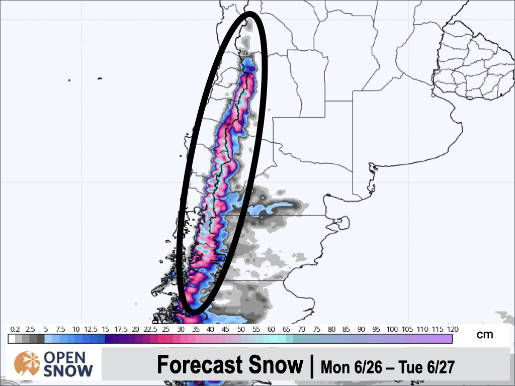
Winds will be very strong with this storm, with gusts over 45 km/hr at upper elevations, and between 25 - 45 km/hr lower down. Winds remain strong through Tuesday, so expect this snow to be fairly wind affected.
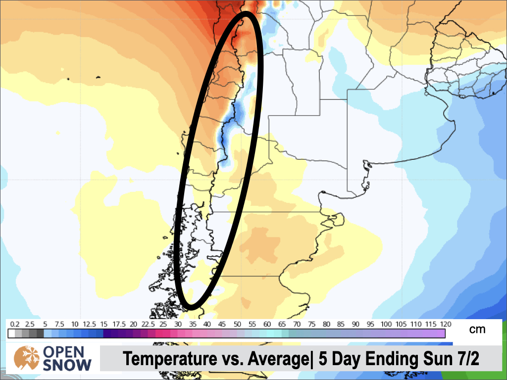
Forecast for Wednesday 6/28 - Sunday 7/2
Wednesday through Sunday will be mainly dry, with only some showers possible for the central and southern resorts on Thursday. Overall, temperatures will rise and be above normal during this time. Below is the temperature anomaly for the fire days ending on Sunday 7/2.
Extended Forecast
Outlook for Monday 7/3 - Friday 7/7
The models have come into better agreement for this period. Whereas just a few days ago the timing and strength of an offshore storm was handled quite differently across the models, now all models agree on the arrival of a strong storm Sunday night. There are still some discrepancies on just HOW strong this storm will be as well as the exact timing, but all models show the storm starting out warm with a strong cold front arriving pretty quickly. Some models have this all getting started as early as Sunday afternoon. I will provide. more details on this potential storm on Wednesday.
Thanks for reading the South America daily snow! Follow me @lstone84 on Instagram to check out some new content I will be creating for the North American summer months.
About Our Forecaster


