South America Daily Snow

By Luke Stone, Forecaster Posted 2 years ago June 28, 2023
Big Storm Wraps Up, All Eyes On the Weekend
Summary
Central Chilean/Argentinian resorts received heavy snowfall over the last few days, and much more is possible starting this weekend. We will dry out for a few days before the next storm arrives on Sunday. This looks to be the first in another series of storms potentially lasting through the entire week.
Short Term Forecast
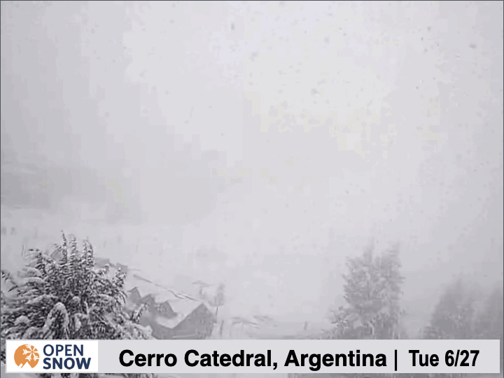
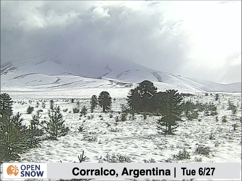
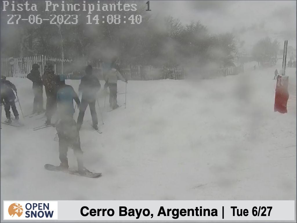
Looking at the webcams yesterday, it was great to see it dumping at several resorts. Check out some of the action below. Most resorts still aren't reporting, but it looked deep at Cerro Catedral, Corralco, Antillanca, and Chepalco.
Dumping at Cerro Catedral yesterday, Tuesday 6/27.
Some skiers and boarders out at Cerro Bayo yesterday while it was dumping.
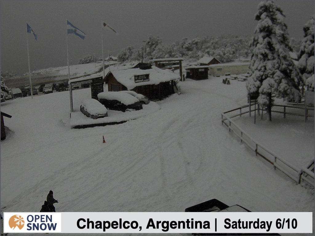
Some buried cars at the base of Chapelco.
Opening day for Valle Nevado is today, and the recent storm over the weekend definitely helped.
Forecast for Wednesday 6/28 - Saturday 7/1
We will have a bit of a break before the next storm arrives over the weekend. Outside of a few snow showers in the central and southern mountains on Thursday, it will be mainly warm and dry during this period.
Forecast for Sunday 7/2 - Monday 7/3
The first in the next series of storms should arrives Saturday night, bringing precipitation to the resorts beginning on Sunday morning. Check out the upper level pattern below starting on Saturday.
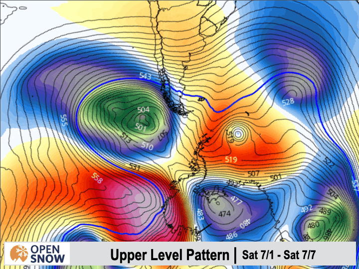
You can see several storms, indicated by the blue colors, coming one after another through South America over the next week. Very excited for this active weather to continue.
Snow levels will be high as the first storm arrives, but should lower throughout the day on Sunday. This storm will favor the central and southern resorts once again, with minimal impacts farther north. Early indications for this first storm put it in the 20 - 50 cm range for the central resorts, like Corralco, Carro Bayo, Pucon, Chapelco, and Cerro Catedral, with around 10 - 20 cms for Nevados de Chillan, Antillanca, and Perito Morena. Further north/south, snow totals will be minor. Snow should taper off Monday afternoon/night.
Forecast for Tuesday 7/4 - Friday 7/7
As has been the case many times so far this year, the next storm will be right on the heels of the first. Snow will develop in the Tuesday morning timeframe, continue heavily through Thursday, and linger through Friday possibly. This is shaping up to be a stronger event, with more significant totals spread over a larger area as well, as two waves of snow will slam the Andes back to back.
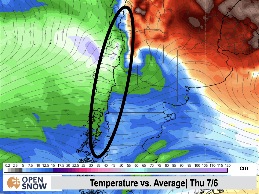
The central resorts could easily see 50 - 100+ cms from this storm, as it will feature some of the coldest air of the season and low snow levels. Northern resorts will see much less, but still respectable totals in the 20 - 40 cm range.
Check out the northern extend of the the cold air below, with this map showing well below normal temperatures.
It's a bit early to put too much confidence in these totals, and I will refine them a bit on Friday and more so next week.
Extended Forecast
Outlook for Saturday 7/8 - Wednesday 7/12
Beyond the middle of next week, the models show things drying out a bit. There is a small bit of hope for more storms, as one model keeps the pattern active. I will have an update on the long range in the next post.
Thanks for reading the South America daily snow! Follow me @lstone84 on Instagram to check out some new content I will be creating for the North American summer months.
About Our Forecaster


