South America Daily Snow

By Luke Stone, Forecaster Posted 2 years ago July 5, 2023
Dumping Across the Andes with More On the Way!
Summary
Heavy snow has been falling since Monday and it’s still coming down across the Andes. This storm will linger through Thursday, followed by more action later in the week.
Short Term Forecast
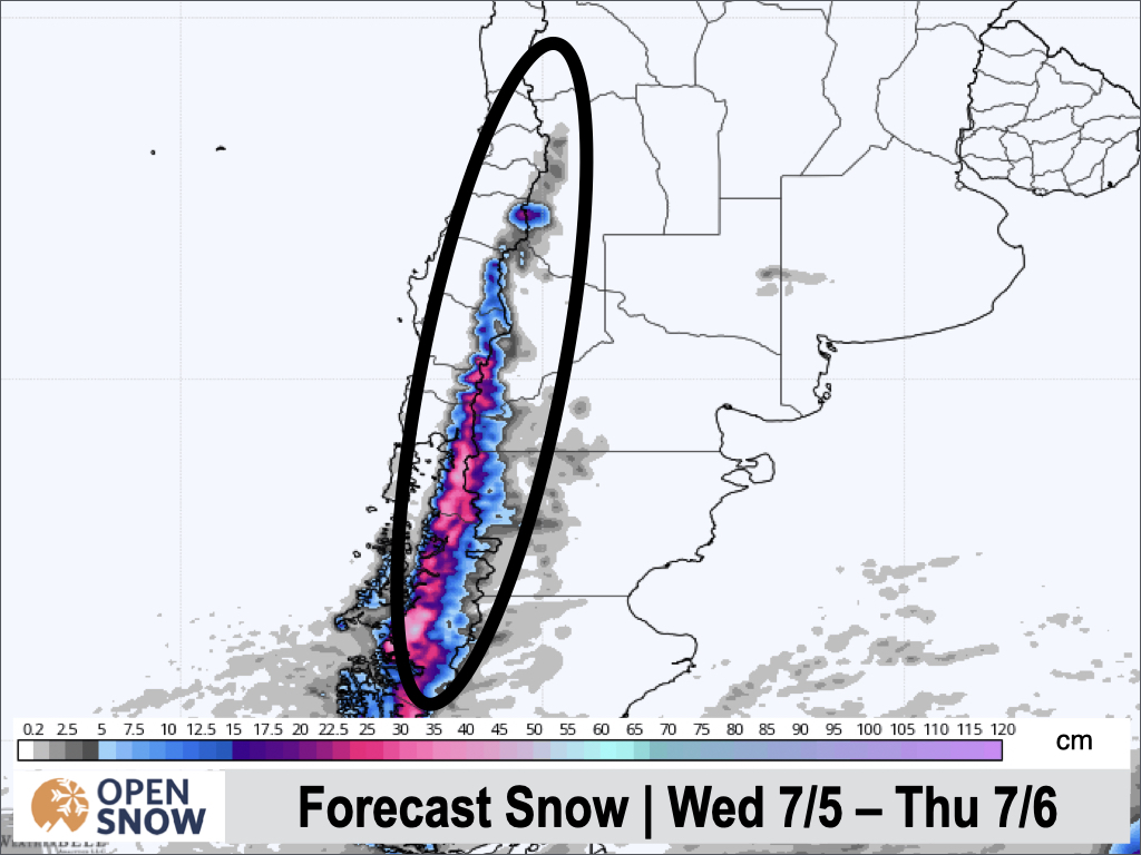
Forecast for Wednesday 7/7 - Thursday 7/8
Heavy snow will continue throughout the day today (Wednesday), with significant accumulations. Temperatures are cold enough for snow down to resort bases, but still this is not an especially cold storm. Snow depths are still low though, so this will be a welcome base building snow for middle and lower elevations. Snow will become more showery Wednesday night and continue through much of the day Thursday as well.
Expect an additional 20 - 50 cms for Nevados de Chillan, Corralco, Pucon, Antillanca, Las Araucarias, Volcan Osorno, and Cerro Bayo. For Antuco, Cerro Catedral, Caviahue, Chapelco, and Perita Moreno, another 10 - 20 cms is likely. Everywhere else, <10 cms of additional snow is expected through Thursday.
Below is the snow forecast from the European model for Wednesday and Thursday.
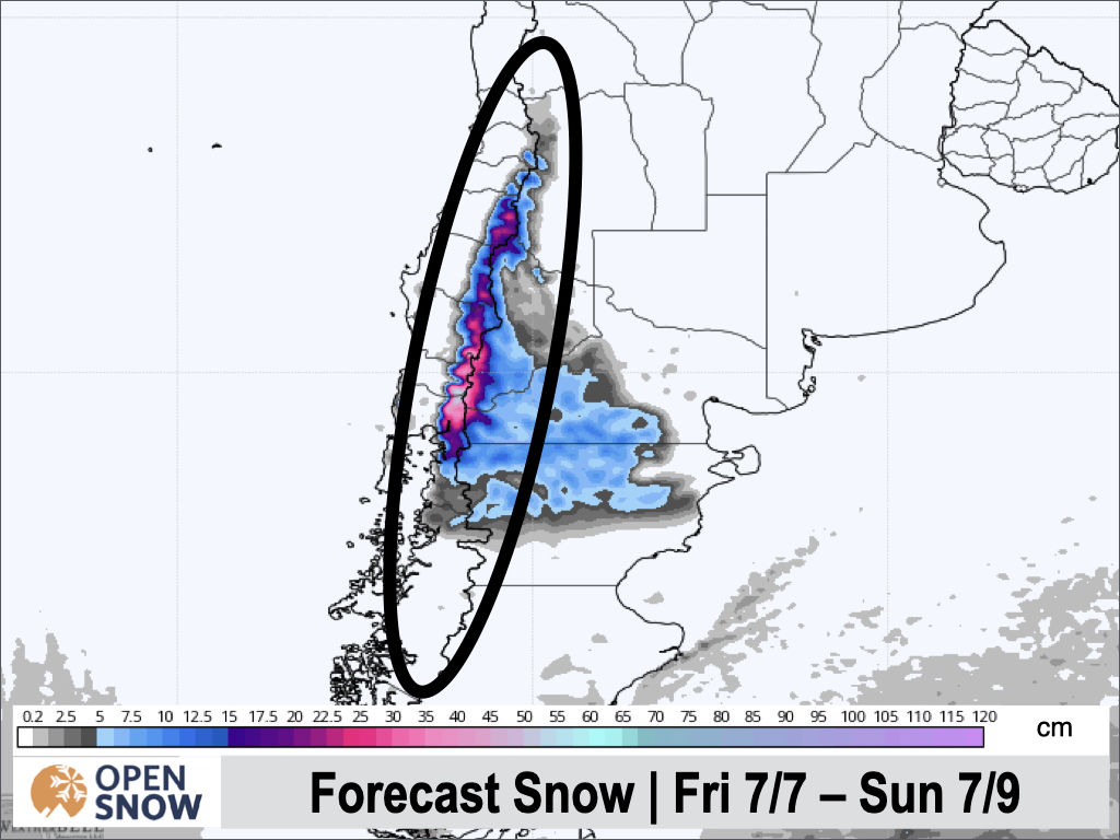
Forecast for Friday 7/9 - Sunday 7/11
Friday will briefly dry out, in between storms. This will be short lived though, as the next wave arrives Friday night. This round of snow won't be as significant, but another solid dump on what is currently falling is more than welcome. Again, this storm will focus on the central resorts, with not much action reaching the northern resorts.
On the high end, central Chilean resorts like Pucon, Antillanca, Las Araucarias, Volcan Osorno, Nevados de Chillan and Corralco could see another 15 - 30+ cms. The heaviest precipitation will likely stay over Chile, with only light snow reaching Argentina, resulting in only 5 - 15 cms.
Below is the snow forecast from the European model for this period.
Extended Forecast
Outlook for Monday 7/12 - Friday 7/16
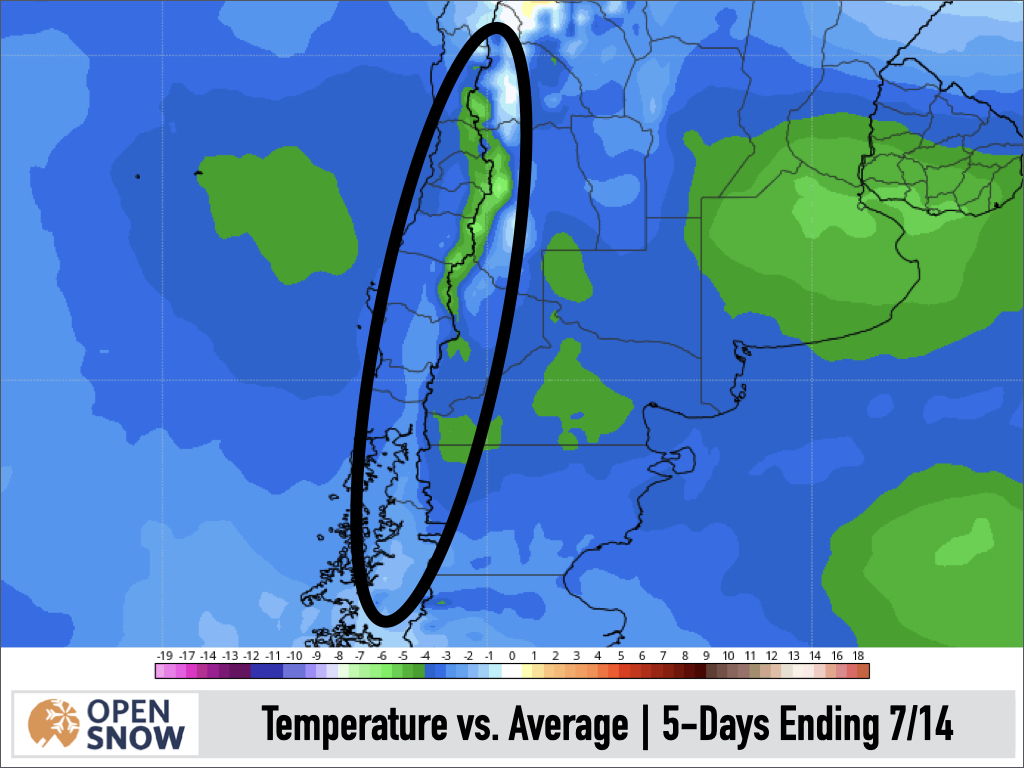
Next week, we have the chance for some light snow during the early part of the week, on Monday and Tuesday. Northern resorts will likely benefit most from this storm, with potentially some solid totals. Later in the week, starting on Thursday, chances increase for another large storm. Overall, temperatures look colder than average during this period, so any snow that does fall should be of a lighter density than most of what's fallen to date.
You can see the below average temps in the map below, which shows the departure from normal for the five day period ending Friday 7/7.
I will have more on next week's storms on Friday's post!
Thanks for reading the South America daily snow! Follow me @lstone84 on Instagram to check out some new content I will be creating for the North American summer months.
About Our Forecaster


