South America Daily Snow

By Luke Stone, Forecaster Posted 1 year ago July 28, 2023
Warm Storms with High Snow Levels On Tap for The Weekend and Next Week
Summary
The next seven days will feature two warm storms that will unfortunately bring rain to the central and southern resorts. The northern resorts will be spared but a significant amount of rain is likely elsewhere. There is a chance for some snow at the tail end of each storm, especially the second, but right now these amounts look minor.
Short Term Forecast
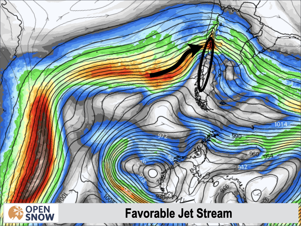
Unfortunately the jet stream will set up an unfavorable pattern during the next week. Ideally, we want the jet stream to dip down from the south, bringing cold polar southwest winds with it, as seen below.
For the next week, we will see a jet stream that is sagging north towards the equator, which will bring in warm air in a more north westerly flow pattern. You can see the jet stream on Sunday below.
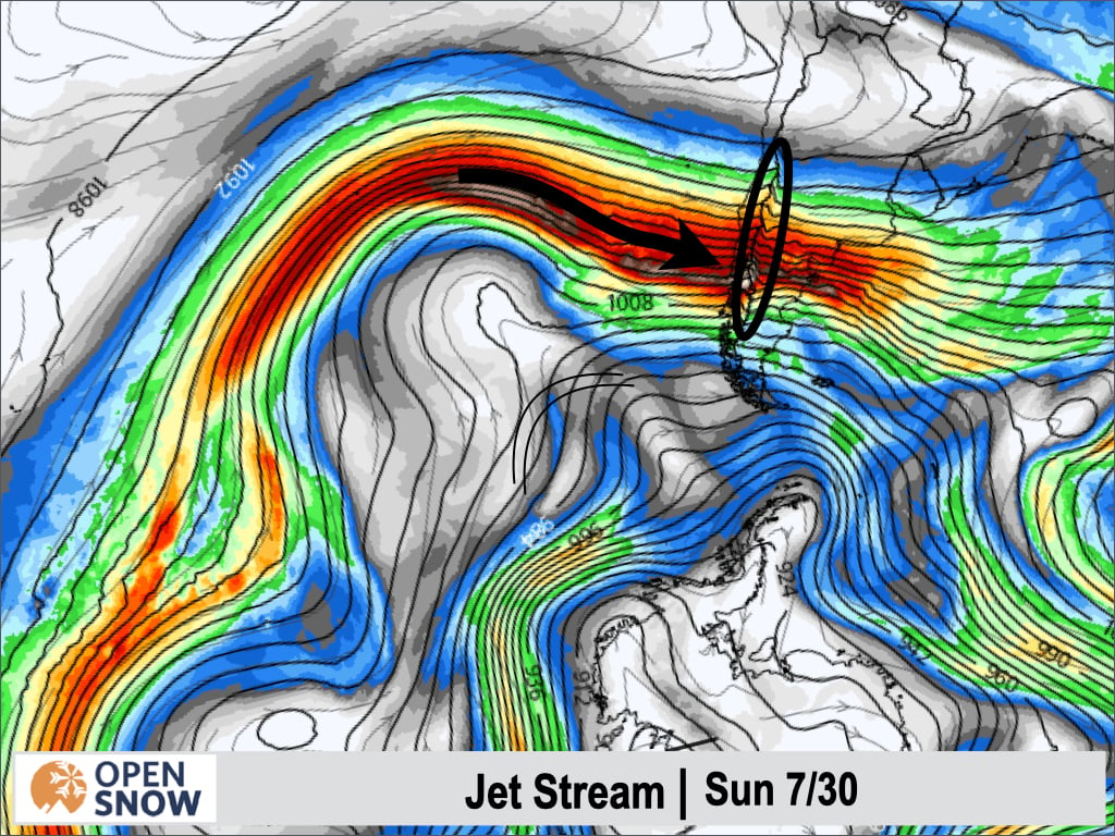
In this pattern, warm air will infiltrate the region. While the jet stream remains the same, further reinforcements of warm air will arrive. Slight dips in the jet stream will allow minor cooling, but temperatures will warm even more as this pattern endures.
These storms have a strong moisture source as well. You can see the moisture tap extending from the tropics to South America in the image below.
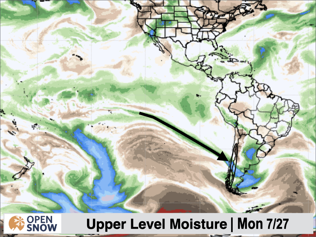
This combination of the jet stream and tropical moisture will result in a warm and wet pattern.
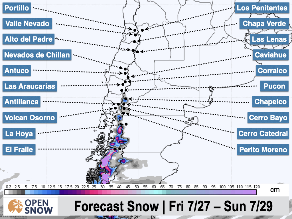
Forecast for Friday 7/27 - Sunday 7/29
Rain is already underway in the southern region, and it will spread north throughout the day. The heaviest rain will fall during the day on Friday into Friday evening, before becoming more showery in nature. Showers will continue through Sunday morning, and temperatures will cool off a little but Saturday night.
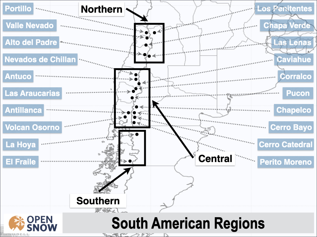
Rain will transition to snow as early as Saturday at El Fraile, while La Hoya and Cerro Catedral could see a transition Sunday morning. Most of the moisture will be gone at that point, with only a few centimeters expected, except for El Fraile where 5 - 15 cms are possible. North of Cerro Catedral, the storm may finish off with some flurries but no accumulations are expected at mid and lower elevations. You can see the snow forecast from the Canadian model below.
Forecast for Monday 7/30 - Thursday 8/3
Another warm storm will kick off more rain showers as early as Sunday night, from south to north. The models are in disagreement on the exact timing, but a cold front will move south at some point during the day on Monday. This will start changing the rain over to snow, from south to north. The heaviest snow totals will be for the southern resorts, and the southern most central resorts, where 10 - 20 cms are possible after the transition to snow. El Fraile could see 20+ cms. Generally, accumulations will decrease as you go north.
I will provide additional details and a snow map for this storm on Monday.
Extended Forecast
Outlook for Friday 8/4 - Tuesday 8/8
In the long range, the models show a break after the second warm storm. Once showers taper off on Thursday, a ridge will likely cause a period of dry weather. The next potential system may arrive around Monday the 7th or Tuesday the 8th. I will have an update on the long range forecast in the next post as well.
Thanks for reading the South America daily snow! Follow me @lstone84 on Instagram to check out some new content I will be creating for the North American summer months.
Announcements
About Our Forecaster


