South America Daily Snow

By Luke Stone, Forecaster Posted 1 year ago July 31, 2023
More Rain This Week Followed By A Dry Stretch
Summary
The second of two warm storms is getting started this Monday morning, and will continue through Wednesday. A cold front will cool things off Monday night leading to some light snow on the tail end of this storm. The next few storms look to stay too far south for any impacts, but we will keep an eye on those for a northward trend.
Short Term Forecast
Forecast for Monday 7/31 - Wednesday 8/2
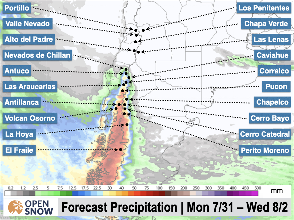
Another round of rain is expected today, Monday, for the central and southern resorts. The heaviest totals will be in the south, and will decrease as you move north. You can see this below in the total precipitation forecast from the European model.
Refer to the previous post for details on the war air and unfavorable upper level pattern producing this warm and wet storm.
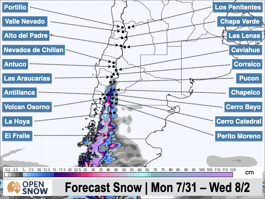
Fortunately, a cold front will arrive from the south Monday night. The heaviest moisture will have moved through already, but there will be enough left for some light snow Monday night through Wednesday. Between 10 - 25 cms are possible during this period for the southern central and southern resorts. Antillanca, Volcan Osorno, Perito Moreno, and Cerro Bayo should do decently well after the changeover. You can see the snow forecast from the Canadian model in the map below.
Due to the warm temperatures initially, the greatest totals will be at higher elevations. Snow totals drop off as you head north.
Forecast for Thursday 8/3 - Monday 8/7
There's not a whole lot to say about the end of the week and into early next week. We have a ridge setting up that should keep the entire region dry for at least five days. The first part of the period will feature some action to the south, which may bring some flurries to the southern resorts, but overall this will be mainly dry.
Extended Forecast
Outlook for Tuesday 8/8 - Saturday 8/12
The next chance for some significant precipitation will be sometime between the 8th and the 10th. One model brings a strong storm in on the 8th, while the others hold off until the 9th or 10th. The models are hinting at a weak wave of moisture for the northern resorts a few days earlier as well. Since this is solidly in the fantasy time frame, expect the forecast details to change a bit. I will have an update on the long range pattern and the next storm on the Wednesday update.
Thanks for reading the South America daily snow! Follow me @lstone84 on Instagram to check out some new content I will be creating for the North American summer months.
About Our Forecaster


