News

By Sam Collentine, Meteorologist Posted 11 years ago December 30, 2013
Weather for the week - Dec 30 to Jan 3, 2014
The dominating weather pattern this week will once again be a high pressure ridge in the west and a low pressure trough in the east. This pattern has been much of the norm over the past few weeks bringing powder conditions to many parts of the upper Midwest and New England. As we bring in the New Year, great conditions will be found in the upper Midwest and New England, while more snow finds it's way into the northern Rockies.
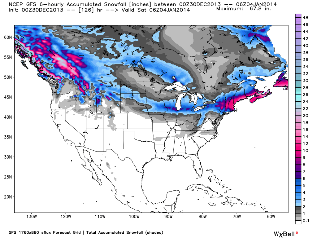
Total accumulated snowfall, according to the American GFS, through Friday night. Source: WeatherBell.com
Two systems will make their way through the West early this week bringing moderate to possibly heavy snow to Idaho, Montana, Wyoming, and Colorado. These systems are once again embedded in the general flow so totals won't be big but a strong northwest flow can always bring about a few surprises. Snow will be off and on from Monday night through New Years Day with Wednesday having the best conditions for skiing in the West. Grab the latest details and analysis for the inner West via The Utah Daily Snow and The Colorado Daily Snow.
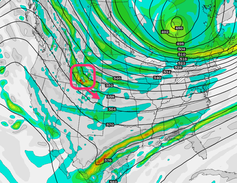
Area of vorticity (energy) that will bring snow to the northern Rockies Monday night through New Years Day. Source: TwisterData.com, analysis by OpenSnow.
The upper Midwest and New England will then begin to see snow during the latter half of the week. A system will drop south out of Canada on Thursday bringing light snow to the resorts of the upper Midwest. Then another round of moderate to heavy snowfall will take place in the Northeast on Thursday into Friday. Frigid temperatures will accompany this system into New England on Friday with day time temperatures way below normal. Bundle up if your headed to the hills because this will be a serious blast of Arctic air. Our New England Meteorologist Brian Clark will have the latest details in The New England Daily Snow.
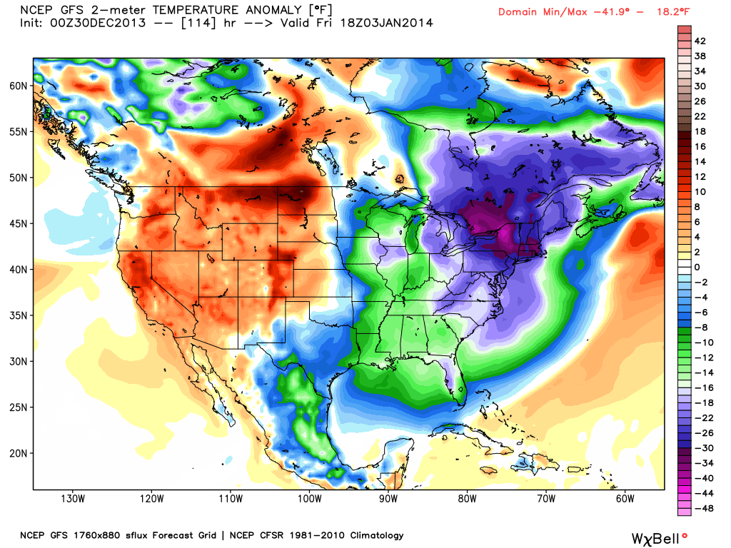
Temperature anomaly in degrees Fahrenheit, according to the American GFS, as of midday Friday. Frigid temperatures will be in place across the upper East Coast. Source: WeatherBell.com
The Pacific Northwest will begin to see a stormier pattern take place on Thursday and Friday as the storm track begins to take aim at the region. A shift in the overall pattern is showing up in the global models that could bring a stormier pattern to much of the West beginning next weekend. The models are still scrambled on the exact track and timing so more on that on Thursday.
When your up on the hill this week post pictures and updates using "LiveSnow", one of the features of our new iPhone app. If your haven't already, download it here.
Check our Powder Finder, forecasts for each mountain, and our Daily Snow posts throughout the week for more details!
SAM COLLENTINE
About The Author


