News

By Sam Collentine, Meteorologist Posted 10 years ago January 20, 2014
Weather for the week - Jan 20 to Jan 24, 2014
For this week, brutally cold temperatures will once again make their way across the Upper Midwest and Northeast while the West sees a slight chance for snow later in the week. Beginning on Tuesday, a blast of Arctic air will push southeast out of Canada with temperatures dropping to dangerous levels for much of the Midwest. This punch of Arctic air will be accompanied by light to heavy snow accumulations for much of the Upper Midwest, Mid-Atlantic, and New England. The northern Rockies will then see a chance for snow Wednesday into Thursday.
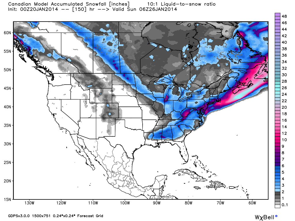
Total accumulated snowfall, according to the Canadian (GEM), through Friday night. Source: WeatherBell.com
The Upper Midwest will see snow Monday into Tuesday as a storm moves across the region. As mentioned above, this system will be accompanied by very cold temperatures and dangerous wind chills. This pattern will be in place throughout the entire week as temperatures struggle to get above zero throughout the region. Lake-effect snowfall will bring heavy accumulations to southern Michigan and northwest Indiana on Monday night and into Tuesday with a lake-effect snow advisory already in place. Andrew will have the latest details in the Upper Midwest Daily Snow.
The Mid-Atlantic region will then see snowfall intensify on Tuesday as the low-pressure swings southeastward on Tuesday. Winter storm watches will be in effect from late Monday night through Tuesday for parts of West Virginia, Virginia, North Carolina, Maryland, Pennsylvania, and Washington D.C. Hazardous driving conditions can be expected throughout Tuesday with snow accumulations ranging from 6 to 12 inches. Frigid temperatures will accompany this system so bundle up if you are looking to chase powder! Grab the latest details from Justin Berk in the Mid-Atlantic Daily Snow.
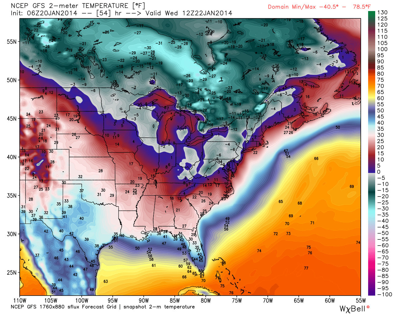
Wednesday morning temperatures, according to the American GFS, for the eastern half of the United States. Source: WeatherBell.com
The pattern will be similar for all areas of New England as chances for snow stay in place for much of the week. According to our New England Meteorologist Brian Clark, northern Vermont will see 2-4 inches on Monday while northern New Hampshire and western Maine will measure 1-3 inches. Highs will be in the teens on Tuesday with temperatures staying in the single digits on Wednesday. Wednesday will also bring another round of snowfall with the coastal resorts. Exact accumulations will depend on how much the system intensifies as it swings up from the Mid-Atlantic. Snowfall could be significant with the combination of cold temperatures and Atlantic moisture. Check out the New England Daily Snow for the latest details.
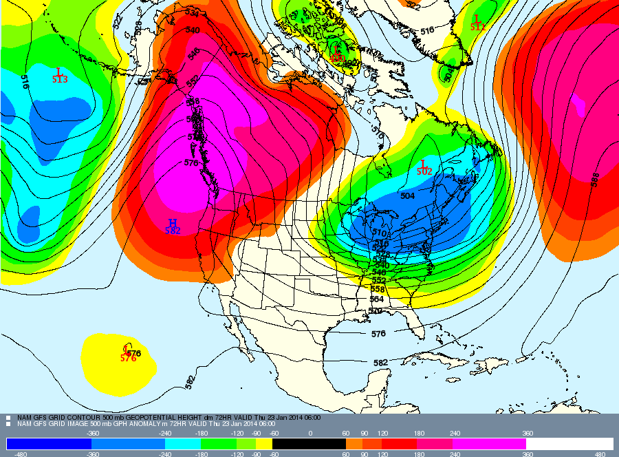
The weather forecast for Thursday, January 23rd. A storm will provide a chance for snow across the northern Rockies while the east will be see frigid temperatures locked in. Source: Meteostar
As for the West, this week will be almost entirely dry. The exception to this rule will be a slight chance for snow Wednesday into Thursday for the northern Rockies. Accumulations will be light. Other than that, the West stays dry with a potential pattern change during the middle of next week. As always, grab the latest details for the West in the Tahoe, Utah, and Colorado Daily Snow.
When you're up on the hill this week post pictures and updates using "LiveSnow", one of the features of our new iPhone app. If your haven't already, download it here. Android coming soon!
Always check our Powder Finder and the forecasts for each mountain throughout the week for more details.
Sam Collentine | OpenSnow
About The Author
Sam Collentine
Meteorologist
Sam Collentine is the Chief Operating Officer of OpenSnow and lives in Basalt, Colorado. Before joining OpenSnow, he studied Atmospheric Science at the University of Colorado, spent time at Channel 7 News in Denver, and at the National Weather Service in Boulder.
Free OpenSnow App


