News

By Sam Collentine, Meteorologist Posted 10 years ago February 20, 2014
Weather for the weekend - Feb 21 to Feb 23, 2014
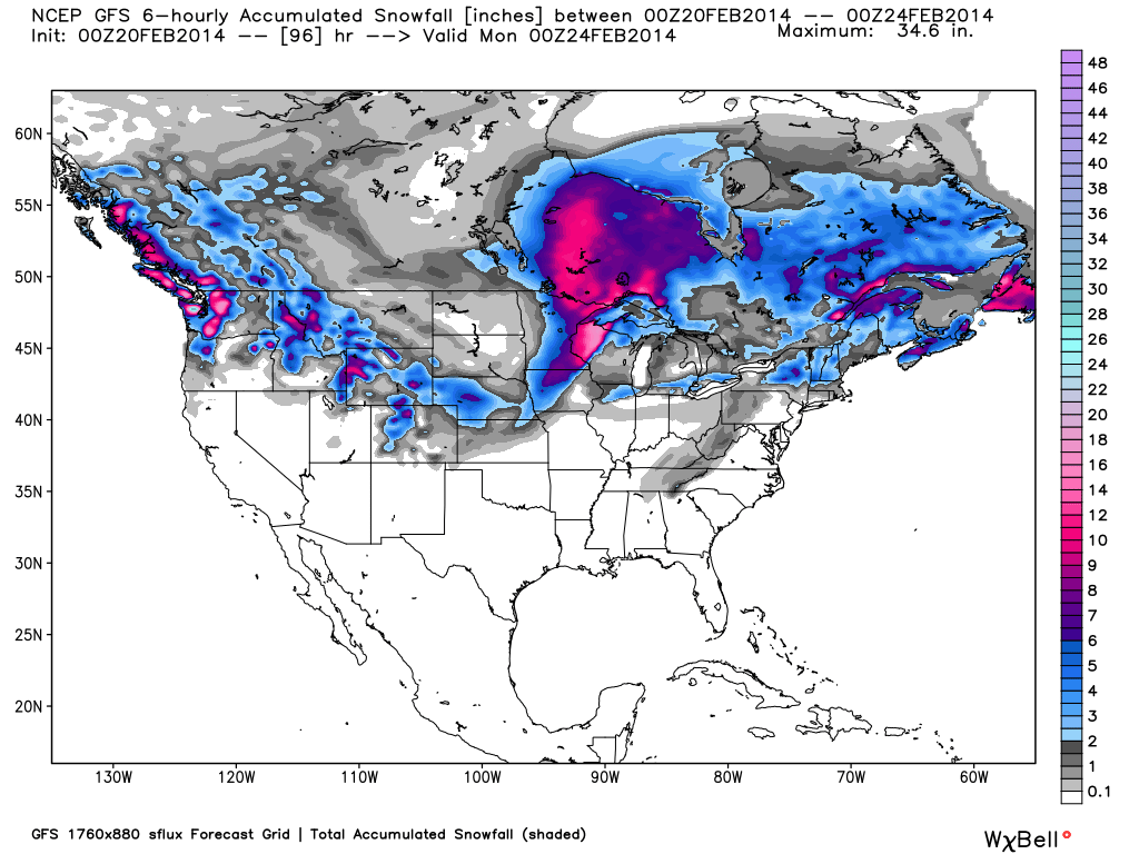
For this weekend, the central Rockies become the main target for deep accumulations while generally light snowfall takes aim at the Upper Midwest and New England. After a blitzkrieg of deep powder, conditions are all-time across the Pacific Northwest. The previous week has dropped numerous feet of snow across the region so powder skiing will be impossible to miss. Finally, a northwest flow will be in place across the central Rockies allowing for moderate to heavy accumulations through Saturday night.

Total accumulated snowfall, according to the American GFS, through Sunday night. Source: WeatherBell.com
Northwest
What a week it's been for the Northwest! Most resorts across the region have seen anywhere from 5-9 FEET over the previous 7 days. Friday and Saturday will be excellent as an overall drying trend begins to move into the region. There will be plenty of leftover powder for the people who have missed out on the storm skiing. Avalanche mitigation is a top priority at many of the resorts and backcountry zones at the current time so ski with a friend and stay safe out there. A few lingering showers will take place within the Washington Cascades on Friday and Sunday but totals will be on the lighter side. Our Northwest Meteorologist Larry Schick has been verifying the snow forecasts all week and will continue throughout the weekend so head over to The Northwest Daily Snow for the latest update.

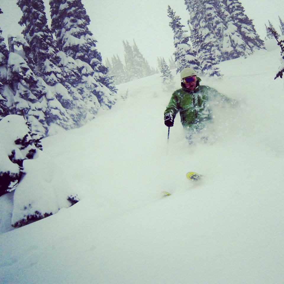
Northwest Meteorologist Larry Schick conducting powder snow forecast quality control and assurance at Crystal Mountain.
Central Rockies
Idaho, Montana, Wyoming, and Colorado will be the winners this weekend when it comes to the best powder reports as a cool northwest flow settles over the region. Jackson Hole and Big Sky look to be primed for moderate to heavy accumulations thoughout the weekend. A northwest to westerly flow will be in place over Colorado leading to decent accumulations through Saturday night and possibly into Sunday morning. Utah will just miss out on this pattern as there is only a slight chance for snow on Friday and Saturday. Head over to the Colorado and Utah Daily Snow for the latest details.

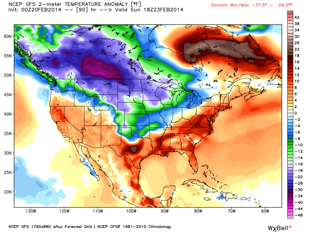
The temperature anomaly, or the departure from the long-term average, as of Sunday afternoon. Source: WeatherBell.com
Upper Midwest
Wisconsin, Minnesota, and northern Michigan will see light to moderate snow accumulations this weekend as a system pushes northeast up the Mississippi Valley. This will be a very fast moving system with the majority of the snow falling on Friday. Temperatures will be generally mild, relatively speaking, with highs in the mid to lower teens. Andrew will have all the details in The Upper Midwest Daily Snow.
New England and Mid-Atlantic
New England will see light snow accumulations during the morning and throughout the day Friday as the quick moving system moves northeast across the region. Totals will generally range from 1-3 inches with the highest amounts aimed at central and northern Maine. This will lead into a very mild weekend with above average temperatures. Brian and Justin will break it all down in the New England and Mid-Atlantic Daily Snow.
When you're up on the hill this weekend post pictures and updates using "LiveSnow", one of the features of our FREE iPhone and Android app.
Always check our Powder Finder and the forecasts for each mountain throughout the weekend for more details.
Sam Collentine | OpenSnow
PS - Checkout Liftopia for Discount Lift Tickets
About The Author


