News

By Sam Collentine, Meteorologist Posted 11 years ago February 24, 2014
Weather for the week - Feb 24 to Feb 28, 2014
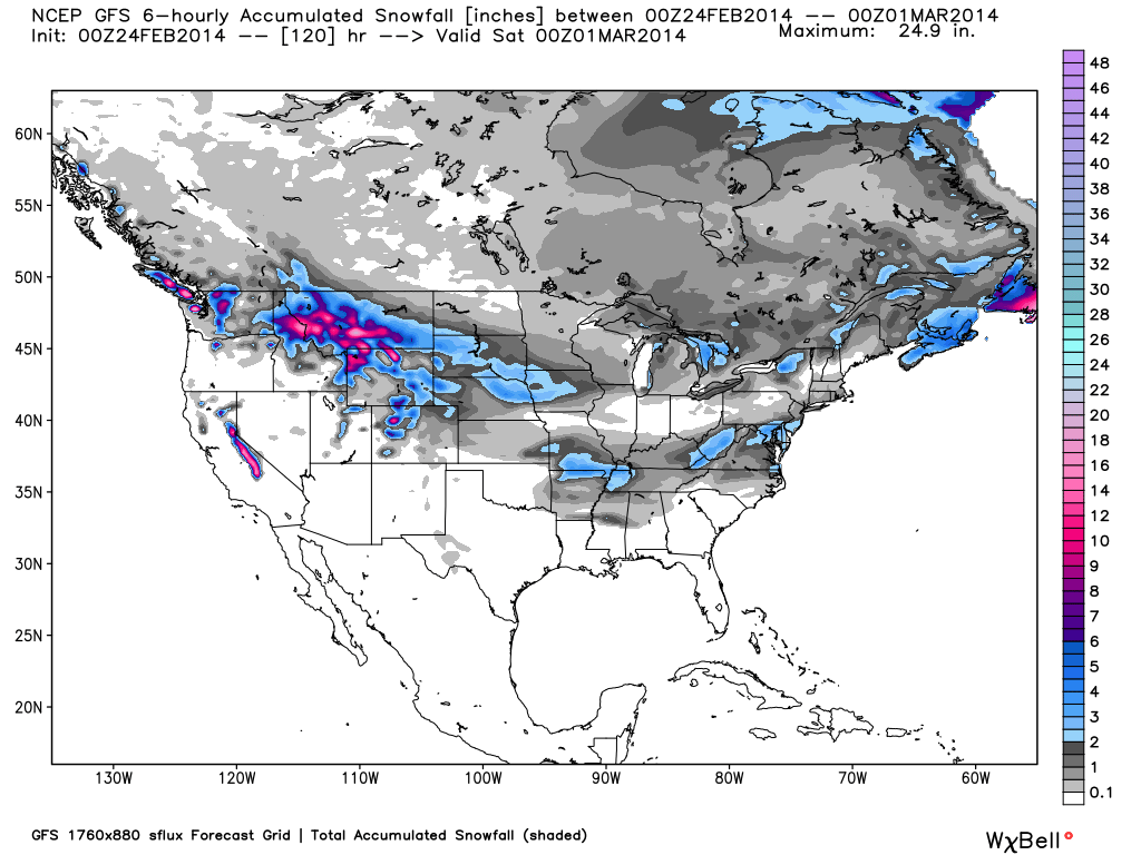
The last week of February will reign in light to significant snowfall for every region of the country. The northern Rockies will dominate the powder forecast through Tuesday until a pattern change brings moderate to heavy accumulations to the Lake Tahoe region beginning on Wednesday. This pattern change will then aim abundant Pacific moisture towards Utah and Colorado on Thursday providing a powder day on Friday. Cold temperatures will return to the Upper Midwest and Northeast this week as an Arctic airmass parks over southeastern Canada. Overall, plenty of fresh snow will be found from the Sierra Nevada of California to the Green Mountains of Vermont.

Total accumulated snowfall, according to the American GFS, through Friday. Source: WeatherBell.com
Northwest and Northern Rockies
Conditions have been all-time across the Northwest and within the northern Rockies over the past week with Monday and Tuesday looking to be much of the same. Washington, Idaho, western Montana, and Wyoming will see significant totals through Tuesday morning as the dominating northern storm track continues. Storm skiing will be found on Monday with clearing skies taking over on Tuesday. Wednesday will be dry until the next chance for snow begins on Thursday. Larry will have all the details in The Northwest Daily Snow.
Lake Tahoe
Mild and dry conditions will be in place on Monday and Tuesday before the next system moves into the region beginning on Wednesday. Snow levels will begin at 6500-7000 feet on Wednesday before colder air moves in on Wednesday night. 6-12 inches will likely fall across the higher elevations through Thursday morning with scattered showers during the day on Thursday. Another stronger system is looking to move into the region on Friday so check back to The Tahoe Daily Snow throughout the week for the latest details.
Utah and Colorado
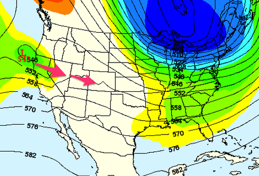
Dry conditions will begin the week until the next chance for snow begins on Tuesday. This will only bring snow to the far northern mountains of Utah and Colorado through Tuesday night until drier conditions prevail on Wednesday. Beginning on Thursday, abundant Pacific moisture will move into the region bringing snow across all of Utah and Colorado. This system will once again be on the warmer side due to it's Pacific origin but it should be cold enough to avoid liquid precip. Evan and Joel will have all the details in the Utah and Colorado Daily Snow.

Wednesday and Thursday's storm track according to the American GFS. Source: Meteostar, analysis by OpenSnow.
Upper Midwest
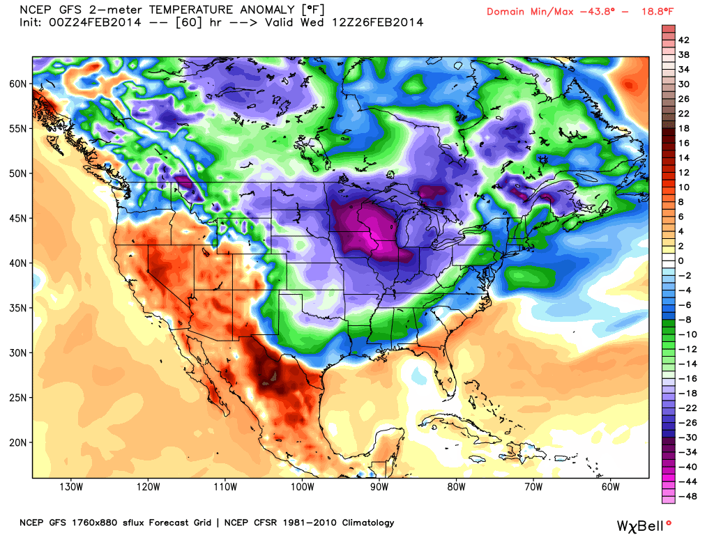
Very cold temperatures will headline the region this week as an Arctic airmass parks over southern Canada. Highs will struggle to get out of the negatives on Wednesday and Thursday with dangerous wind chills likely. There will be chances for snow throughout the week but totals will not amount to much. Bundle up and prepare for the worst when headed outside during the latter half of the week. Andrew will provide all the details in The Upper Midwest Daily Snow.

The temperature anomaly, or the departure from the long-term average, as of Wednesday morning. Source: WeatherBell.com
Northeast
Similar to the Upper Midwest, the return of very cold temperatures will highlight the region throughout this week. The famed "Polar Vortex" will return to the news but in reality this is only a very cold airmass with an Arctic origin. The northern reaches of New England will see chances for snow throughout the week with a stronger coastal storm taking aim at the entire region on Wednesday. These coastal storms provide a very tricky forecast as a slight change in the storm track can significantly change what areas receive snow. A clipper storm will also look to move through during the latter half of the week. Brian and Justin will have all the details in the New England and Mid-Atlantic Daily Snow.
When you're up on the hill this week post pictures and updates using "LiveSnow", one of the features of our FREE iPhone and Android app.
Always check our Powder Finder and the forecasts for each mountain throughout the week for more details.
> Checkout Liftopia for Discount Lift Tickets
Sam Collentine | OpenSnow
About The Author


