News

By Sam Collentine, Meteorologist Posted 11 years ago January 13, 2014
Weather for the week - Jan 13 to Jan 17, 2014
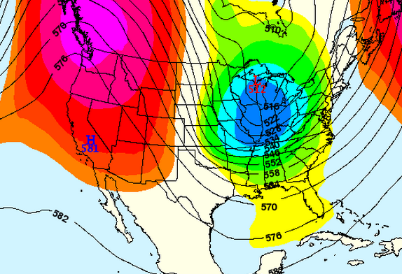
For this week, after one more day of solid snowfall across the Western US, a cold and stormier pattern will shift back to the Upper Midwest and East Coast. This past weekend provided amazing powder skiing to almost all areas of the West but good things don't last forever. Beginning on Tuesday, a high pressure ridge will push in off the Pacific bringing dry conditions to the West while the eastern half of the US takes aim at a stormier pattern.

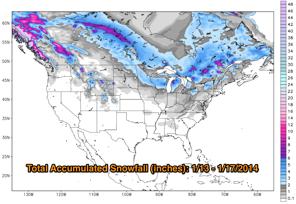
Total accumulated snowfall, according to the American GFS, through Friday. Source: WeatherBell.com, analysis by OpenSnow.
Looking into the West, Monday will provide one more day of good accumulations to the northern Rockies. This will be due to a strong upper level jet stream on the backside of the system that is currently pushing east. This area of the jet stream will give the necessary lift to provide anywhere from 6 to 12 inches of fresh powder through Tuesday. Expect the northern reaches of the Idaho Panhadle, Western Montana, Wyoming, and Northern Colorado to come away with the best powder reports on Tuesday morning. A dry and warm high pressure ridge will then move into the West for the foreseeable future. The long term outlook doesn't look promising but this can always change for the better over the course of a few days. Always remember to grab the latest details for the West in the Tahoe, Utah, and Colorado Daily Snow.

Weather forecast from January 16th for at least 10 days. Source: Meteostar
As for the Upper Midwest, a series of systems will move through the region this week beginning on Monday. This will be an ongoing trend as the ridge builds in the West allowing for numerous sysems to drop southeast out of Canada. Snow accumulations throughout the region will be light to moderate with the northern and western reaches of Michigan expected to do best. Check out the Upper Midwest Daily Snow for the latest details.
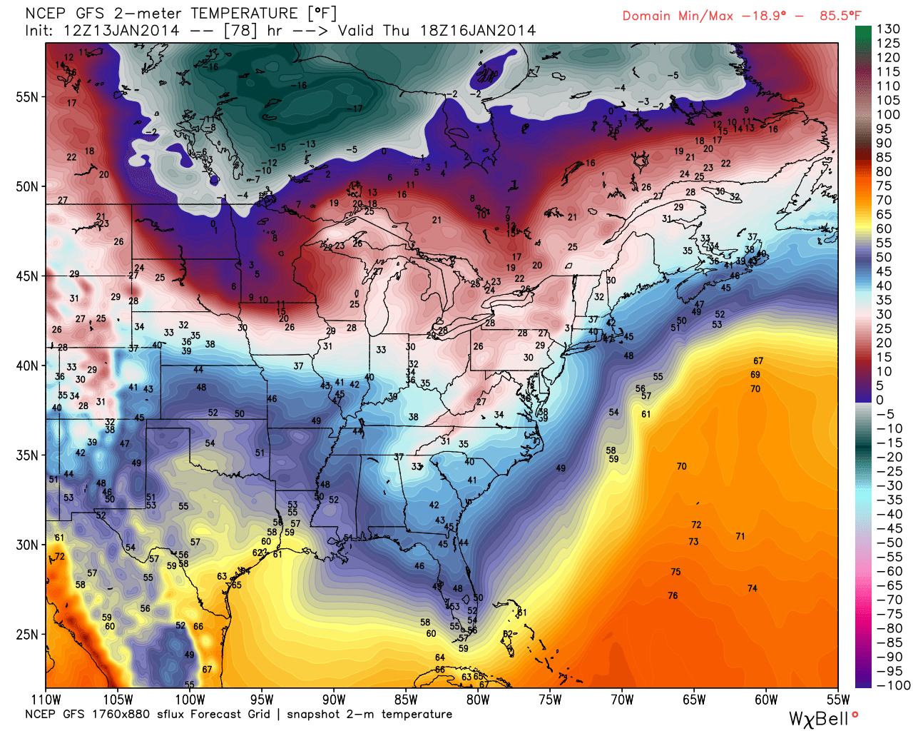
After a weekend of warm temperatures and rain, New England looks to move back into a colder and stormier trend starting on Wednesday. Depending on the exact track and how deep the systems push into the East, a much more snow and skier happy trend is looking to take position in the east. Brian will have all the details in the New England Daily Snow.

Eastern United States temperatures, according to the American GFS, on Thursday afternoon. Source: WeatherBell.com
Finally, we are more than excited to welcome the newest addition to our team as Justin Berk takes over our Mid-Atlantic Meteorologist duties. This will be a great first full week for Justin as the stormier pattern moves into the region. As the trough begins to deepen on Wednesday, light snow showers can be expected for the northern aspects of the Mid-Atlantic. Colder temperatures will also allow for significant snowmaking at many resorts so it's all good news for the Mid-Atlantic heading into the middle of the week. Justin will have all the latest deatils in the Mid-Atlantic Daily Snow.
When you're up on the hill this week post pictures and updates using "LiveSnow", one of the features of our new iPhone app. If your haven't already, download it here. Android coming soon!
Always check our Powder Finder and the forecasts for each mountain throughout the week for more details.
Sam Collentine | OpenSnow
About The Author


