News

By Sam Collentine, Meteorologist Posted 11 years ago January 23, 2014
Weather for the weekend - Jan 24 to Jan 26, 2014
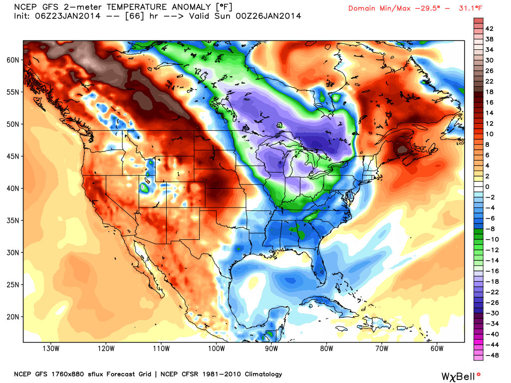
For this weekend, the Upper Midwest and Northeast will remain under an active storm pattern while a stubborn high-pressure ridge remains parked over the western United States. Unseasonably cold temperatures look to stay put over the eastern half of the United States allowing for around-the-clock snowmaking. The West on the other hand will remain under mild temperatures with only a slight chance of snow for the upper reaches of the northern Rockies.

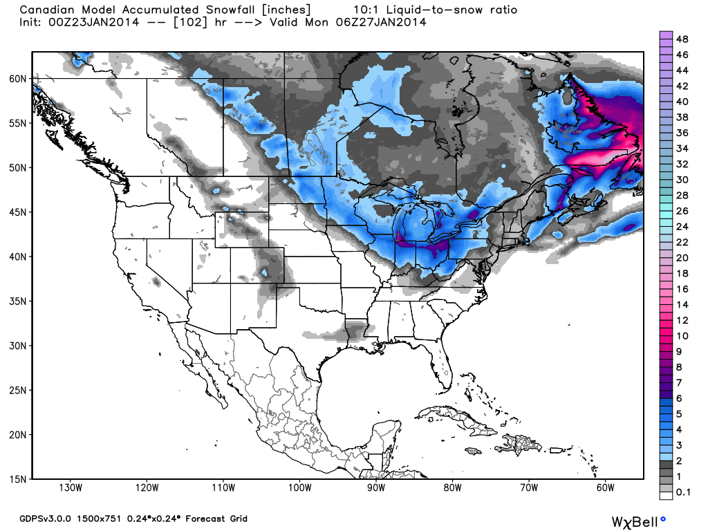
Total accumulated snowfall, according the Canadian model (GEM), through Sunday night. Source: WeatherBell.com
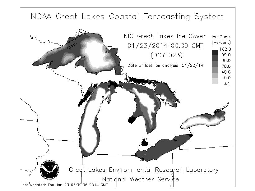
The Upper Midwest will be the main area of focus for the weekend as the parade of clippers continue to roll through the region. The next system will move through on Friday packing another punch of frigid air along with 1-2 inches of snow accumulation. We are reaching a period in the winter when the Great Lakes become nearly frozen creating difficult lake effect snow forecasts. Our Upper Midwest Meteorologist Andrew Murray is erring on the safe side with total weekend snow accumulations ranging from 3-6 inches. After a break on Saturday, another system will make it's way through the region on Sunday accompanied by another round of light snow. Grab the latest details in The Upper Midwest Daily Snow.

Great Lakes total ice concentration as of January 22nd. The darker the area, the higher the concentration of ice coverage and vice-versa. Source: NOAA
This weekend in New England will consist of below average temperatures and another round of snow come Saturday. This will provide ideal conditions for around-the-clock snowmaking. Expect snow accumulations to range from 1-3 inches through Sunday with potentially locally heavier amounts at the higher elevated resorts. This trend of parading systems looks to stay in play for at least the next week so take advantage of the great conditions all across the region! Brian will have the latest details in The New England Daily Snow.
The Mid-Atlantic will look a lot like New England with another shot for snow on Saturday. This will be accompanied by bone-chilling temperatures as they will struggle to get above the freezing mark through Saturday. Around-the-clock snowmaking will persist through the weekend as more trails can be expected to open. This weekend will provide some great skiing so head up to the hills if you can! Look to Justin for the latest details in The Mid-Atlantic Daily Snow.

Temperature anomaly, or departures from the long-term average, according to the American GFS as of Saturday evening. Source: WeatherBell.com.
As for the West, the stubborn high-pressure ridge looks to remain in place over the region through at least early next week. Sunshine and mild temperatures are to be expected with only a slight chance for snow across western and central Montana on Sunday. The long-term models are finally coming into agreement on a shift in the weather pattern next week. As we get closer, we'll get more confident with individual storms, but at this point the pattern change looks good. As always, get the latest details for the West in the Tahoe, Utah, and Colorado Daily Snow. Pacific Northwest coming soon!
When you're up on the hill this weekend post pictures and updates using "LiveSnow", one of the features of our new iPhone and Android app. If your haven't already, download the iPhone version here and the new Android version here.
Always check our Powder Finder and the forecasts for each mountain throughout the weekend for more details.
Sam Collentine | OpenSnow
About The Author


